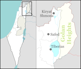
Kfar Kama
Kfar Kama
| ||
|---|---|---|
| Hebrew transcription(s) | ||
| • ISO 259 | Kfar Kamaˀ | |
| • Also spelled | Кфар Кама (Adyghe) (official) | |
 | ||
| ||
 Kfar Kama | ||
| Coordinates: 32°43′19″N 35°26′27″E / 32.72194°N 35.44083°ECoordinates: 32°43′19″N 35°26′27″E / 32.72194°N 35.44083°E | ||
| Grid position | 191/236 PAL | |
| District | Northern | |
| Founded | 1878 | |
| Government | ||
| • Type | Local council (from 1950) | |
| Area | ||
| • Total | 8,854 dunams (8.854 km2 or 3.419 sq mi) | |
| Population (2017)[1] | ||
| • Total | 3,284 | |
| • Density | 370/km2 (960/sq mi) | |
| Name meaning | The village of truffles[2] | |
Kfar Kama (Hebrew: כְּפַר כַּמָא, Arabic: كفر كما, Adyghe: Кфар Кама) is a town located in the Lower Galilee, Israel. In 2017 it had a population of 3,284, largely Circassian.
History
Kfar Kama might be identified with a village Helenoupolis that Constantine established in honor of his mother Helen.[3]
Excavations carried out in 1961 and 1963 revealed 4th century tombs.[4] Two churches dated to the early 6th century, one dedicated to Saint Thecla, were uncovered, with multicolored mosaics of floral, animal and geometric patterns.[4]
In the Crusader period it was known as Kapharchemme or Capharkeme.[5]
Ruins and parts of five limestone columns have been found, together with a circular basalt olive-press and cisterns.[6]
Ottoman era
In 1596, Kfar Kama appeared in Ottoman tax registers as a village in the Nahiya of Tiberias in the Liwa of Safad. It had a population of 34 Muslim households and paid taxes on wheat, barley, summer crops, cotton, and goats or beehives.[7]
A map from Napoleon's invasion of 1799 by Pierre Jacotin showed the place, named as El Hadaci.[8]
In the 1870s, it was described as having "basaltic stone houses, containing about 200 Moslems, situated in plain of arable soil."[9]
The current village was founded in 1878 by 1,150 Circassian immigrants from the Adyghe tribe Shapsugs who were exiled from the Caucasus by the Russians to the Ottoman Empire due to the Russian-Circassian War.[10] Initially they made their living by raising animals, but later became farmers.[10] The first school was established about 1880.[10]
A population list from about 1887 showed Kfar Kama to have about 1,150 inhabitants; all Muslims. It was also noted that they were Circassian.[11]
British Mandate era
At the time of the 1922 census of Palestine, Kfar Kama had a population of 670 Muslims and 7 Christians,[12] decreasing slightly in the 1931 census to 644, one Christian and the rest Muslims, in a total of 169 houses.[13]
In 1945 census, the population comprised 660 Muslims[14] and the land area was 8,819 dunams.[15][14] Of this, 8,293 dunams were for cereals,[16][14] while 108 dunams were built-up land.[17][14]
Israeli period
The school in the village teaches in a mixed environment of classes in Circassian, Hebrew, Arabic and English languages.[18]
Kfar Kama is one of two Circassian villages in Israel. The other one is Rehaniya. The Circassians are Muslims, who unlike the main Israeli Arab Muslim minority, perform military service in the IDF.
A Center for Circassian Heritage is situated in the village.
Notable natives and residents
- Bibras Natkho (born February 18, 1988), a Circassian Israeli footballer currently playing for CSKA Moscow and the Israeli national football team.
- Nili Natkho (February 18, 1982 – November 5, 2004), a Circassian Israeli basketball player who played for Maccabi Raanana and Elitzur Ramla.
- Izhak Nash (born June 23, 1989), a Circassian Israeli footballer currently playing for Hapoel Ironi Baqa al-Gharbiyye
The Kfar Kama families
Shapsug families that live in Israel Kfar Kama
- Abrag (Adyghe: Абрэгь)
- Ashmuz/Achmuzh (Adyghe: Ачъумыжъ)
- Bghana (Adyghe: Бгъанэ)
- Bat (Adyghe: Бат)
- Blanghaps (Adyghe: БлэнгъэпсI)
- Batwash (Adyghe: БэтIыуашъ)
- Zazi(Adyghe: Зази)
- Kobla (Adyghe: Коблэ)
- Qal (Adyghe: Къалыкъу)
- Qatizh (Adyghe: Къэтыжъ)
- Lauz (Adyghe: ЛъыIужъ)
- Libai/Labai(Adyghe: ЛIыпый)
- Nago (Adyghe: Наго)
- Natkho (Adyghe: Натхъо)
- Nash (Adyghe: Наш)
- Napso (Adyghe: Нэпсэу)
- Thawcho (Adyghe: Тхьэухъо)
- Gorkozh (Adyghe: ГъоркIожъ)
- Hazal (Adyghe: Хъэзэл)
- Hadish (Adyghe: Хьэдищ)
- Hako/Hakho (Adyghe: Хьэхъу)
- Shamsi (Adyghe: Чъуэмшъо)
- Choshha/Shoshha (Adyghe: Чъушъхьэ)
- Showgan (Adyghe: Шэугьэн)
- Shaga (Adyghe: Шъуагьэ)
- Sagas/Shagash (Adyghe: Шъэгьашъ)
In the past there was also Shhalakhwa (Adyghe: Шхьэлахъуэ).
Other families that live in Kfar Kama
Gallery
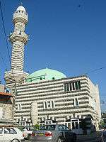 The mosque next to the Circassian Heritage Center in Kfar Kama.
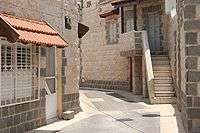 The old village in Kfar Kama.
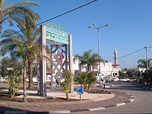
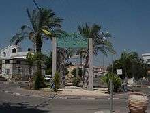 The welcome sign in Hebrew and Circassian.
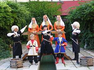 Circassians in traditional clothes in Kfar Kama.
See also
References
- ↑ "List of localities, in Alphabetical order" (PDF). Israel Central Bureau of Statistics. Retrieved August 26, 2018.
- ↑ Palmer, 1881, p. 127
- ↑ Tsafrir, Di Segni and Green, 1994, 142
- 1 2 Dauphin, 1998, p. 727
- ↑ Pringle, 1997, p. 117
- ↑ Conder and Kitchener, 1881, SWP I, p. 391
- ↑ Hütteroth and Abdulfattah, 1977, p. 190
- ↑ Karmon, 1960, p. 167.
- ↑ Conder and Kitchener, 1881, SWP I, p. 360
- 1 2 3 Nirit Reichel (2010). "The role of the educational system in retaining Circassian identity during the transition from Ottoman control to life as Israeli citizens (1878–2000)". Israel Affairs. 16: 251–267. doi:10.1080/13537121003643896.
- ↑ Schumacher, 1888, p. 185
- ↑ Barron, 1923, Table XI, Sub-district of Tiberias, p. 39
- ↑ Mills, 1932, p. 84
- 1 2 3 4 Department of Statistics, 1945, p. 12
- ↑ Government of Palestine, Department of Statistics. Village Statistics, April, 1945. Quoted in Hadawi, 1970, p. 72
- ↑ Government of Palestine, Department of Statistics. Village Statistics, April, 1945. Quoted in Hadawi, 1970, p. 122
- ↑ Government of Palestine, Department of Statistics. Village Statistics, April, 1945. Quoted in Hadawi, 1970, p. 172
- ↑ Yulie Khromchenko (22 March 2005). מדברים פה בהרבה שפות? נקרא לזה "בית ספר רב לשוני [They talk a lot of languages? Called it 'a multilingual school']. Haaretz (in Hebrew). Retrieved 25 August 2014.
Bibliography
- Barron, J. B., ed. (1923). Palestine: Report and General Abstracts of the Census of 1922. Government of Palestine.
- Conder, C.R.; Kitchener, H.H. (1881). The Survey of Western Palestine: Memoirs of the Topography, Orography, Hydrography, and Archaeology. 1. London: Committee of the Palestine Exploration Fund.
- Dauphin, Claudine (1998). La Palestine byzantine, Peuplement et Populations. BAR International Series 726 (in French). III : Catalogue. Oxford: Archeopress. ISBN 0-86054-905-4.
- Department of Statistics (1945). Village Statistics, April, 1945. Government of Palestine.
- Hadawi, S. (1970). Village Statistics of 1945: A Classification of Land and Area ownership in Palestine. Palestine Liberation Organization Research Center.
- Hütteroth, Wolf-Dieter; Abdulfattah, Kamal (1977). Historical Geography of Palestine, Transjordan and Southern Syria in the Late 16th Century. Erlanger Geographische Arbeiten, Sonderband 5. Erlangen, Germany: Vorstand der Fränkischen Geographischen Gesellschaft. ISBN 3-920405-41-2.
- Karmon, Y. (1960). "An Analysis of Jacotin's Map of Palestine" (PDF). Israel Exploration Journal. 10 (3, 4): 155–173, 244–253.
- Mills, E., ed. (1932). Census of Palestine 1931. Population of Villages, Towns and Administrative Areas. Jerusalem: Government of Palestine.
- Palmer, E.H. (1881). The Survey of Western Palestine: Arabic and English Name Lists Collected During the Survey by Lieutenants Conder and Kitchener, R. E. Transliterated and Explained by E.H. Palmer. Committee of the Palestine Exploration Fund.
- Pringle, Denys (1997). Secular buildings in the Crusader Kingdom of Jerusalem: an archaeological Gazetter. Cambridge University Press. ISBN 0-521-46010-7.
- Rhode, H. (1979). Administration and Population of the Sancak of Safed in the Sixteenth Century. Columbia University.
- Schumacher, G. (1888). "Population list of the Liwa of Akka". Quarterly statement - Palestine Exploration Fund. 20: 169–191.
- Tsafrir, Yoram; Leah Di Segni; Judith Green (1994). (TIR): Tabula Imperii Romani: Judaea, Palaestina. Jerusalem: Israel Academy of Sciences and Humanities. ISBN 965-208-107-8.
External links
- Kfar Kama local council
- The World Circassian Heritage Center
- Survey of Western Palestine, Map 6: IAA, Wikimedia commons
- Welcome To Kafr Kama