Jadeidi-Makr
Jadeidi-Makr
| |
|---|---|
| Hebrew transcription(s) | |
| • ISO 259 | Ǧudéida - Makkr |
| • Also spelled |
Judeidi-Maker (official) Makr-Jadeidi (unofficial) |
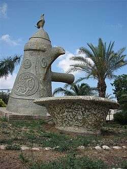 Entrance to Jadeidi-Makr | |
 Jadeidi-Makr  Jadeidi-Makr | |
| Coordinates: 32°56′00″N 35°8′29″E / 32.93333°N 35.14139°ECoordinates: 32°56′00″N 35°8′29″E / 32.93333°N 35.14139°E | |
| Grid position | 163/259 PAL |
| District | Northern |
| Government | |
| • Type | Local council (from 1990) |
| Area | |
| • Total | 8,974 dunams (8.974 km2 or 3.465 sq mi) |
| Population (2017)[1] | |
| • Total | 20,613 |
| • Density | 2,300/km2 (5,900/sq mi) |
| Name meaning | El Judeiyideh, the dyke, or coloured streak in the mountain side[2] el Mekr, from personal name[3] |
Jadeidi-Makr or Makr-Jadeidi (Hebrew: גֻ'דֵידָה-מַכְּר; Arabic: مكر جديده) is an Arab local council formed by the merger of the two Arab towns of Makr and Jadeidi in 1990. It is located a few kilometers east of the city of Acre in the Northern District, Israel.
In 2017 its population was 20,613.[1]
History
Under the names "Makr Harsin"[4] and "al-Hudeidah",[5] Makr and Jadeidi, respectively, were mentioned as part of the domain of the Crusaders during the hudna (truce agreement) of 1283 between the Crusaders based in Acre and the Mamluk sultan al-Mansur Qalawun.[4] However, it is also possible that Makr Harsin in the original text referred to separate locations Makr and Harsini, the latter unidentified.[4]
Ottoman era
Incorporated into the Ottoman Empire in 1517, Makr appeared in the census of 1596, located in the nahiya (subdistrict) of Acre, part of Safad Sanjak. The population was 22 households and 3 bachelors, all Muslim. They paid taxes on wheat, barley, summer crops, fruit trees, cotton, occasional revenues, goats and beehives; a total of 17,000 akçe.[6][7] A map by Pierre Jacotin from Napoleon's invasion of 1799 showed both places, named as "Makr" and "Sedid".[8]
In 1875 Victor Guérin visited Makr, and found it to have 350 inhabitants, half Muslim and half "Schismatic Greek".[9] He further noted that "In and about El Mekr are broken columns, the fragment of an ancient bas-relief, a little sarcophagus in terra cotta, and several sepulchral caves."[10] He found Jadeidi to have 350 inhabitants.[11]
In 1881, the Palestine Exploration Fund's Survey of Western Palestine (SWP) described Jadeidi as "a village, built of stone, containing about eighty Moslems and twenty Christians, surrounded by olives and arable land, situated near the plain, .....with many cisterns for rain water to drink from."[12] Makr was described as "a village, built of stone, containing 100 Moslems and eighty Christians, situated at the edge of the plain, surrounded by olives and arable land; there are many cisterns for rain-water in the village."[13]
A population list from about 1887 showed that Jadeidi had about 245 inhabitants; half Muslim and half Greek Christians, while Makr had 280 inhabitants; one third Catholic and Greek Christians, two thirds Muslim.[14]
British Mandate period
In the 1922 census of Palestine conducted by the British Mandate authorities Jadeidi had a population of 204 residents; 108 Muslims and 96 Christians.[15] Of the Christians, 51 were Orthodox and 45 Greek Catholic (Melchite).[16] Al Makr had a population of 281; 206 Muslims and 75 Christians.[15] Of the Christians, 30 were Orthodox and 45 Greek Catholic (Melchite).[16] In the 1931 census, Jadeidi had a population of 249; 146 Muslims and 103 Christians, in a total of 57 houses, while Makr had a population of 331; 257 Muslims and 74 Christians, in a total of 77 houses.[17]
In the 1945 statistics the population of Jadeidi was 280; 150 Muslims and 130 Christians,[18] who owned 5,219 dunams of land according to an official land and population survey.[19] 1,855 dunams were plantations and irrigable land, 2,202 dunams were used for cereals,[20] while 39 dunams were built-up (urban) land.[21]
The same year the population of Makr was 490; 390 Muslims and 100 Christians,[18] while 8,791 dunams of land belonged to the village according to the same official land and population survey.[19] 96 dunams were for citrus and bananas, 730 for plantations and irrigable land, 7,241 used for cereals,[22] while 26 dunams were built-up (urban) land.[23]
1948, and aftermath
Makr was captured by the Israeli army during the first part of Operation Dekel, 8–14 July 1948,[24] and remained under Martial Law until 1966. Mahmoud Darwish's family, who originated from the destroyed Arab village of al-Birwa, live in the town and Darwish was educated and raised there.[25]
Sports and culture
The town's main football team, Hapoel Bnei Jadeidi F.C., will start the 2011-12 season in the Israeli Liga Gimel (Israeli Fifth Division).
Transportation
Israel Railways has proposed building an additional train station at Jadeidi-Makr on the Railway to Karmiel, although the dates for construction are not set.[26]
See also
References
- 1 2 "List of localities, in Alphabetical order" (PDF). Israel Central Bureau of Statistics. Retrieved August 26, 2018.
- ↑ Palmer, 1881, p. 43
- ↑ Palmer, 1881, p. 52
- 1 2 3 Barag, 1979, p. 204, No. 14
- ↑ Barag, 1979, p. 204, No. 15
- ↑ Hütteroth and Abdulfattah, 1977, p. 192
- ↑ Note that Rhode, 1979, p. 6 writes that the Safad register that Hütteroth and Abdulfattah studied was not from 1595/6, but from 1548/9
- ↑ Karmon, 1960, p. 162
- ↑ Guérin, 1880, pp. 2-4
- ↑ Guérin, 1880, pp. 2-4, as translated by Conder and Kitchener, 1881, SWP I, p. 191
- ↑ Guérin, 1880, p. 14
- ↑ Conder and Kitchener, 1881, SWP I, p. 146
- ↑ Conder and Kitchener, 1881, SWP I, p. 147
- ↑ Schumacher, 1888, p. 172
- 1 2 Barron, 1923, Table XI, Sub-district of Acre, p. 36
- 1 2 Barron, 1923, Table XVI, p. 50
- ↑ Mills, 1932, p. 101
- 1 2 Department of Statistics, 1945, p. 4
- 1 2 Government of Palestine, Department of Statistics. Village Statistics, April, 1945. Quoted in Hadawi, 1970, p. 40
- ↑ Government of Palestine, Department of Statistics. Village Statistics, April, 1945. Quoted in Hadawi, 1970, p. 80
- ↑ Government of Palestine, Department of Statistics. Village Statistics, April, 1945. Quoted in Hadawi, 1970, p. 130
- ↑ Government of Palestine, Department of Statistics. Village Statistics, April, 1945. Quoted in Hadawi, 1970, p. 81
- ↑ Government of Palestine, Department of Statistics. Village Statistics, April, 1945. Quoted in Hadawi, 1970, p. 131
- ↑ Morris, 1987, p. 198
- ↑ Palestinian poet Mahmoud Darwish to be laid to rest in Ramallah Bar'el, Zvi. Haaretz. 2008-08-11.
- ↑ "Karmiel - Akko railway line completed". Globes. 16 March 2017. Retrieved 21 March 2017.
Bibliography
- Barag, Dan (1979). "A new source concerning the ultimate borders of the Latin Kingdom of Jerusalem". Israel Exploration Journal. 29: 197–217.
- Barron, J.B., ed. (1923). Palestine: Report and General Abstracts of the Census of 1922. Government of Palestine.
- Conder, C.R.; Kitchener, H.H. (1881). The Survey of Western Palestine: Memoirs of the Topography, Orography, Hydrography, and Archaeology. 1. London: Committee of the Palestine Exploration Fund.
- Dauphin, Claudine (1998). La Palestine byzantine, Peuplement et Populations. BAR International Series 726 (in French). III : Catalogue. Oxford: Archeopress. ISBN 0-860549-05-4.
- Department of Statistics (1945). Village Statistics, April, 1945. Government of Palestine.
- Guérin, V. (1880). Description Géographique Historique et Archéologique de la Palestine (in French). 3: Galilee, pt. 2. Paris: L'Imprimerie Nationale.
- Hadawi, S. (1970). Village Statistics of 1945: A Classification of Land and Area ownership in Palestine. Palestine Liberation Organization Research Center.
- Hütteroth, Wolf-Dieter; Abdulfattah, Kamal (1977). Historical Geography of Palestine, Transjordan and Southern Syria in the Late 16th Century. Erlanger Geographische Arbeiten, Sonderband 5. Erlangen, Germany: Vorstand der Fränkischen Geographischen Gesellschaft. ISBN 3-920405-41-2.
- Karmon, Y. (1960). "An Analysis of Jacotin's Map of Palestine" (PDF). Israel Exploration Journal. 10 (3, 4): 155–173, 244–253.
- Lerer, Yoav (2009-05-06). "El-Judeida Final Archive Report" (121). Hadashot Arkheologiyot – Excavations and Surveys in Israel.
- Mills, E., ed. (1932). Census of Palestine 1931. Population of Villages, Towns and Administrative Areas. Jerusalem: Government of Palestine.
- Morris, B. (1987). The Birth of the Palestinian refugee problem, 1947-1949. Cambridge University Press. ISBN 0-521-33028-9.
- Palmer, E.H. (1881). The Survey of Western Palestine: Arabic and English Name Lists Collected During the Survey by Lieutenants Conder and Kitchener, R. E. Transliterated and Explained by E.H. Palmer. Committee of the Palestine Exploration Fund.
- Rhode, H. (1979). Administration and Population of the Sancak of Safed in the Sixteenth Century. Columbia University.
- Schumacher, G. (1888). "Population list of the Liwa of Akka". Quarterly statement - Palestine Exploration Fund. 20: 169–191.
External links
- Welcome To al-Jadeida
- Welcome To Makr
- Survey of Western Palestine, Map 3: IAA, Wikimedia commons