Zarzir
Zarzir
| |
|---|---|
| Hebrew transcription(s) | |
| • ISO 259 | Zarzir |
| • Also spelled |
Bet Zarzir (official) Zarazir (unofficial) |
 Council headquarters | |
 Zarzir | |
| Coordinates: 32°43′38.32″N 35°13′28.92″E / 32.7273111°N 35.2247000°ECoordinates: 32°43′38.32″N 35°13′28.92″E / 32.7273111°N 35.2247000°E | |
| District | Northern |
| Government | |
| • Type | Local council (from 1997) |
| Area | |
| • Total | 3,889 dunams (3.889 km2 or 1.502 sq mi) |
| Population (2017)[1] | |
| • Total | 7,792 |
| • Density | 2,000/km2 (5,200/sq mi) |
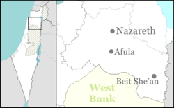
Zarzir (Arabic: زرزير, Hebrew: זַרְזִיר), or Beit Zarzir, is an Arab local council located 10 kilometres (6.2 mi) west of the city of Nazareth in the Northern District of Israel. In 2017 it had a population of 7,792,[1] consisting of five Bedouin tribes.
See also
References
- 1 2 "List of localities, in Alphabetical order" (PDF). Israel Central Bureau of Statistics. Retrieved August 26, 2018.
External links
This article is issued from
Wikipedia.
The text is licensed under Creative Commons - Attribution - Sharealike.
Additional terms may apply for the media files.