Golan Regional Council
Golan
| |
|---|---|
 | |
| District | Northern |
| Government | |
| • Type | Regional council |
| • Head of Municipality | Eli Malka |
| Area | |
| • Total | 1,090,220 dunams (1,090.22 km2 or 420.94 sq mi) |
| Population (2014) | |
| • Total | 15,100 |
| • Density | 14/km2 (36/sq mi) |
| Website | Official website |
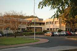
The Golan Regional Council (Hebrew: מועצה אזורית גולן, Arabic: مجلس الجولان الإقليمي) is a regional council that supervises regional services to Israeli settlements located on the Golan Heights. It is made up of 19 moshavim and 10 kibbutzim, and other villages. The council headquarters are in Katzrin. The current Head of Council is Eli Malka.
The Golan Heights were captured by Israel from Syria in the Six-Day War of 1967 and unilaterally annexed in 1980. They are internationally recognized as Syrian territory occupied by Israel.
Heads of council
- Moshe Gorlik (1978–79)
- Eytan Lis (1979–88)
- Yehuda Vulman (1988–2001)
- Eli Malka (2001–)
Shimon Sheves was deputy council head in the early years of the council's existence.
Settlements
Alphabetical list.
| type | name | founded |
|---|---|---|
| kibbutz | Afik | 1972 |
| moshav | Alonei HaBashan | 1981 |
| moshav | Aniam | 1978 |
| moshav | Avnei Eitan | 1978 |
| moshav | Bnei Yehuda | 1972 |
| kibbutz | Ein Zivan | 1968 |
| kibbutz | El Rom | 1971 |
| moshav | Eliad | 1968 |
| kibbutz | Geshur | 1976 |
| moshav | Givat Yoav | 1970 |
| comm.settlmt. | Had Nes | 1989 |
| moshav | Hispin (Haspin) | 1978 |
| moshav | Kanaf | 1991 |
| comm.settlmt. | Kela Alon | 1991 |
| moshav | Keshet | 1974 |
| kibbutz | Kfar Haruv | 1974 |
| moshav | Kidmat Tzvi | 1981 |
| moshav | Ma'ale Gamla | 1975 |
| kibbutz | Merom Golan | 1967 |
| kibbutz | Metzar | 1981 |
| kibbutz | Mevo Hama | 1968 |
| kibbutz | Natur | 1980 |
| moshav | Neot Golan | 1968 |
| moshav | Neve Ativ | 1968 |
| moshav | Nimrod | 1982 |
| moshav | Nov | 1974 |
| moshav | Odem | 1975 |
| kibbutz | Ortal | 1977 |
| moshav | Ramat Magshimim | 1968 |
| moshav | Ramot | 1969 |
| moshav | Sha'al | 1980 |
| moshav | Yonatan | 1978 |
References
External links
- (in Hebrew) Official website
- Open to life
Coordinates: 32°59′37.55″N 35°41′56.55″E / 32.9937639°N 35.6990417°E
This article is issued from
Wikipedia.
The text is licensed under Creative Commons - Attribution - Sharealike.
Additional terms may apply for the media files.