Jacobabad
| Jacobabad آباد جيڪب | |
|---|---|
| City | |
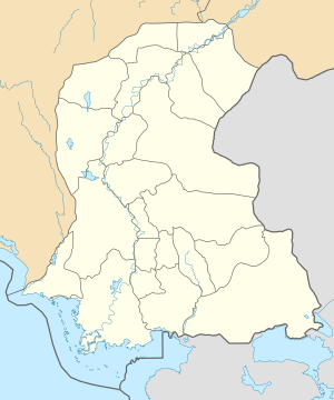 Jacobabad Location in Sindh | |
| Coordinates: 28°16′37″N 68°27′05″E / 28.27694°N 68.45139°ECoordinates: 28°16′37″N 68°27′05″E / 28.27694°N 68.45139°E | |
| Country | Pakistan |
| Province | Sindh |
| District | Jacobabad District |
| Founded | 1847 |
| Time zone | UTC+5 (PST) |
Jacobabad (Sindhi and Urdu: جيڪب آباد) is a city in Sindh, Pakistan, serving as both the capital city of Jacobabad District and the administrative centre of Jacobabad Taluka, an administrative subdivision of the district. The city itself is subdivided into 8 Union Councils. Sitting close to the provincial boundaries of Sindh and Balochistan, Jacobabad became a city on the site of an existing village (Khangarh), and is crossed by the Pakistan Railway and many main roads of the province.
Etymology
The translation of Jacobabad from Urdu to English is known as the City of Jacob, after John Jacob, an East India Company officer (1812–1858) and engineer, from the original Khangarh Village of Khan.
History
During British rule, as part of British Raj, the town was the administrative headquarters of the Upper Sind Frontier District of the Bombay Presidency; with a station on the Quetta branch of the North-Western Railway. It became well known for consistently having the highest temperature in South Asia, and has a mean summer average of 98 °F (37 °C).[1]
In November 2010, former Prime Minister Yousaf Raza Gillani announced that University of Information Technology would be established in Jacobabad.[2]
Twenty-two Shiites were killed in by a suicide bomber in October 2015.[3]
Religion
- Hindu temples
- Baba Kalyan Dass Mandir
- Bhagwan Shiv Mandir at Ladies Market
- Lal Sain Mandir at Bhahan Bazar
- Nandro Mata Waro Mandir at Chenchri Ghitti
- Sach Khand Dham
- Shive shankar Mandir at Peti Bazar
- Swami Kirshan Gir Darbar (Kundan Gir Marri)
Climate
Jacobabad has a hot desert climate (Köppen climate classification BWh) with extremely hot summers and mild winters. The highest recorded temperature is 52.8 °C (127.0 °F), and the lowest recorded temperature is −3.9 °C (25.0 °F). Rainfall is low, and mainly occurs in the monsoon season (July–September).
| Climate data for Jacobabad | |||||||||||||
|---|---|---|---|---|---|---|---|---|---|---|---|---|---|
| Month | Jan | Feb | Mar | Apr | May | Jun | Jul | Aug | Sep | Oct | Nov | Dec | Year |
| Record high °C (°F) | 30.6 (87.1) |
34.0 (93.2) |
42.1 (107.8) |
45.6 (114.1) |
52.8 (127) |
51.1 (124) |
47.8 (118) |
45.0 (113) |
42.8 (109) |
41.7 (107.1) |
38.0 (100.4) |
30.6 (87.1) |
52.8 (127) |
| Average high °C (°F) | 22.6 (72.7) |
25.2 (77.4) |
31.3 (88.3) |
38.0 (100.4) |
43.1 (109.6) |
44.3 (111.7) |
40.6 (105.1) |
38.2 (100.8) |
37.0 (98.6) |
35.3 (95.5) |
30.1 (86.2) |
24.1 (75.4) |
34.2 (93.5) |
| Daily mean °C (°F) | 15.1 (59.2) |
17.9 (64.2) |
23.8 (74.8) |
30.2 (86.4) |
34.9 (94.8) |
36.9 (98.4) |
34.9 (94.8) |
33.2 (91.8) |
31.4 (88.5) |
27.8 (82) |
22.1 (71.8) |
16.4 (61.5) |
27.1 (80.7) |
| Average low °C (°F) | 7.7 (45.9) |
10.5 (50.9) |
16.3 (61.3) |
22.3 (72.1) |
26.7 (80.1) |
29.4 (84.9) |
29.2 (84.6) |
28.3 (82.9) |
25.9 (78.6) |
20.3 (68.5) |
14.1 (57.4) |
8.7 (47.7) |
20 (67.9) |
| Record low °C (°F) | −1.1 (30) |
1.0 (33.8) |
6.0 (42.8) |
13.5 (56.3) |
18.9 (66) |
21.0 (69.8) |
20.3 (68.5) |
22.8 (73) |
17.8 (64) |
12.0 (53.6) |
3.9 (39) |
0.3 (32.5) |
−1.1 (30) |
| Average precipitation mm (inches) | 3.1 (0.122) |
7.1 (0.28) |
10.3 (0.406) |
2.0 (0.079) |
1.7 (0.067) |
4.7 (0.185) |
36.8 (1.449) |
26.3 (1.035) |
11.2 (0.441) |
2.3 (0.091) |
1.2 (0.047) |
3.7 (0.146) |
110.4 (4.348) |
| Mean monthly sunshine hours | 241.9 | 214.7 | 247.5 | 249.4 | 266.4 | 272.7 | 236.0 | 259.8 | 278.1 | 288.8 | 267.6 | 243.7 | 3,066.6 |
| Source: NOAA (1961–1990) [4] | |||||||||||||
Airport and airbase
The commercial airport at Jacobabad, about 300 miles (480 km) north of Karachi and 300 miles (480 km) southeast of Kandahar, is located on the border between Sindh and Balochistan provinces. The Shahbaz Air Base (co-located with the commercial airport in Jacobabad) was one of three Pakistani air bases used by U.S. and allied forces to support the Operation Enduring Freedom campaign in Afghanistan and reportedly ongoing drone strikes in North Western Pakistan tribal regions.[5]
References
- ↑ Medical and Physical Society of Bombay (1857). Transactions. Retrieved 17 March 2011.
- ↑ "Jacobabad to have IT university: PM". thenews.com.pk. Retrieved 27 January 2012.
- ↑
- ↑ "Jacobabad Climate Normals 1961–1990". National Oceanic and Atmospheric Administration. Retrieved January 17, 2013.
- ↑ "CIA drones quit one Pakistan site – but US keeps access to other airbases". The Bureau of Investigative Journalism. Retrieved 24 March 2013.
| Authority control |
|---|