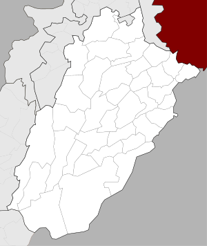
Burewala
| Burewala بُورے والا | |
|---|---|
| City | |
 Burewala  Burewala | |
| Coordinates: 30°9′33″N 72°40′54″E / 30.15917°N 72.68167°ECoordinates: 30°9′33″N 72°40′54″E / 30.15917°N 72.68167°E | |
| Country |
|
| Province | Punjab |
| Elevation | 133 m (436 ft) |
| Population (2010) | |
| • Total | 309,343 |
| Time zone | UTC+5 (PST) |
| Website |
www |
Burewala (Urdu: بُوریوالا ), (Punjabi: بُورے والا), is a city of Vehari District in Punjab, Pakistan. The city of Burewala is the headquarters of Burewala Tehsil, an administrative subdivision of the district.[1] It is located at 30°10'0N 72°39'0E and has an altitude of 133 metres (439 feet).[2] According to the 1998 census of Pakistan, Burewala had a population of about 150,000 people.[3] As of 2000, it is the 31st biggest city in Pakistan by population.[4] Postal code of Burewala is 61010.
History
Burewala is situated on the Dehli Multan Road. Sutlej River crosses Burewala near the towns Kachi Pakki, Jamlera and Sahuka. Shrine of Hazrat Baba Haji Sher Dewan Chawli Mashaikh is also situated in Dewan Sahib at a distance of 18 km. from Burewala. Prior to its settlement, the area was a jungle which was later populated by the Dhuddi tribe.[3] When the Pakpattan canal started operating in this area, people started to settle in villages as agriculture developed, resulting in jungles being cut to make way for cultivation fields. As this area was in 'Eastern Canal Division' so it was named village no. 134/EB (EB = Eastern Barr). In the northern side of Burewala, there are still signs of an old water canal which is now called Sukh Bias.[3]
Etymology
The exact origin of Burewala's name is unknown; however, there are different theories. One theory is that the city is named after a person named "Burha." He was, according to some people, 'Sikh'. The village is also called "Old Bura" or "Purana Boora." The people of this villages constructed a well with a diameter of 8 feet and named it after their ancestor so it was called "Chah Boorhay wala" (Well of Burha). This well is now included in the P.I. Link canal. Due to this well the new city was named Burewala. In July 1976, Burewala was upgraded as a subdivision. The areas of Gaggo Mandi, Shokh Fazal, Sahuka Pakistan, Jamlerah, and Suldera Pakistan were included in the subdivision.[1]
References
- 1 2 Tehsils & Unions in the District of Vehari – Government of Pakistan website, National Reconstruction Bureau, archived on 5 August 2012, Retrieved 29 September 2017
- ↑ Location of Burewala – Falling Rain Genomics website, Retrieved 29 September 2017
- 1 2 3 Burewala Travel Guide and City History, world66.com website, Published 28 December 2006, Retrieved 29 September 2017
- ↑ "Pakistan City & Town Population List". Tageo.com website. Retrieved 29 September 2017.
External links
Neighbourhoods of Vehari | ||
|---|---|---|
Administrations: Vehari District | ||
| Tehsils |  | |
| Cities | ||
| Towns and councils |
| |
| Villages | ||
Website: Vehari District | ||