History
During the seventh century AD, the celebrated Chinese Buddhist monk, scholar, translator and pilgrim to India Hsuan Tsang mentioned Bhimber in his works.
The works of Hsuan Tsang were translated into English in 1884 by Samuel Beal a scholar from England.
Bhimber has remained capital city of Chibhal, named after Raja Chib Chand the eldest son of Raja Partab chand Katoch who came to Bhimber and established the state after marrying local ruler`s daughter in 1400 A.D. Chibs are direct descendents of Raja Chib Chand Katoch.[2][3][4]
In Chibs, the first who embraced Islam was Shadaab Khan who is famous as Hazrat Baba Shadi Shaheed. His Hindu name was Raja Dharm Chand Chib. The last ruler of Chibhal was Raja Sultan Khan (1800–1840). Bhimber has been important strategically. It lies on the route that was followed by the Mughal Emperors for their frequent visits to the Kashmir Valley. It is also known as "Baab-e-Kashmir" (Door to Kashmir) because of its importance and geographical location which was ideal for Mughal Emperors to enter Kashmir. Therefore, the Mughals used Bhimber as a staging point for journey to Srinagar. Mughal Emperor Jahangir discussed Bhimber in his book Tuzk-e-Jahangiri.[5]
Culture
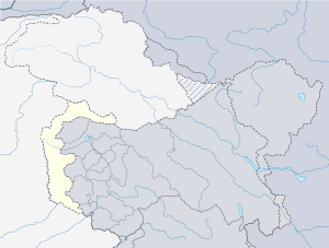
Majority of people speak Punjabi and people migrated from Samahni Valley speak Pahari. Bhimber is situated at the border of Azad Kashmir and Punjab.
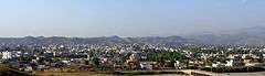
Geography and climate
Bhimber is a valley. Its hot, dry climate and other geographical conditions closely resemble with those of Gujrat, the adjoining district of Pakistan.
Education
District Bhimber stands at number 11 in ranking related to education with an education score of 72.73, according to Alif Ailaans’ Pakistan District Education Ranking 2017,
When it comes to infrastructure Bhimber ranks at 137, with school infrastructure of 24.64 Retention score is at 42.04. Like most districts in Kashmir , schools in Bhimber don’t habve proper building walls , furniture and other facilities which help aid the student to study. Retention score is also low because of less number of beyond primary schools.
Lack of government school for girls and girls having to travel far away to school daily is one of the issues reported on TaleemDo! App. This is also a reason why less girls are enrolled in the schools in this district.
Tourism
Bhimber and its surrounding area is very rich in archaeological remains. There is a forest rest house in Bhimber. Famous historical and scenic sites in the town and surrounding area include:
- Baghsar Fort – This ancient fort is built in Samahni Valley close to a place known as Baghsar.
- Baghsar Lake – This lake is situated near Baghsar Fort.
- Famous Haathi Gate – Jahangir's elephant used to enter the town through it.
- Jandi Chontra – This is the place from where Srinagar and Lahore are at the same distance.
- Sarai Saadabad – The Sarai is located near Bandala in the Samahni Valley. It was used as a staging camp during Mughal Era for the caravans moving from Lahore to Kashmir.
- Tomb of Sufi saint Baba Shadi Shaheed.
Transportation
Rail
There is no railways station in Bhimber, the nearest railways stations are that of Gujrat, Lala Musa Junction and Kharian City & Cantt.