Hendra, Queensland
| Hendra Brisbane, Queensland | |||||||||||||||
|---|---|---|---|---|---|---|---|---|---|---|---|---|---|---|---|
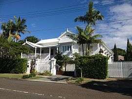 Residential street in Hendra | |||||||||||||||
| Population | 4,417 (2011 census)[1] | ||||||||||||||
| • Density | 1,636/km2 (4,240/sq mi) | ||||||||||||||
| Postcode(s) | 4011 | ||||||||||||||
| Area | 2.7 km2 (1.0 sq mi) | ||||||||||||||
| Location | 9 km (6 mi) from Brisbane | ||||||||||||||
| LGA(s) |
City of Brisbane (Hamilton Ward)[2] | ||||||||||||||
| State electorate(s) | Clayfield | ||||||||||||||
| Federal Division(s) | Brisbane | ||||||||||||||
| |||||||||||||||
Hendra is a suburb of the city of Brisbane, Queensland, Australia. It lies roughly six kilometres north-east of Brisbane central business district. The streets of Hendra are lined with Jacaranda and Royal poinciana Trees.[3][4] As with its neighbouring suburbs, Hendra is predominantly a family-oriented community.
History
Hendra was originally a farming district, an expansion of the Nundah settlement. The crops were citrus fruits, grapes and pineapples. There were also dairy herds.[5]
Heritage listings
Hendra has a number of heritage-listed sites, including:
- 5 Derby Street: Glengariff, once the residence of millionaire Thomas Beirne[6]
- Ardon Residence 27 Bowley Street, Hendra [7]
- Inspice Residence 70 Zillman Road, Hendra [7]
Hendra today
Hendra is home to an abundance of restaurants and cafes, including local cafés, take-aways, antiques and pubs. Toombul Shopping Centre is the nearest major shopping mall, but there are many local shops on Junction Road and Sandgate Road.
The local school, Hendra Secondary College, is supplemented by state and private schools in the neighbouring suburbs.
Hendra has the Doomben Racecourse, and several parks (notably T.C. Beirne Park), bikeways and walkways. Kedron Brook runs through Hendra, Nundah and Wooloowin and has walking and biking paths running alongside.
The Hendra virus is named after this suburb, as it was the first place where the virus was detected, in September 1994.[8] The affected stables were located at 10 Williams Avenue.
Demographics
In the 2011 census the population of Hendra was 4,417: 50.8% female and 49.2% male.[1]
The median age of the Hendra population was 39 years, 2 years above the Australian median.
74.8% of people living in Hendra were born in Australia, compared to the national average of 69.8%; the next most common countries of birth were England 4%, New Zealand 4%, South Africa 1.1%, Ireland 0.8%, Philippines 0.7%. 86.6% of people spoke only English at home; the next most popular languages were 0.9% Italian, 0.7% Arabic, 0.6% Mandarin, 0.6% Greek, 0.5% French.
Nearly three-quarters (72.1%) of households in Hendra were family households, 22.6% were single person households and 5.3% were group households. Of the families, almost half (48.6%) were couple families with children, 34.7% were couples without children, and 14.6% were one parent families. Stand alone houses account for 86.1% of occupied private dwellings in Hendra, 8.9% were semi-detached, 4.8% were flats, units or apartments and 0.2% were other dwellings.
The median weekly household income was $1,894, compared to the national median of $1,234.
Amenities
Hendra is home to the All Stars Baseball Club,[9] T. C Beirne Park,[9] Ti-trees Swimming Club,[10] and the Northern Suburbs Bridge Club.[11]
Education
The local school, Hendra Secondary College, is supplemented by state and private schools in the neighbouring suburbs.
- Goodstart Early Learning[12]
- Our Lady Help of Christians[13] was opened 1 January 1937.[14]
- Hendra State School[15] was opened on 1 August 1864 and is one of the oldest primary schools in Queensland.[16]
- Aviation High School[17] formerly known as Hendra Secondary College was opened on 29 January 2007.[18] Hendra Secondary College was opened on 1 January 1994. Before this it was known as Hendra State High School. This school was opened on 29 January 1963.[19]
Transport
Public transport services in the area are abundant with the northern train line running through the area and Hendra, Albion, Wooloowin, Eagle Junction, and Toombul train stations all close by. Regular bus services also make getting into and out of the CBD easy for Hendra residents.
Brisbane's domestic and international airport terminals are just as easily accessible by car or the AirTrain. Apart from some light industrial and commercial lots, Hendra is zoned 'residential A' and therefore all residential properties are houses.
Places of worship
Economy
Strategic Airlines has its head office in the suburb of Hendra.[22]
References
- 1 2 Australian Bureau of Statistics (31 October 2012). "Hendra (State Suburb)". 2011 Census QuickStats. Retrieved 25 October 2013.

- ↑ "Hamilton Ward". Brisbane City Council. Brisbane City Council. Retrieved 12 March 2017.
- ↑ "Hendra Real Estate - Suburb Information | Clark Real Estate". Clark Real estate. Retrieved 1 November 2017.
- ↑ "Alert over 'plague' of caterpillars". Retrieved 1 November 2017.
- ↑ Our Brisbane, Hendra. Retrieved 6 December 2009
- ↑ "Glengariff (entry 600222)". Queensland Heritage Register. Queensland Heritage Council. Retrieved 6 July 2013.
- 1 2 "Federation-House - Queensland Federation Heritage Sites". federation-house.wikispaces.com. Retrieved 4 November 2017.
- ↑ "Second hendra outbreak in Queensland". ABC News. 2 July 2011. Retrieved 5 July 2011.
- 1 2 "All Stars Baseball Club". www.allstarsbaseball.com.au. Retrieved 1 November 2017.
- ↑ "Sport centre - – The Ti-Trees Swimming Club Ltd – Modern Sport Centre". www.titreesswimmingclub.com.au. Retrieved 1 November 2017.
- ↑ "Northern Suburbs Bridge Club". www.northernsuburbs.bridgeaustralia.org. Retrieved 1 November 2017.
- ↑ https://www.goodstart.org.au
- ↑ "Welcome to Our Lady Help of Christians". www.olhchendra.qld.edu.au. Retrieved 4 November 2017.
- ↑ "Opening and closing dates of Queensland schools (N)". education.qld.gov.au. Retrieved 2018-01-29.
- ↑ https://hendrass.eq.edu.au
- ↑ "The oldest state primary schools in Queensland". education.qld.gov.au. Retrieved 2018-01-29.
- ↑ https://aviationhigh.eq.edu.au
- ↑ "Opening and closing dates of Queensland schools (A)". education.qld.gov.au. Retrieved 2018-01-29.
- ↑ "Opening and closing dates of Queensland schools (H)". education.qld.gov.au. Retrieved 2018-01-29.
- ↑ "Hendra Northgate". hncatholic.org.au. Retrieved 4 November 2017.
- ↑ "Welcome". hendraclayfieldanglican.com. Retrieved 4 November 2017.
- ↑ "Contact." Strategic Aviation. Retrieved 31 August 2011. "Brisbane Office 34 Navigator Place, Hendra QLD 4011 Australia"
External links
![]()
- University of Queensland: Queensland Places: Hendra
- "Hendra". BRISbites. Brisbane City Council. Archived from the original on 20 July 2008.
- "Hendra". Our Brisbane. Brisbane City Council. Archived from the original on 11 October 2007.