Inala, Queensland
| Inala Brisbane, Queensland | |||||||||||||||
|---|---|---|---|---|---|---|---|---|---|---|---|---|---|---|---|
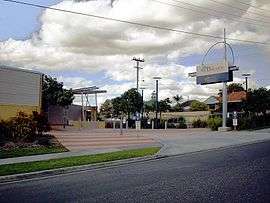 The Bremer Institute of TAFE, Inala | |||||||||||||||
 Inala | |||||||||||||||
| Coordinates | 27°35′24″S 152°58′14″E / 27.59°S 152.9705°ECoordinates: 27°35′24″S 152°58′14″E / 27.59°S 152.9705°E | ||||||||||||||
| Population | 14,849 (2016 census)[1] | ||||||||||||||
| • Density | 2,091/km2 (5,420/sq mi) | ||||||||||||||
| Established | 1946 | ||||||||||||||
| Postcode(s) | 4077 | ||||||||||||||
| Area | 7.1 km2 (2.7 sq mi) | ||||||||||||||
| Location | 18 km (11 mi) from Brisbane CBD | ||||||||||||||
| LGA(s) |
City of Brisbane (Forest Lake Ward)[2] | ||||||||||||||
| State electorate(s) | Inala | ||||||||||||||
| Federal Division(s) | Oxley | ||||||||||||||
| |||||||||||||||
Inala is a suburb in the City of Brisbane, Queensland, Australia.[3]
Geography
Inala is 18 kilometres (11 mi) south-west of the Brisbane CBD.
Inala Avenue/Poinsettia Street is the main roadway east-west and Serviceston Avenue/Rosemary Street and Blunder Road are the main roads stretching north-south. Newer estate Forest Lake is situated to the south; other surrounding suburbs include Durack, Darra and Oxley to the north; Richlands, Ellen Grove and Wacol to the west; and Willawong, Acacia Ridge, Pallara and Doolandella to the East.
History
Following World War II there was a shortage of 250,000 houses across Australia. In Queensland alone over 4,000 families were living in makeshift dwellings of tin, calico and canvas. The Queensland and Australian Governments responded by making housing a priority.
The history of Inala started as Serviceton suburb, the establishment of which was a meeting held in a Brisbane RSL Hall in May 1946. A group of ex-servicemen, led by Harold (Hock) Davis, were seeking affordable accommodation for their families during the post-war housing shortage. The Serviceton Co-operative Society was formed and they purchased 480 hectares of flood-safe land, which was then divided amongst the shareholders, giving them 800 square meters each. At that stage, Inala was planned as a satellite town set on a broad, high, gently sloping ridge. In 1949–1950 the Queensland Housing Commission purchased Serviceton, comprising approximately 850 acres (3.4 km²) of land, from the faltering Serviceton Housing Co-operative. The Housing Commission subsequently annexed another 200 acres (0.8 km²) to the suburb and changed its name to Inala in 1953 to avoid postal confusion with another Serviceton in South Australia. The name 'Inala' is an indigenous word meaning 'resting place', as it was a traditional stopping point for indigenous travellers on their way east to the Moreton Bay region prior to colonisation. The traditional tribe is Jagera.
Architecture
The development of Inala coincided with the emergence of architectural modernism in Australia. The innovative designs of young southern architects such as Robin Boyd, Roy Grounds and Harry Seidler featured the efficient use of space with minimal ornamentation, utilisation of new materials and techniques, and above all design simplicity, while striving to build solid houses that would require little maintenance. Inala was designed and built in Modernist Revival style with elements of Art Deco. It was both aesthetically successful and a practical architectural solution.
The post-war worldwide shortage of building materials coupled with huge demands created the impetus for exploring and using new materials and techniques in Inala. The choice to use reinforced concrete in the construction of Inala houses was made because of its strength, reliability and flexibility. Inala also had the advantage of good access to the local cement and concrete made from washed river sand and lime from Moreton Bay coral shipped up the river by barge and processed at Darra. Concrete was an ideal material for the fashionable Modernist style. Inala houses were built on raised concrete foundations, framed with hardwood timber, floored with hard-wearing brushbox, with silky oak used for window frames. The outer walls were constructed of poured concrete approximately 18 cm thick, internal walls and ceilings — with rendered wire lath. These robust construction techniques also served to minimise maintenance costs and achieve a long life span of the houses.
Demographics
In the 2016 census, Inala recorded a population of 14,849 people, 48.5% male and 51.5% female. The median age of the Inala population was 34 years, 3 years below the Australian median. 45.9% of people living in Inala were born in Australia, compared to the national average of 66.7%; the next most common countries of birth were 19.4% Vietnam, 3.1% New Zealand, 2.0% Samoa and 1.9% England. 39.8% of people spoke only English at home.
According to the 2016 census, Inala has the largest Buddhist community (2,055 people; 13.8%) and the largest Vietnamese Australian community (4,446 people; 30.0%) of any suburb in Queensland.[4][5]
Suburb amenities, facilities and services
There are several shopping precincts within Inala. The joined Inala Plaza–Civic Centre complex located on the corner of Kittyhawk and Inala Avenues is the largest precinct in Inala and serves the ethnically diverse community by offering two major supermarkets and a large number of various shops and restaurants. Other shops and restaurants exist in Biota Street located to the north, Skylark Street shops — to the east, and on Lavender/Lilac Streets. Richlands Plaza shopping and business centre opened on the border of Inala and Richlands in 2010, and offers a major supermarket, adjacent shops, services, cafes and a gym.
Inala has two post offices, numerous medical centres and services, many of which are bulk billing, two community halls, a community art gallery, various churches, and a Buddhist temple and monastery.
There are a large number of government funded community organisations and programs located in Inala, some of these include Inala Youth Service, Inala Community House, Skylarkers, Western Districts Out of Home Care, Western Districts Family Steps, Shared Family Care and The Childcare Access and Equity Resource Support Unit. Most government services are located within the Inala Plaza precinct and in its surrounds. These include a Brisbane City Council Library,[6] Department of Communities, Department of Corrective Services and a Medicare and Centrelink office. The Inala Library opened in 1963 with a major refurbishment in 1994 and a smaller renovation in 2011.[7]
Sport and recreation facilities include a Police Citizens Youth Club gym and fitness centre, a number of Brisbane City Council parks and recreation areas, sport ovals and facilities, and one of the best skate parks in Brisbane – Inala Skate Park (D.J. Sherrington Park). Special pedestrian walkways between residential houses facilitate residents′ access to bus stops, schools, shops and recreational areas.
Inala has a high percentage of green areas and parks with predominantly native Australian vegetation.[8] The parks and the large amounts of grown native trees through the suburb maintain the ecosystem of Inala, quiet environment and clean air.[9]
Education
Inala has a number of schools and educational institutions. Schools include Richlands East Primary School, Serviceton South Primary School, St Marks Primary School. Inala also has a campus of the Bremer TAFE. Other Schools nearby include Inala Primary School, Durack State School, Glenala High School and Western Suburbs Special School.
Serviceton South State School caters for students Prep to Year 6.[10] The school opened on 2 September 1963 and celebrated its 50th Anniversary on 2 September 2013.[11][12]
Inala West State School opened on 2 January 1960 and closed on 31 December 2009. Richlands State School opened on 12 June 1934 and closed on 31 December 2010.[13]
Transport
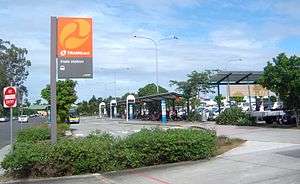
Buses conduct services from Inala bus station near the Inala Plaza shopping centre, through the Inala suburb, to railway stations nearest to Inala: Richlands, Darra, Oxley. Richlands railway station opened in 2011 and is now Inala′s closest rail link, approximately 3 kilometres (1.9 mi) from central Inala. Paths for easy pedestrian and bike access from Inala to Richlands station are set in the area development plan.[14] Inala also has bus connections to Moorooka and Coopers Plains train stations, South Bank and the Brisbane City via the frequent express bus route 100 that operates from early morning until late night.
Inala has a very good access to Ipswich Motorway, Centenary Motorway and Logan Motorway, and further to Warrego Highway and Cunningham Highway.
Political representation
Les Bryant, former ALP Richlands Ward Councillor, represented Inala in the Brisbane City Council for 17 years, 1991 - 2008.[15] The Bryant family moved onto Blunder Road late 1946, when there was nothing but bushland where Inala now stands. They saw Inala grow from early beginnings to what it is today, a mature, successful multi cultural local community. Les and his wife Margaret still live in the Inala district today in retirement, in sister suburb Durack. Les was succeeded by Milton Dick (Australian Labor Party A.L.P.) in 2008, who moved into Federal politics winning the Federal Division of Oxley in 2016. Charles Strunk (ALP) won the renamed old Ward of Richlands, now Forest Lake Ward, in 2016, to become the new Brisbane City Councillor for Forest Lake Ward.[16][17] Annastacia Palaszczuk (ALP) is the Member of the Queensland Legislative Assembly for Inala; she became Premier of Queensland in 2015.
Former Inala resident, Joanna Lindgren was an LNP Australian Senator for Queensland in 2015 and 2016; the niece of Neville Bonner AO, Joanna is the first Aboriginal female Senator for Queensland.[18]
Culture and ethnicity
Inala is a vibrant multicultural society boasting more than 20 different nationalities. Big celebrations such as Multicultural Fiesta and Lunar New Year (Tết) are held regularly. In 2016 Census, 31.3% of Inala residents stated no religious affiliation, followed by Inala′s two major religious affiliations: Catholic (21.2%) and Buddhism (13.8%).
Inala has its own not-for-profit community group — “Richlands, Inala and Suburbs History Group” — dedicated to the research of local history and diverse cultural heritage, historical presentations and book publications on the topics of local history, community and culture.
Churches and religious buildings
- Anglican Church
- Assemblies of God (Australian Christian Churches)
- Buddhist Temple Chùa Pháp Quang
- Buddhist Temple Chùa Phật Đà
- Christian Reformed Church
- Citipointe West Church
- Gospel Hall
- Great Hope Baptist Church
- Inala Church of the Nazarene
- Methodist Church Of Samoa
- Saint Mark's Catholic Church
- Sikh Temple Guru Nanak Gurdwara
- The Church of Jesus Christ of Latter-day Saints
- The Salvation Army
- The Seventh Day Adventists
- Uniting Church
- Vietnamese Catholic Community Brisbane (Cộng Đồng Công Giáo Việt Nam Brisbane)[19]
- Vietnamese English Baptist Church (Hội Thánh Tinh Lành Báp-tít Việt-Anh)
Sporting clubs
- Blue Fin Fishing Club
- Brisbane Lions Soccer Club
- West Inala Panthers Rugby League Football Club
- West Inala Panthers Junior Rugby League Football Club
References
- ↑ Australian Bureau of Statistics (27 June 2017). "Inala (State Suburb)". 2016 Census QuickStats. Retrieved 9 November 2017.

- ↑ "Forest Lake Ward". Brisbane City Council. Brisbane City Council. Archived from the original on 12 March 2017. Retrieved 12 March 2017.
- ↑ "Inala - suburb in City of Brisbane (entry 43379)". Queensland Place Names. Queensland Government. Retrieved 5 November 2017.
- ↑ "2016Census_G14_QLD_SSC - Census DataPacks - General Community Profile". Australian Bureau of Statistics – Census 2016. Retrieved 18 July 2017.
- ↑ Australian Bureau of Statistics (27 June 2017). "Inala (State Suburb)". 2016 Census QuickStats. Retrieved 18 July 2017.
- ↑ "Library opening hours and locations". Brisbane City Council. 3 January 2018. Archived from the original on 30 January 2018. Retrieved 30 January 2018.
- ↑ "Public Libraries Statistical Bulletin 2016-17" (PDF). Public Libraries Connect. State Library of Queensland. November 2017. p. 11. Archived (PDF) from the original on 30 January 2018. Retrieved 30 January 2018.
- ↑ "Inala parks". Brisbane City Council. Brisbane City Council. Archived from the original on 13 April 2016. Retrieved 9 November 2017.
- ↑ Community Renewal Progress Report January 2002 – June 2003
- ↑ "Serviceton South State School". Retrieved 28 January 2018.
- ↑ "Queensland schools opening dates". Retrieved 28 January 2018.
- ↑ "Queensland School Anniversaries". Education Queensland. 19 August 2013. Retrieved 31 January 2018.
- ↑ "Opening and closing dates of Queensland Schools". Queensland Government. Retrieved 12 February 2015.
- ↑ Richlands Wacol Corridor Neighbourhood Plan, Brisbane City Council
- ↑ "Richlands". Brisbane City Council elections 2008. Archived from the original on 3 October 2017. Retrieved 3 October 2017.
- ↑ "2016 Brisbane City Council - Councillor Election - Forest Lake - Ward Summary". Electoral Commission of Queensland. 19 April 2016. Archived from the original on 26 May 2016. Retrieved 16 June 2016.
- ↑ "Brisbane City Council Division Maps". Electoral Commission of Queensland. Retrieved 16 June 2016.
- ↑ "BIO". Senator Joanna Lindgren. Archived from the original on 10 March 2016. Retrieved 28 May 2016.
- ↑ "Cộng Đồng Công Giáo Việt Nam Brisbane". Archived from the original on 18 January 2016. Retrieved 8 February 2016.
Further reading
- Clark, Fred; Mynott, Vicki (2013), Serviceton : the soldier settlement that became Inala (Second ed.), Richlands, Inala and Suburbs History Group