Sinnamon Park, Queensland
| Sinnamon Park Brisbane, Queensland | |||||||||||||||
|---|---|---|---|---|---|---|---|---|---|---|---|---|---|---|---|
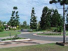 Sinnamon Road and roundabout | |||||||||||||||
| Population | 6,362 (2011 census)[1] | ||||||||||||||
| Postcode(s) | 4073 | ||||||||||||||
| LGA(s) |
City of Brisbane (Jamboree Ward)[2] | ||||||||||||||
| State electorate(s) | Mount Ommaney | ||||||||||||||
| Federal Division(s) | Oxley | ||||||||||||||
| |||||||||||||||
Sinnamon Park is a suburb of Brisbane, Queensland, Australia located 14 kilometres (8.7 mi) south-west of the Brisbane CBD.
Geography
The suburb's northern boundary is marked by the Brisbane River.
History
Sinnamon Park is named for the pioneering Sinnamon Family. The land occupied by Sinnamon Village retirement complex and the river flats east of the Centenary Freeway were formerly the family farm.
Heritage listings
Sinnamon Park has a number of heritage-listed sites, including:
- 675 Seventeen Mile Rocks Road: Sinnamon Memorial Uniting Church[3]
- 693 Seventeen Mile Rocks Road: Sinnamon Farm[4]
Demographics
In the 2011 census, the population of Sinnamon Park was 6,362, 53.4% female and 46.6% male.
The median age of the Sinnamon Park population was 39 years, 2 years above the Australian median.
61.1% of people living in Sinnamon Park were born in Australia, compared to the national average of 69.8%; the next most common countries of birth were England 5.3%, New Zealand 3%, India 2.7%, South Africa 2.5%, Vietnam 2.5%.
72.2% of people spoke only English at home; the next most common languages were 3.7% Vietnamese, 3% Mandarin, 2% Cantonese, 1.7% Hindi, 1.1% Persian (excluding Dari).
Politics
The people of Sinnamon Park are represented in the Queensland Parliament by Jess Pugh, the ALP Member for Mount Ommaney.
References
- ↑ Australian Bureau of Statistics (31 October 2012). "Sinnamon Park (State Suburb)". 2011 Census QuickStats. Retrieved 2 February 2013.

- ↑ "Jamboree Ward". Brisbane City Council. Brisbane City Council. Retrieved 12 March 2017.
- ↑ "Sinnamon Memorial Uniting Church (entry 600235)". Queensland Heritage Register. Queensland Heritage Council. Retrieved 6 July 2013.
- ↑ "Sinnamon Farm (entry 600233)". Queensland Heritage Register. Queensland Heritage Council. Retrieved 6 July 2013.
External links
| Wikimedia Commons has media related to Sinnamon Park, Queensland. |
Coordinates: 27°32′26″S 152°57′07″E / 27.5406°S 152.9519°E