Tennyson, Queensland
| Tennyson Brisbane, Queensland | |||||||||||||||
|---|---|---|---|---|---|---|---|---|---|---|---|---|---|---|---|
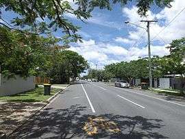 King Arthur Terrace, 2014 | |||||||||||||||
| Population | 1,019 (2016 census)[1] | ||||||||||||||
| Postcode(s) | 4105 | ||||||||||||||
| Location | 7 km (4 mi) from Brisbane GPO | ||||||||||||||
| LGA(s) |
City of Brisbane (Tennyson Ward)[2] | ||||||||||||||
| State electorate(s) | Miller | ||||||||||||||
| Federal Division(s) | Moreton | ||||||||||||||
| |||||||||||||||
Tennyson is a suburb of Brisbane, Australia. It is 7 kilometres (4.3 mi) south of the CBD on the Brisbane River. At the 2016 Australian census the suburb had a population of 1019.[1]
The area was originally named Softstone by James Strong, one of the original settlers, but by 1897 the name was changed to Tennyson. Tennyson is named after the British poet Alfred Tennyson.

The Queensland Tennis Centre[3] is located in Tennyson. It is built on the site of the demolished Tennyson Power Station.
Demographics
In the 2011 census the population of Tennyson was 859, 51% female and 49% male.[4] The median age of the Tennyson population was 41 years, four years above the Australian median. 70.8% of people living in Tennyson were born in Australia, compared to the national average of 69.8%. The other top responses for country of birth were England 4.1%, New Zealand 2.4%, Philippines 1.3%, Germany 1.2%, United States of America 1%. 83.6% of people spoke only English at home; the next most popular languages were 1.2% Vietnamese, 0.9% Spanish, 0.8% Invented Languages, 0.8% Korean, 0.6% Filipino.[4]
Transport
Services to the Tennyson railway station were suspended in 2011, with no future plans of reopening the station for use yet. Bus services run through the suburb as a replacement to the railway.
References
- 1 2 Australian Bureau of Statistics (27 June 2017). "Tennyson (Brisbane City) (State Suburb)". 2016 Census QuickStats. Retrieved 25 March 2018.

- ↑ "Tennyson Ward". Brisbane City Council. Brisbane City Council. Retrieved 19 March 2017.
- ↑ "Queensland Tennis Centre". Department of Public Works. Archived from the original on 16 May 2009. Retrieved 25 November 2009.
- 1 2 Australian Bureau of Statistics (27 June 2017). "Tennyson (Brisbane City) (State Suburb)". 2016 Census QuickStats. Retrieved 10 October 2011.
External links
| Wikimedia Commons has media related to Tennyson, Queensland. |