Richlands, Queensland
| Richlands Brisbane, Queensland | |||||||||||||||
|---|---|---|---|---|---|---|---|---|---|---|---|---|---|---|---|
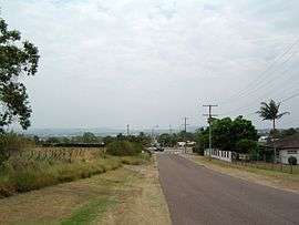 Orchard Road, Richlands | |||||||||||||||
| Population | 3,598 (2016 census)[1] | ||||||||||||||
| Established | 1975 | ||||||||||||||
| Postcode(s) | 4077 | ||||||||||||||
| Location | 16 km (10 mi) from Brisbane GPO | ||||||||||||||
| LGA(s) |
City of Brisbane (Forest Lake Ward)[2] | ||||||||||||||
| State electorate(s) | Inala | ||||||||||||||
| Federal Division(s) | Oxley | ||||||||||||||
| |||||||||||||||
Richlands is an outer suburb of Brisbane, Australia. It is 16 kilometres (9.9 mi) south-west of the CBD. At the 2016 Australian Census the suburb recorded a population of 3,598.[1]
The suburb features the cross over of the Ipswich Motorway (M7) and Centenary Motorway (M5), and is home to Queensland Lions Football Club who play in the Brisbane Premier League.
Demographics
In the 2011 Census, Queensland the population of Richlands was 2,076, 51.4% female and 48.6% male.
The median age of the Richlands population was 29 years, 8 years below the Australian median.
52.8% of people living in Richlands were born in Australia, compared to the national average of 69.8%; the next most common countries of birth were Vietnam 10.3%, New Zealand 8.9%, England 2.4%, Philippines 2.2%, India 1.9%.
54.8% of people spoke only English at home; the next most common languages were 17.2% Vietnamese, 3.8% Samoan, 2.3% Hindi, 1.7% Italian, 1.1% Spanish.
History
In 1934, Richlands State School was opened with one teacher.[3] At the same time, a small sub-division was named Richland Estate, which is most probably the origin of the suburb's name. It was part of the larger suburb called Darra until it officially became a suburb in 1975.[3]
Early industries in the suburb were dairy and poultry farming, honey production and table grape growing.[3]
The suburb is home to a number of recreational clubs including the Brisbane West Tennis Centre which opened in the early 1980s, Richlands Tenpin Bowl which opened in 1991 and the Darra Oxley Pony Club.[3]
The Richlands Drive-in theatre opened in the late 1970s at 295 Archerfield Road, closing in December 2000 making it the last to be operating in Brisbane.[3]
References
- 1 2 Australian Bureau of Statistics (27 June 2017). "Richlands (Brisbane City) (State Suburb)". 2016 Census QuickStats. Retrieved 14 January 2013.

- ↑ "Forest Lake Ward". Brisbane City Council. Brisbane City Council. Retrieved 12 March 2017.
- 1 2 3 4 5 Mynott, Wicki (2009). 150 years: Richlands, Inala & neighbouring suburbs in Brisbane's South West. Richlands, Inala & Suburbs History Group. pp. 174–190.
|access-date=requires|url=(help)
External links
| Wikimedia Commons has media related to Richlands, Queensland. |
Coordinates: 27°34′S 152°56′E / 27.567°S 152.933°E