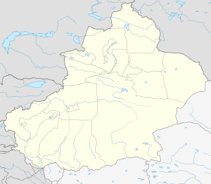
Fuhai County
| Fuhai County 福海县 بۇرۇلتوقاي ناھىيىسى | |
|---|---|
| County | |
.png) Location of Fuhai County (red) within Altay Prefecture (yellow) and Xinjiang | |
 Fuhai Location of the seat in Xinjiang | |
| Coordinates: 47°06′43″N 87°29′13″E / 47.112°N 87.487°ECoordinates: 47°06′43″N 87°29′13″E / 47.112°N 87.487°E | |
| Country | People's Republic of China |
| Autonomous region | Xinjiang |
| Prefecture | Altay |
| Time zone | UTC+8 (China Standard) |
| Fuhai County | |||||||||||
| Chinese name | |||||||||||
|---|---|---|---|---|---|---|---|---|---|---|---|
| Simplified Chinese | 福海县 | ||||||||||
| Traditional Chinese | 福海縣 | ||||||||||
| |||||||||||
| Alternative Chinese name | |||||||||||
| Simplified Chinese | 布伦托海县 | ||||||||||
| Traditional Chinese | 布倫託海縣 | ||||||||||
| |||||||||||
| Uyghur name | |||||||||||
| Uyghur |
بۇرۇلتوقاي ناھىيىسى | ||||||||||
| |||||||||||
| Kazakh name | |||||||||||
| Kazakh |
بۋرىلتوعاي اۋدانى Kazakh Cyrillic: Бурылтоғай ауданы Kazakh Latin alphabet: Bwrıltoğay awdanı | ||||||||||
Fuhai County (Chinese: 福海县) as the official romanized name, also transliterated from Uyghur as Burultokay County (Uyghur: بۇرۇلتوقاي ناھىيىسى ; Chinese: 布伦托海县), is a county in the Xinjiang Uyghur Autonomous Region and is under the administration of the Altay Prefecture. It has an area of 33,273 km2 (12,847 sq mi) with a population of 70,000. The Postcode is 836400.
This county is a verdant lush valley surrounded by the barren deserts and wastelands.
The Altay Mountains flank this county in the north, two rivers flow through the area the Ulungur River and the Ertix River (Irtysh). The end result is a fertile area for pasture that supports the famous Xinjiang sheep which are supposedly 'big as a cow'.
Administrative divisions
- Town: Fuhai Town.
- Townships: Kokagax Township (喀拉玛盖乡), Ardebil Township (阿尔达乡)