Mussoorie
| Mussoorie | |
|---|---|
| Hill Station | |
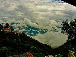 View of Mussoorie from the top of Gun Hill | |
| Nickname(s): Queen of the Mountains; Queen of the Hills | |
 Mussoorie Location in Uttarakhand, India | |
| Coordinates: 30°27′N 78°05′E / 30.45°N 78.08°ECoordinates: 30°27′N 78°05′E / 30.45°N 78.08°E | |
| Country |
|
| State | Uttarakhand |
| District | Dehradun |
| Elevation | 2,005.5 m (6,579.7 ft) |
| Population (2011) | |
| • Total | 30,118 |
| Languages | |
| • Official | Hindi, Garhwali |
| • Other | Garhwali, Hindi, English |
| Time zone | UTC+5:30 (IST) |
| PIN | 248179 |
| Vehicle registration | UK 07, UK 09 |
Mussoorie (Garhwali/Hindi: Masūrī) is a hill station and a municipal board in the Dehradun District of the northern Indian state of Uttarakhand. It is about 35 kilometres (22 mi) from the state capital of Dehradun and 290 km (180 mi) north of the national capital of New Delhi. The hill station is in the foothills of the Garhwal Himalayan range. The adjoining town of Landour, which includes a military cantonment, is considered part of 'greater Mussoorie', as are the townships of Barlowganj and Jharipani. The pin code for Mussoorie is 248179.[1]
Mussoorie is at an average altitude of 1,880 metres (6,170 ft). To the northeast are the Himalayan snow ranges, and to the south, the Doon Valley and Shiwalik ranges. The second highest point is the original Lal Tibba in Landour, with a height of over 2,275 metres (7,464 ft). Mussoorie is popularly known as The Queen of the Hills.[2][3]
History
Mussoorie was founded by Lt. Frederick Young of East India Company. Lt. Young came to these hills for the purpose of shooting game.
He was so enamoured by the beauty that he decided to build a hunting lodge (shooting box) on the Camel's Back Road with FJ Shore, Jt. Magistrate of Doon in 1823. He raised the first Gurkha Regiment and planted the first potatoes in the valley. His tenure in Mussoorie ended in 1844 and he further served in Dimapore and Darjeeling and retired as a General and went back to Ireland. There are no memorials to commemorate Young in Mussoorie. However, there is a Young Road in Dehradoon on which ONGC's Tel Bhawan stands.
In 1832 Mussoorie was the intended terminus of the Great Trigonometric Survey of India that began at the southern tip of India. Although unsuccessful, the Surveyor General of India at the time, George Everest wanted to have the new office of the Survey of India based in Mussoorie. A compromise was to have it in Dehradun, where it still is.
In 1850 the first beer brewery in India was built in Mussoorie.[4] By 1894 there were 22 breweries in India producing 6 million gallons a year.
By 1901 Mussoorie's population had grown to 6,461, rising to 15,000 in the summer. Earlier, Mussoorie was approachable by road from Saharanpur, 58 miles (93 km) away. Accessibility became easier in 1900 with the railway coming to Dehradun, thus shortening the road trip to 21 miles (34 km).[5]
The name Mussoorie is often attributed to a derivation of 'mansoor', a shrub which is indigenous to the area. The town is often referred to as 'Mansoori' by most Indians.
The main promenade in Mussoorie is called, as in other hill stations, the Mall. In Mussoorie, the Mall stretches from Picture Palace at its eastern end to the Public Library at its western end. The Nehru family, including Nehru's daughter Indira (later Indira Gandhi) were frequent visitors to Mussoorie in the 1920s, 1930s and 1940s, and stayed at the Savoy Hotel. They also spent much time in nearby Dehradun, where Nehru's sister Vijayalakshmi Pandit ultimately settled full-time.
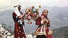
During the 1959 Tibetan Rebellion, the Central Tibetan Administration of the 14th Dalai Lama was at first established in Mussoorie before being moved to its present location in Dharamsala, Himachal Pradesh. The first Tibetan school was established in Mussoorie in 1960. Tibetans settled mainly in Happy Valley. Today, some 5,000 Tibetans live in Mussoorie.
Mussoorie today has an increased development of hotels and tourist lodges, given its relative proximity to Delhi, Ambala, and Chandigarh, and has serious problems of garbage collection, water scarcity and parking shortages, especially during the summer tourist season. Landour, Jharipani and Barlowganj have fewer such problems.
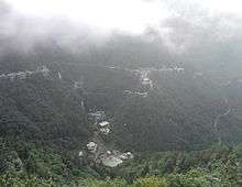
.jpg)
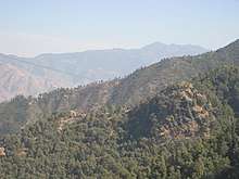
Geography and climate
Mussoorie has an average elevation of about 1,500 metres or 4,920 feet. The highest point is 'Lal Tibba', at a height of about 6,000 feet or 1,830 metres, although the name Lal Tibba is now also used to describe a lookout point, a short distance from the peak.
Mussoorie has a fairly typical subtropical highland climate (Köppen Cwb) for the mid-altitude Himalaya. Summers are warm and very wet, with July and August averaging approximately 660 millimetres or 25.98 inches of rain per month due to orographic lift of the extremely moist monsoonal air. The pre-monsoon seasons in April and May is warm to very warm and generally dry and clear, giving way to heavy rainfall from mid-June, while the post-monsoon season is also dry and clear but substantially cooler. In winter, rainfall is a little more frequent than in the pre-and post-monsoon seasons, and the general weather cool and partly cloudy. Mussoorie usually receives a few spells of snowfall in December, January and February, although the number of snowy days has come down in recent years due to a combination of local and global factors, such as deforestation, construction activity and global warming.
| Climate data for Mussoorie | |||||||||||||
|---|---|---|---|---|---|---|---|---|---|---|---|---|---|
| Month | Jan | Feb | Mar | Apr | May | Jun | Jul | Aug | Sep | Oct | Nov | Dec | Year |
| Record high °C (°F) | 20 (68) |
23 (73) |
26 (79) |
29 (84) |
34 (93) |
31 (88) |
29 (84) |
25 (77) |
27 (81) |
25 (77) |
25 (77) |
23 (73) |
34 (93) |
| Average high °C (°F) | 10 (50) |
12 (54) |
16 (61) |
21 (70) |
24 (75) |
23 (73) |
20 (68) |
20 (68) |
19 (66) |
18 (64) |
15 (59) |
13 (55) |
18 (64) |
| Average low °C (°F) | 2 (36) |
3 (37) |
5 (41) |
7 (45) |
14 (57) |
16 (61) |
15 (59) |
15 (59) |
14 (57) |
11 (52) |
7 (45) |
4 (39) |
10 (50) |
| Record low °C (°F) | −5 (23) |
−6 (21) |
−2 (28) |
−1 (30) |
4 (39) |
4 (39) |
11 (52) |
7 (45) |
1 (34) |
2 (36) |
−2 (28) |
−3 (27) |
−6 (21) |
| Average precipitation mm (inches) | 51 (2.01) |
52 (2.05) |
57 (2.24) |
30 (1.18) |
58 (2.28) |
174 (6.85) |
662 (26.06) |
670 (26.38) |
277 (10.91) |
64 (2.52) |
14 (0.55) |
18 (0.71) |
2,127 (83.74) |
| Source: | |||||||||||||
Demographics
As of 2011 India census,[6] Mussoorie had a population of 30,118. Males constitute 55% of the population and females 45%. Mussoorie has an average literacy rate of 89%, higher than the national average of 75%: male literacy is 94%, and female literacy is 84%. In Mussoorie, 9% of the population is under 6 years of age. In Mussoorie Nagar Palika Parishad, female sex ratio is of 812 against state average of 963. Moreover, child sex ratio in Mussoorie is around 918 compared to Uttarakhand state average of 890.
Landmarks
Tourism is the most significant segment of Mussoorie's economy.
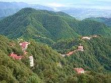
It has a nature walk known as "Camel's Back Road". This road takes its name from a rocky outcrop in the shape of a camel's hump. The road contains hotels and motels, and a cemetery is about mid-way on the loop. There is "Gun Hill" where a cannon was used to sound out midday for many years. Gun Hill is accessible by the cable car on the Mall road. The oldest Christian church in the Himalayas, St Mary's, is above Mall Road and is undergoing restoration. Company Garden a tourist attraction, has a large collection of flowers and plants.
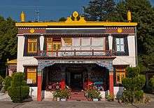
At Happy Valley is a small Tibetan temple, constructed in 1960 by the Tibetan refugees, the first Tibetan temple to be built in India. Lal Tibba is another Mussoorie tourist attraction with views of the Himalayas, and is situated above Mussoorie in the cantonment area of Landour.
Nahata Estate
Previously known as "Childer's Lodge", Nahata Estate is a property of more than 300 acres (120 ha), owned by the Harakh Chand Nahata family. It is the highest peak of Mussoorie near Lal Tibba with mountain views, 5 km (3 mi) from the Tourist Office.
Gun Hill
Gun Hill is the second highest point of Mussoorie, at an altitude of 2,024 m (6,640 ft) located at 30°29′43″N 78°04′28″E / 30.4953°N 78.0745°E
Kempty Falls
The Kempty Falls are on the hilly tracks of Uttarakhand, India, 15 km (9.3 mi) from Mussoorie along Kempty Fall Road. This place is nearly 1,364 m (4,475 ft) above sea level at 78°-02’ East longitude and 30° -29’ North latitude.
Lake Mist
About 5 km (3 mi) before Kempty Falls on the Mussoorie-Kempty road is Lake Mist, through which flows the Kempty river with its numerous small waterfalls. The resort of Lake Mist provides accommodation,restaurant facilities and boating.
Municipal Garden
The Municipal Garden provides an artificial mini-lake with paddle boats. It is 4 km (2.5 mi) by road transport and 2 km (1 mi) via Waverly Convent School road on foot.
Mussoorie Lake
The newly developed Mussoorie Lake was built by City Board and Mussoorie Dehradun Development Authority. The lake, providing pedal boats and views of Doon Valley and nearby villages, is 6 km (3.5 mi) from Mussoorie on the Mussoorie-Dehradun road.
Bhatta Falls
Bhatta Falls are 7 km (4.5 mi) from Mussoorie on the Mussoorie-Dehradun Road near the village of Bhatta. The falls are 3 km (2 mi) by foot from Bhatta.
Jharipani Fall
Jharipani Fall is 8.5 km (5.5 mi) from Mussoorie on Mussoorie-Jharipani road. From Jharipani fall is approximately 1.5 km (1 mi) by foot.
Mossy Fall
Mossy Fall is surrounded by a dense forest and is 7 km (4.5 mi) from Mussoorie, and is accessed via Barlowganj or Balahisar.
Sir George Everest's House
At Park Estate are the remains of the building and laboratory of Sir George Everest, the Surveyor-General of India from 1830 to 1843. It is after George Everest that the world's highest peak Mt. Everest is named. It is 6 km (3.5 mi) from Gandhi Chowk and a scenic walk from Library Bazaar, although accessible by road transport to at least Haathi Paon. The place provides a view of Doon Valley on one side and a panoramic view of the Aglar River valley and the peaks of the Himalayan ranges on the other. It is a scenic walk from Library Bazaar.
Happy Valley
At Upbeat Valley is the IAS Academy, Tibetan sanctuaries and the Municipal Garden. The range of the valley lies on the western side of Library Point and prompts the Cloud's End, a place where land fringes of Mussoorie end.
Nag Devta Temple
The ancient Nag Devta Temple is dedicated to Snake God Lord Shiva, It is on Cart Mackenzie Road about 6 km (3.5 mi) from Mussoorie on the road to Dehradun. There is vehicular access to the temple, which provides a view of Mussoorie and the Doon Valley.
Jwalaji Temple (Benog Hill)
At an altitude of 2,240 m (7,350 ft), this temple is in the 9 km (5.5 mi) west of Mussoorie. It is at the top of Benog Tibba (Hill) and contains an old idol of Goddess Durga. There is a view of the Aglar River valley. The temple cannot be accessed by vehicle although a motor road goes most of the way from Mussoorie.
Cloud End
Cloud End is surrounded by thick deodar forest. The bungalow, built in 1838 by a British major, was one of the first four buildings in Mussoorie and has been converted to a hotel.
Van Chetna Kendra
Van Chetna Kendra is 11 km (7 mi) to the south of Library Point, and is a sanctuary established in 1993, and covers an area of 339 hectares (840 acres). It is significant for the extinct bird species Mountain Quail (Pahari Bater), which was last spotted in 1876.
Benog Wildlife Sanctuary
This one is about 11 kilometers from Library Point but still interesting for those who like bird watching and the wildlife. Old-cedar trees and many medicinal plants growing in abundance along with pine trees will give a lot of happiness to a nature lover’s heart. Plus there are chances of spotting The White Capped Water Redstart and the Red Billed Blue Magpie, or a panther, leopard, deer, bear and Himalayan goats f you are very lucky.[7]
Mall Road
The Mall is a renowned shopping district situated in the heart of Mussoorie. It is dotted with shops, cafes and a host of colonial remnants that point to Mussoorie’s past glories. There are several video game parlours and skating rinks here for travellers to revel in entertainment activities. The Mall also has a Methodist church and the Tibetan market place nearby makes for a diverse cultural mix.[8]
Lal Tibba
Lal Tibba is the highest point in Mussoorie and offers a panoramic view of the town and its surroundings. The place is famous for a Japanese telescope which was placed here in 1967. One can view Badrinath, Kedarnath, Banderpunch and other Himalyan ranges from this telescope. Lal Tibba is also called Depot Hill due to the presence of a military depot here in earlier times.[9]
Education and services
The Landour Community Hospital is a Christian mission hospital run by the Emmanuel Hospital Association, Delhi,[10] which has provided for the medical needs of Mussoorie's hill people for 75 years.
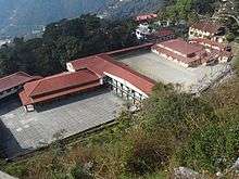
Schools include Woodstock School (1854),[11] the Convent of Jesus and Mary, Waverly (1845), St George's College (1853), Oak Grove School (1888), Wynberg-Allen (1888), Guru Nanak Fifth Centenary (1969), and Convent of Jesus and Mary Hampton Court.[11]
Woodstock School is a Christian, international, co-educational, residential school in Landour, a small hill station contiguous with the town of Mussoorie. The school traces its origin to the 1850s when a group of English ladies were enlisted by British officers and American missionaries to provide a Protestant education for girls.[11] Woodstock is among the most well-known boarding schools of the Indian Subcontinent, said by some to be currently the best international school in India. (Others are the Kodaikanal International School and the Hebron School, Ooty, both in South India.) The school has a campus covering an area of about 250 acres (1 km2) and is in a forest region with a variety of flora including pine, rhododendron, and oak. The terrain of the campus has an altitude range of 350 metres (1,150 ft) from its lowest point to the highest point. Classes at Woodstock begin from ECP (Early Childhood Program) and follow up to grade 12.[11]
St. George's College, Mussoorie (founded in 1853) is among the oldest schools in the country. It has been run by the Patrician Brothers since 1893. Spread over 400 acres (1.6 km2), the school is popularly referred to as 'Manor House'. The students of this prestigious school are referred to as 'Manorites'. The school is located in Barlowganj, a small town at the foot of Mussoorie. The school has been awarded as 2nd most beautiful campus in India. In 2005, the Indian Air Force gifted the school a trainer jet aircraft. Thus the school a long rich history to its name. Its alumni have made significant contributions in several fields, especially in serving the armed forces of the nation. The school's facade is one of the main architectural attractions of Mussoorie.
Oak Grove School difers from other schools of Mussoorie, in that it is affiliated with the CBSE, New Delhi, and is a secular government-aided school, run by the Northern Railway. The school was founded in 1888 by the East Indian Railway (EIR) and passed to the Indian Railways when railways were nationalised after Independence. It has three semi-independent wings and is on two hills in Jharipani, 8 km (5 mi) from Mussoorie town, near Jharipani Fall.
Wynberg Allen School was established in 1888. In Kanpur, during the year 1887, a group of friends, Mr. Alfred Powell, Mr. and Mrs. Arthur Foy and Brigadier J H Condon met and decided to set up a school in Mussoorie. The school was built at Jabarkhet along the Tehri road and was later shifted to the present Wynberg Estate. The object was to provide for and give to children of wholly or partly of European descent, an education based on Protestant Christian principles; to maintain such children; and to give them an academic and practical training conducive to economic welfare and happiness. It now accommodates students of all descents. The school consists of two branches—the Junior branch (Wynberg) and the Senior branch (Allen) and accommodates around 700 children. It has four houses: Allen, Powell, Foy and Condon. A student from the institution is referred to as an "Alwynian."

The Convent of Jesus and Mary, Waverley, Mussoorie was established in 1845 by the Religious Sisters of Jesus and Mary Mussoorie Educational Society.
The school is conducted by the Religious Sisters of Jesus and Mary. It is an all-girls school and perhaps the oldest Convent school in India. Waverley is at an elevation of 7,000 feet (2,100 m) above sea level on one of the most extensive and well wooded hills of Mussoorie. The Jesus and Mary congregation was the first congregation of Sisters to come to the north in 1842 at the invitation of Bishop Borghi the Vicar Apostolic of the Agra Mission. The Archbishop requested the sisters to come to Mussoorie to start a school for girls. In 1845 the sisters came to Mussoorie. The estate of Waverley belonging to an Italian gentleman had just come into the market and the nuns bought it. That year saw the commencement of one of the most important Catholic educational institutions in the North of India. Thousands of girls, Catholic and non-Catholic alike, have since passed through Waverley. The small inadequate bungalow which was all the accommodation at first offered, has given place to a group of buildings which dominate the town of Mussoorie.
The Guru Nanak Fifth Centenary School Mussoorie (GNFCS) is a residential boarding school. Previously owned by the Seventh-day Adventists and known from 1922–1969 as Vincent Hill School, GNFCS purchased the land and extensive buildings and founded an international school to the memory of Sri Guru Nanak Dev Ji, on the occasion of His 500th birth anniversary, celebrated in November 1969. The girls are housed at Shangri La at 6,750 feet (2,057 m) above sea level on an 11-acre (45,000 m2) plot, wooded with cypress, cedar and oak, on the south and west, facing the Himalayan peaks, to the north. The boys are at Vincent Hill, 3 km (2 mi) from Library Chowk. The school comprises a campus covering 45 acres (180,000 m2). The GNFCS prepares students in accordance with the 10+2 formula for school education, for the Indian Certificate of Secondary Education (10 year course) examination and the Indian School Certificate (12 year course) examination.
Other schools in Mussourie include Mussoorie International School (founded in 1984), Mussoorie Modern School, Tibetan Homes, CST Mussoorie and St Clares Convent School.
In Mussorie is the Lal Bahadur Shastri National Academy of Administration,[12] a training institute for officers of the Indian Foreign Service, Indian Administrative Service and other civil services. This academy is approximately 2 km (1 mi) from Gandhi Chowk.
Transport
Mussoorie is connected by road to Delhi and major cities. It is called the "Gateway" to Yamunotri and Gangotri shrines of Northern India. The closest rail station is Dehradun. Within Mussorie are taxis and buses.
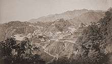 Mussoorie and Landour, 1860s
 Oak Grove School – Junior Wing
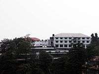 A view of Wynberg Allen School
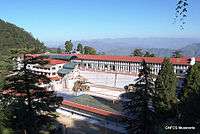 Guru Nanak Fifth Centenary School Shangri-La Girls Campus
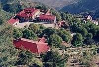 Guru Nanak Fifth Centenary School Vincent-Hill Boys Campus, Mussoorie, est. 1969
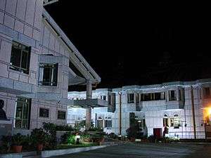 A look at LBSNAA at night.
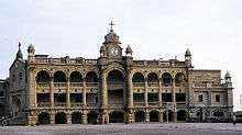 Facade of St. George's College, Mussoorie, established 1853
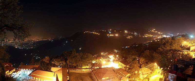 Mussoorie at night.
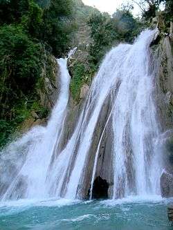 Kempty Water Fall, Mussoorie (in winter)
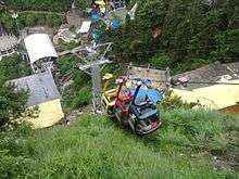 The Ropeway/Cable Car is a tourist attraction in Mussoorie
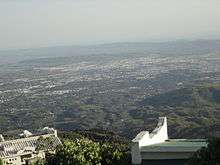 A view of Dehradun from Mussourie
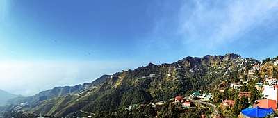
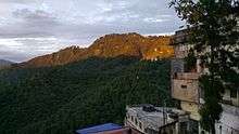 View of the Hills in Mussoorie Towards Sunset
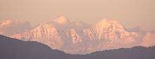 Himalayas at dusk from Mussoorie, Uttarakhand
References
- ↑ "Mussoorie Pin code". citypincode.in. Retrieved 2015-03-03.
- ↑ Dhir, Laruna (16 March 2018). "Who stripped my Dehradun off its charm?". DailyO. Retrieved 6 April 2018.
- ↑ Joshi, Nidhi (23 May 2017). "Mussoorie: The Queen of Hills". Moneycontrol.com. Retrieved 1 March 2018.
- ↑ 'Documentary History of the U.S. Brewers' Association, Part 1' by the United States Brewers' Association, page 63
- ↑

- ↑ "Mussoorie Population Census 2011". Census Commission of India. Archived from the original on 2004-06-16. Retrieved 2016-09-19.
- ↑ "Places to Visit in Mussoorie During Honeymoon". Jaypee Hotels. Retrieved 2018-05-28.
- ↑ "Places to Explore while on a Delhi to Mussoorie Trip". Jaypee Hotels. Retrieved 2017-12-06.
- ↑ "Places to Explore while on a Delhi to Mussoorie Trip". Jaypee Hotels. Retrieved 2017-12-06.
- ↑ Landour Community Hospital
- 1 2 3 4 Woodstock school to host Mussoorie Mountain Festival
- ↑ "LBSNAA". civilservices.gov.in.
External links
![]()
| Wikivoyage has a travel guide for Mussoorie. |