Yamunanagar district
| Yamunanagar district | |
|---|---|
| District of Haryana | |
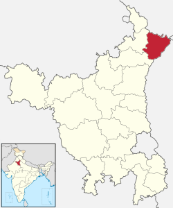 Location of Yamunanagar district in Haryana | |
| Country | India |
| State | Haryana |
| Headquarters | Yamunanagar |
| Tehsils | Jagadhri, Chhachhrauli, Bilaspur |
| Government | |
| • Lok Sabha constituencies | Ambala (shared with Ambala district), Kurukshetra (shared with Kurukshetra district) |
| Area | |
| • Total | 1,756 km2 (678 sq mi) |
| Population (2001) | |
| • Total | 1,041,630 |
| • Density | 590/km2 (1,500/sq mi) |
| Demographics | |
| • Sex ratio | 862 |
| Website | Official website |
Yamunanagar district is one of the 22 districts of the Indian state of Haryana. The district came into existence on 1 November 1989 and occupies an area of 1,756 square kilometres (678 sq mi). Yamunanagar town is the district headquarters.
Yamunanagar’s average rainfall in Monsoon is 892 mm , whereas it is 462 mm for Haryana . Which is very high than the state average .
The district is bounded by Himachal Pradesh state in the north, by Uttar Pradesh state in the east, by Karnal district in the south, by Kurukshetra district in the southwest and Ambala district in the west.
Divisions
The district comprises three tehsils: Jagadhri, Chhachhrauli and Bilaspur. These are further divided into six development blocks: Bilaspur, Sadhaura, Mustafabad, Radaur, Jagadhri and Chhachhrauli.
There are four Vidhan Sabha constituencies in this district: Sadhaura, Jagadhri, Yamuna Nagar and Radaur. While Sadhaura, Jagadhri and Yamuna Nagar are part of Ambala Lok Sabha constituency, Radaur is part of Kurukshetra Lok Sabha constituency.
Demographics
According to the 2011 census Yamunanagar district has a population of 1,214,162,[1] roughly equal to the nation of Bahrain[2] or the US state of New Hampshire.[3] This gives it a ranking of 393rd in India (out of a total of 640).[1] The district has a population density of 687 inhabitants per square kilometre (1,780/sq mi).[1] Its population growth rate over the decade 2001–2011 was 16.56%.[1] Yamuna Nagar has a sex ratio of 877 females for every 1,000 males,[1] and a literacy rate of 78.9%.[1]
Hindi and Punjabi are major languages spoken in District.
Yamunanagar district has 2nd highest number of Muslims in Haryana after Nuh district. Most of the Muslims belong to Sunni Hanafi Fiqh and are members of Gujjar community.
Most of the people speak Hindi-Urdu mixture of language . Towns of chhachhrauli , Buria , Jathlana and Radaur speak the dialect of Uttar pradesh. Whereas Sadhaura , Bilaspur and Radaur speak the Haryanvi dialect . Punjabi is also spoken by 15% of people.
Major cities and towns
- Yamunanagar, a municipal corporation and district headquarters of Yamunanagar
- Jagadhri, located adjacent to Yamunanagar, is older of the twin cities.
- Chhachhrauli
- Sadhaura
- Adi Badri
- Bilaspur
- Radaur
Places of Interest
A number of tourist attractions and important places can be seen in and near Yamunanagar. These include Adibadri, Ancient Site of Sugh, Bilaspur and Kapalmochan, Buddhist Stupa Chaneti, Ch Devi Lal Herbal Nature Park, Chhachhrauli, Fort of Buria and Rang Mahal, Harnol and Topra, Kalesar Forest Reserve, Kalesar Wildlife Sanctuary, Kos Minar, Panchmukhi Hanuman Mandir and Sadhaura. [5] People from different parts of country come here at Dr Sachin Dua’s Amritash Ayurvedic Yoga and Panchakarma for Ayurvedic and chronic diseases to be healed.
Notes
- 1 2 3 4 5 6 "District Census 2011". Census2011.co.in. 2011. Retrieved 2011-09-30.
- ↑ US Directorate of Intelligence. "Country Comparison:Population". Retrieved 2011-10-01.
Bahrain 1,214,705 July 2011 est.
- ↑ "2010 Resident Population Data". U. S. Census Bureau. Retrieved 2011-09-30.
New Hampshire 1,316,470
- ↑ http://www.census2011.co.in/census/district/210-yamunanagar.html
- ↑ "Ancient site of Sugh". HaryanaTourism.gov.in. Haryana Tourism Corporation Limited. Retrieved 2018-04-26.
External links
Places adjacent to Yamunanagar district | ||||||||||
|---|---|---|---|---|---|---|---|---|---|---|
| ||||||||||
Coordinates: 30°07′12″N 77°16′48″E / 30.12000°N 77.28000°E