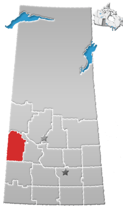
Rural Municipality of Cut Knife No. 439
| Cut Knife No. 439 | |
|---|---|
| Rural municipality | |
 Cut Knife No. 439 | |
| Coordinates: 52°46′59″N 108°58′37″W / 52.783°N 108.977°W | |
| Country | Canada |
| Province | Saskatchewan |
| Census division | Census Division 13 |
| Seat | Cut Knife, Saskatchewan |
| Area | |
| • Total | 651.43 km2 (251.52 sq mi) |
| Population (2006) | |
| • Total | 390 |
| • Density | 0.60/km2 (1.6/sq mi) |
Cut Knife No. 439 is a rural municipality in the Canadian province of Saskatchewan, located in the Census Division 13. The seat of the municipality is located in the town of Cut Knife.
Demographics
In 2006, the municipality had a population of 390 in 345 dwellings, a -12.9% decrease from 2001. On a surface of 651.43 km² it has a density of 0.6 inhabitants/km².[1]
Communities and localities
The following urban municipalities are surrounded by the Rural Municipality:
- none
- Cut Knife, (seat of municipality)
- none
- none
The following hamlets are located within the Rural Municipality:
- none
- Rockhaven, (dissolved as a village, December 31, 2007)
- none
Transportation
Attractions
- Clayton McLain Memorial Museum
- World's Largest Tomahawk
- Chief Poundmaker Historical Center
- Atton Lake Regional Park
- Table Mountain Regional Park
See also
References
- ↑ 2006 Community Profiles Cut Knife No. 439, Saskatchewan
External links
This article is issued from
Wikipedia.
The text is licensed under Creative Commons - Attribution - Sharealike.
Additional terms may apply for the media files.