Cumberland, Kentucky
| Cumberland, Kentucky | |
|---|---|
| City | |
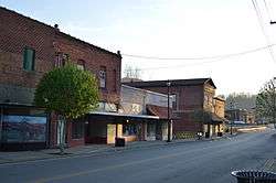 Main Street downtown | |
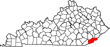
 Location of Cumberland in Harlan County, Kentucky. | |
| Coordinates: 36°58′37″N 82°59′15″W / 36.97694°N 82.98750°WCoordinates: 36°58′37″N 82°59′15″W / 36.97694°N 82.98750°W | |
| Country | United States |
| State | Kentucky |
| County | Harlan |
| Area | |
| • Total | 3.14 sq mi (8.14 km2) |
| • Land | 3.12 sq mi (8.07 km2) |
| • Water | 0.03 sq mi (0.08 km2) |
| Elevation | 1,444 ft (440 m) |
| Population (2010) | |
| • Total | 2,237 |
| • Estimate (2016)[1] | 2,059 |
| • Density | 718/sq mi (277.3/km2) |
| Time zone | UTC-5 (Eastern (EST)) |
| • Summer (DST) | UTC-4 (EDT) |
| ZIP code | 40823 |
| Area code(s) | 606 |
| FIPS code | 21-19108 |
| GNIS feature ID | 0511673 |
Cumberland is a home rule-class city[2] in Harlan County, Kentucky, in the United States. The population according to the 2010 Census was 2,237,[3] down from 2,611 at the 2000 census.
History
Cumberland was settled in 1837 and named "Poor Fork", for its location on a fork of the Cumberland River with relatively poor soil.[4] It remained isolated until the coal mining boom of the 1900s when railroads connected it with surrounding towns. It was renamed "Cumberland" in 1926.
Geography
Cumberland is located in northeastern Harlan County at 36°58′37″N 82°59′15″W / 36.97694°N 82.98750°W (36.977016, -82.987434)[5] in the valley of the Poor Fork of the Cumberland River, where it is joined by Looney Creek from the southeast and Cloverlick Creek from the south. The city limits extend to the north up to the crest of Pine Mountain, which forms the Letcher County line. Elevations within the city range from 1,400 feet (430 m) above sea level along the Poor Fork on the west side of town to 2,700 feet (820 m) atop Pine Mountain.
U.S. Route 119 passes through Cumberland, passing south of the city center. US 119 leads northeast 34 miles (55 km) to Jenkins and southwest 22 miles (35 km) to Harlan, the Harlan County seat. Kentucky Route 160 passes through the center of Cumberland, leading southeast 2.5 miles (4.0 km) to Benham and 12 miles (19 km) to the Virginia border, and north over Pine Mountain 5 miles (8 km) to Gordon.
According to the United States Census Bureau, the city of Cumberland has a total area of 3.1 square miles (8.1 km2), of which 0.03 square miles (0.08 km2), or 0.95%, are water.[3]
Climate
The climate in this area is characterized by hot, humid summers and generally mild to cool winters. According to the Köppen Climate Classification system, Cumberland has a humid subtropical climate, abbreviated "Cfa" on climate maps.[6]
Demographics
| Historical population | |||
|---|---|---|---|
| Census | Pop. | %± | |
| 1920 | 300 | — | |
| 1930 | 2,639 | 779.7% | |
| 1940 | 4,149 | 57.2% | |
| 1950 | 4,249 | 2.4% | |
| 1960 | 4,271 | 0.5% | |
| 1970 | 3,380 | −20.9% | |
| 1980 | 3,712 | 9.8% | |
| 1990 | 3,112 | −16.2% | |
| 2000 | 2,611 | −16.1% | |
| 2010 | 2,237 | −14.3% | |
| Est. 2016 | 2,059 | [1] | −8.0% |
| U.S. Decennial Census[7] | |||
As of the census[8] of 2000, there were 2,611 people, 1,076 households, and 723 families residing in the city. The population density was 570.5 people per square mile (220.1/km²). There were 1,288 housing units at an average density of 281.4 per square mile (108.6/km²). The racial makeup of the city was 93.60% White, 5.09% African American, 0.50% Native American, 0.04% Asian, 0.04% from other races, and 0.73% from two or more races. Hispanic or Latino of any race were 0.84% of the population.
There were 1,076 households out of which 31.4% had children under the age of 18 living with them, 46.7% were married couples living together, 16.8% had a female householder with no husband present, and 32.8% were non-families. 31.0% of all households were made up of individuals and 14.1% had someone living alone who was 65 years of age or older. The average household size was 2.35 and the average family size was 2.95.
In the city, the population was spread out with 25.5% under the age of 18, 9.2% from 18 to 24, 25.5% from 25 to 44, 22.1% from 45 to 64, and 17.7% who were 65 years of age or older. The median age was 38 years. For every 100 females, there were 87.7 males. For every 100 females age 18 and over, there were 82.6 males.
The median income for a household in the city was $15,929, and the median income for a family was $22,365. Males had a median income of $34,327 versus $13,750 for females. The per capita income for the city was $9,835. About 31.5% of families and 38.7% of the population were below the poverty line, including 56.3% of those under age 18 and 19.5% of those age 65 or over.
Education
Cumberland is home to the main campus of Southeast Kentucky Community and Technical College, part of the Kentucky Community and Technical College System. The city is also served by Rebecca Caudill Public Library, first established in 1965 in an old store building on Myers Street. It was funded by the State Department of Libraries. When the library was opened it was named in honor of a local author, Rebecca Caudill. In 1972, the Cumberland Branch moved to a newly constructed building, located on Main Street, funded by state library funds. In 1995, an addition to this construction was completed. Project funds were provided by an LSCA Grant through the Kentucky Department for Libraries and Archives, the Harlan County Library District and gifts. Rebecca Caudill Public Library is a branch of the Harlan County Public Libraries.
Attractions
Cumberland is home to Kingdom Come State Park, which features a lake, gift shop, camp sites, miniature golf, paddleboating, picnic facilities, primitive camping, hiking trails, and an amphitheatre. The park is home to natural rock formations including Raven Rock and Log Rock. Two overlooks in the park provide scenic views of the Appalachian Mountains.
Cumberland is home to the annual Kingdom Come Swappin' Meetin', a festival honoring Appalachian history, folklore, and products. The festival is held on the campus of Southeast Kentucky Community and Technical College in Cumberland. The festival includes live demonstrations of Appalachian methods and traditions. The most recent festival is the annual Black Bear Festival, in honor of the popular black bears at Kingdom Come State Park.
References
- 1 2 "Population and Housing Unit Estimates". Retrieved June 9, 2017.
- ↑ "Summary and Reference Guide to House Bill 331 City Classification Reform" (PDF). Kentucky League of Cities. Retrieved December 30, 2014.
- 1 2 "Geographic Identifiers: 2010 Demographic Profile Data (G001): Cumberland city, Kentucky". American Factfinder. U.S. Census Bureau. Retrieved June 28, 2017.
- ↑ Rennick, Robert M. (1987). Kentucky Place Names. University Press of Kentucky. p. 75. Retrieved 2013-04-28.
- ↑ "US Gazetteer files: 2010, 2000, and 1990". United States Census Bureau. 2011-02-12. Retrieved 2011-04-23.
- ↑ Climate Summary for Cumberland, Kentucky
- ↑ "Census of Population and Housing". Census.gov. Archived from the original on May 12, 2015. Retrieved June 4, 2015.
- ↑ "American FactFinder". United States Census Bureau. Archived from the original on 2013-09-11. Retrieved 2008-01-31.
Further reading
- Caudill, Harry M., Night Comes to the Cumberlands (1963). ISBN 0-316-13212-8