Maplewood, Missouri
| Maplewood, Missouri | |
|---|---|
| City | |
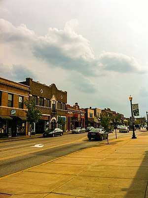 Manchester Road passes through Maplewood, Missouri | |
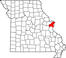
 Location of Maplewood, Missouri | |
| Coordinates: 38°36′45″N 90°19′17″W / 38.61250°N 90.32139°WCoordinates: 38°36′45″N 90°19′17″W / 38.61250°N 90.32139°W | |
| Country | United States |
| State | Missouri |
| County | St. Louis |
| Area[1] | |
| • Total | 1.56 sq mi (4.04 km2) |
| • Land | 1.56 sq mi (4.04 km2) |
| • Water | 0 sq mi (0 km2) |
| Elevation | 505 ft (154 m) |
| Population (2010)[2] | |
| • Total | 8,046 |
| • Estimate (2016)[3] | 7,868 |
| • Density | 5,200/sq mi (2,000/km2) |
| Time zone | UTC-6 (Central (CST)) |
| • Summer (DST) | UTC-5 (CDT) |
| FIPS code | 29-45830[4] |
| GNIS feature ID | 0756345[5] |
| Website | City of Maplewood official website |
Maplewood is an inner-ring suburb of St. Louis, located in St. Louis County. The population was 8,046 at the 2010 census.[6]
Geography
Maplewood is located at 38°36′45″N 90°19′17″W / 38.61250°N 90.32139°W (38.612535, -90.321339).[7]
According to the United States Census Bureau, the city has a total area of 1.56 square miles (4.04 km2), all of it land.[1]
History
Maplewood was established around the turn of the 20th century. Maplewood was one of the early suburbs of St. Louis. Located just outside the city limits, Maplewood was located at the end of one of St. Louis's streetcar lines and was also located near major railroads.
It was built as a bedroom community. Advertising suggested that people should get away from the city (in an era of common and sooty commercial, industrial, and domestic coal burning) and enjoy the fresh air of less densely populated areas like Maplewood. Maplewood's historic residential areas were mostly built from 1900–1910 and a number of well-preserved homes remain. Several of these homes have remained in the same family for generations.
Maplewood is currently being revitalized by an influx of restaurants, businesses, and shops around Manchester Ave., Sutton Ave., and the Greenwood Historic District.
Under a local nuisance ordinance, a person who calls the police for domestic violence more than twice in 180 days can face eviction. In 2012, a woman was evicted from her home after she had called the police four times to request protection from physical assaults by her ex-boyfriend. She became homeless in the process. In 2017, the ACLU filed a lawsuit on behalf of the victim, claiming that the Maplewood nuisance ordinance violates the First Amendment right to petition the government for assistance, as well as the rights to travel, equal protection and due process.[8]
Demographics
| Historical population | |||
|---|---|---|---|
| Census | Pop. | %± | |
| 1910 | 4,976 | — | |
| 1920 | 7,431 | 49.3% | |
| 1930 | 12,657 | 70.3% | |
| 1940 | 12,875 | 1.7% | |
| 1950 | 13,416 | 4.2% | |
| 1960 | 12,552 | −6.4% | |
| 1970 | 12,785 | 1.9% | |
| 1980 | 10,960 | −14.3% | |
| 1990 | 9,962 | −9.1% | |
| 2000 | 9,228 | −7.4% | |
| 2010 | 8,046 | −12.8% | |
| Est. 2017 | 8,115 | [9] | 0.9% |
| U.S. Decennial Census[10] | |||
2010 census
As of the census[4] of 2010, there were 8,046 people, 4,269 households, and 1,769 families residing in the city. The population density was 5,963.8 people per square mile (2,298.7/km²). There were 4,889 housing units at an average density of 3,403.3 per square mile (1,311.8/km²). The racial makeup of the city was 74.1% White, 17.2% African American, 0.2% Native American, 3.5% Asian, 0.1% Pacific Islander, 1.3% from other races, and 3.5% from two or more races. Hispanic or Latino of any race were 2.22% of the population.
There were 4,269 households of which 18.6% had children under the age of 18 living with them, 25.3% were married couples living together, 12.2% had a female householder with no husband present, and 58.6% were non-families. 48.6% of all households were made up of individuals and 6.5% had someone living alone who was 65 years of age or older. The average household size was 1.88 and the average family size was 2.78.
In the city, the population was spread out with 19.1% under the age of 20, 9.1% from 20 to 24, 37.0% from 25 to 44, 26.9% from 45 to 64, and 7.9% who were 65 years of age or older. The median age was 34.7 years. The city was 50.2% male and 49.8% female.[11]
2000 census
As of the census[4] of 2000, there were 9,228 people, 4,815 households, and 2,041 families residing in the city. The population density was 5,963.8 people per square mile (2,298.7/km²). There were 5,266 housing units at an average density of 3,403.3 per square mile (1,311.8/km²). The racial makeup of the city was 76.16% White, 15.93% African American, 0.33% Native American, 4.23% Asian, 0.07% Pacific Islander, 0.72% from other races, and 2.58% from two or more races. Hispanic or Latino of any race were 2.22% of the population.
There were 4,815 households out of which 19.1% had children under the age of 18 living with them, 27.1% were married couples living together, 81.6% had a female householder with no husband present, and 5.6% were non-families. 4.5% of all households were made up of individuals and 7.5% had someone living alone who was 65 years of age or older. The average household size was 1.92 and the average family size was 2.83.
In the city, the population was spread out with 18.3% under the age of 18, 13.0% from 18 to 24, 39.0% from 25 to 44, 20.6% from 45 to 64, and 9.1% who were 65 years of age or older. The median age was 34 years. For every 100 females, there were 99.6 males. For every 100 females age 18 and over, there were 98.7 males.
In 2000 the median income for a household in the city was $29,151, and the median income for a family was $44,178. Males had a median income of $30,279 versus $24,025 for females. The per capita income for the city was $19,087. About 10.6% of families and 14.1% of the population were below the poverty line, including 17.5% of those under age 18 and 9.1% of those age 65 or over.
Schools
Public School District
The Maplewood Richmond Heights High School, tracing its beginnings to 1840, is part of the oldest school district in St. Louis County. The district covers an approximate area of two square miles and is located southwest of, and adjacent to, the city of St. Louis. Neighboring school districts include Brentwood, Clayton, and Webster Groves. In 2015 the school got rid of it's football program, causing a small uproar in the community.
Notable people
- Mark Christman, baseball player
- Ray Kennedy , jazz pianist
- Kevin McCameron, poet/actor/comedian
- Kathleen Dwyer, received the Presidential Award for Excellence in Science and Math Teaching. PAEMST profile
- Pee Wee Russell, jazz musician was born in Maplewood
See also
- 1939 St. Louis smog, an example of what levels pollution could rise to in nearby St. Louis
- Schlafly Bottleworks, Maplewood branch of the Saint Louis Brewery and a restaurant
References
- 1 2 "US Gazetteer files 2010". United States Census Bureau. Archived from the original on 2012-01-24. Retrieved 2012-07-08.
- ↑ "American FactFinder". United States Census Bureau. Retrieved 2012-07-08.
- ↑ "Population and Housing Unit Estimates". Retrieved June 9, 2017.
- 1 2 3 "American FactFinder". United States Census Bureau. Retrieved 2008-01-31.
- ↑ "US Board on Geographic Names". United States Geological Survey. 2007-10-25. Retrieved 2008-01-31.
- ↑ "Race, Hispanic or Latino, Age, and Housing Occupancy: 2010 Census Redistricting Data (Public Law 94-171) Summary File (QT-PL), Maplewood city, Missouri". U.S. Census Bureau, American FactFinder 2. Retrieved October 24, 2011.
- ↑ "US Gazetteer files: 2010, 2000, and 1990". United States Census Bureau. 2011-02-12. Retrieved 2011-04-23.
- ↑ A Missouri Town Exiled A Woman For Calling The Police On Her Abusive Ex, Melissa Jeltsen, The Huffington Post, April 11, 2017
- ↑ "Population and Housing Unit Estimates". Retrieved May 25, 2018.
- ↑ "Census of Population and Housing". Census.gov. Retrieved June 4, 2015.
- ↑ "United States Census American Factfinder: Maplewood city, Missouri". Archived from the original on 2011-02-12.
External links
| Wikimedia Commons has media related to Maplewood, Missouri. |