Bella Villa, Missouri
| Bella Villa, Missouri | |
|---|---|
| City | |
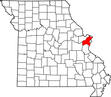
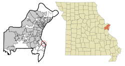 Location of Bella Villa, Missouri | |
| Coordinates: 38°32′35″N 90°17′8″W / 38.54306°N 90.28556°WCoordinates: 38°32′35″N 90°17′8″W / 38.54306°N 90.28556°W | |
| Country |
|
| State |
|
| County | St. Louis |
| Incorporated | May 26, 1947[1] |
| Area[2] | |
| • Total | 0.13 sq mi (0.34 km2) |
| • Land | 0.13 sq mi (0.34 km2) |
| • Water | 0 sq mi (0 km2) |
| Elevation | 463 ft (141 m) |
| Population (2010)[3] | |
| • Total | 729 |
| • Estimate (2016)[4] | 738 |
| • Density | 5,600/sq mi (2,100/km2) |
| Time zone | UTC-6 (Central (CST)) |
| • Summer (DST) | UTC-5 (CDT) |
| FIPS code | 29-04114[5] |
| GNIS feature ID | 0755744[6] |
| Website | http://www.cityofbellavilla-mo.org/ |
Bella Villa is a city in St. Louis County, Missouri, in the United States. As of the 2010 census, the city population was 729.[7]
Geography
Bella Villa is located at 38°32′35″N 90°17′08″W / 38.542952°N 90.285564°W.[8]
According to the United States Census Bureau, the city has a total area of 0.13 square miles (0.34 km2), all of it land.[2]
Demographics
| Historical population | |||
|---|---|---|---|
| Census | Pop. | %± | |
| 1950 | 557 | — | |
| 1960 | 779 | 39.9% | |
| 1970 | 1,018 | 30.7% | |
| 1980 | 758 | −25.5% | |
| 1990 | 708 | −6.6% | |
| 2000 | 687 | −3.0% | |
| 2010 | 729 | 6.1% | |
| Est. 2016 | 738 | [4] | 1.2% |
| U.S. Decennial Census[9] | |||
2010 census
As of the census[3] of 2010, there were 729 people, 333 households, and 197 families residing in the city. The population density was 5,607.7 inhabitants per square mile (2,165.1/km2). There were 346 housing units at an average density of 2,661.5 per square mile (1,027.6/km2). The racial makeup of the city was 92.6% White, 1.5% African American, 0.3% Native American, 1.9% Asian, 1.6% from other races, and 2.1% from two or more races. Hispanic or Latino of any race were 4.3% of the population.
There were 333 households of which 26.4% had children under the age of 18 living with them, 46.5% were married couples living together, 9.6% had a female householder with no husband present, 3.0% had a male householder with no wife present, and 40.8% were non-families. 34.5% of all households were made up of individuals and 12.9% had someone living alone who was 65 years of age or older. The average household size was 2.19 and the average family size was 2.82.
The median age in the city was 41.8 years. 18.5% of residents were under the age of 18; 5.9% were between the ages of 18 and 24; 29.8% were from 25 to 44; 30.3% were from 45 to 64; and 15.5% were 65 years of age or older. The gender makeup of the city was 46.4% male and 53.6% female.
2000 census
As of the census[5] of 2000, there were 687 people, 336 households, and 185 families residing in the city. The population density was 5,468.3 people per square mile (2,040.4/km²). There were 351 housing units at an average density of 2,793.8 per square mile (1,042.5/km²). The racial makeup of the city was 98.25% White, 0.15% African American, 0.29% Native American, 0.29% Asian, 0.29% from other races, and 0.73% from two or more races. Hispanic or Latino of any race were 1.46% of the population.
There were 336 households out of which 17.6% had children under the age of 18 living with them, 41.7% were married couples living together, 10.7% had a female householder with no husband present, and 44.9% were non-families. 39.3% of all households were made up of individuals and 20.8% had someone living alone who was 65 years of age or older. The average household size was 2.04 and the average family size was 2.68.
In the city, the population was spread out with 15.4% under the age of 18, 7.3% from 18 to 24, 31.3% from 25 to 44, 24.6% from 45 to 64, and 21.4% who were 65 years of age or older. The median age was 42 years. For every 100 females, there were 89.3 males. For every 100 females age 18 and over, there were 83.3 males.
The median income for a household in the city was $36,827, and the median income for a family was $50,313. Males had a median income of $31,406 versus $28,672 for females. The per capita income for the city was $21,692. About 5.6% of families and 7.2% of the population were below the poverty line, including 7.1% of those under age 18 and 6.5% of those age 65 or over.
References
- ↑ http://www.cityofbellavilla-mo.org/OURHISTORY.html
- 1 2 "US Gazetteer files 2010". United States Census Bureau. Archived from the original on 2012-01-24. Retrieved 2012-07-08.
- 1 2 "American FactFinder". United States Census Bureau. Retrieved 2012-07-08.
- 1 2 "Population and Housing Unit Estimates". Retrieved June 9, 2017.
- 1 2 "American FactFinder". United States Census Bureau. Archived from the original on 2013-09-11. Retrieved 2008-01-31.
- ↑ "US Board on Geographic Names". United States Geological Survey. 2007-10-25. Retrieved 2008-01-31.
- ↑ "Race, Hispanic or Latino, Age, and Housing Occupancy: 2010 Census Redistricting Data (Public Law 94-171) Summary File (QT-PL), Bella Villa city, Missouri". U.S. Census Bureau, American FactFinder 2. Archived from the original on September 11, 2013. Retrieved October 18, 2011.
- ↑ "US Gazetteer files: 2010, 2000, and 1990". United States Census Bureau. 2011-02-12. Retrieved 2011-04-23.
- ↑ "Census of Population and Housing". Census.gov. Archived from the original on May 12, 2015. Retrieved June 4, 2015.