Eureka, Missouri
Coordinates: 38°30′10″N 90°38′42″W / 38.502736°N 90.645075°W
| Eureka, Missouri | |
|---|---|
| Country | |
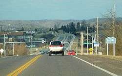 Entering Eureka along State Route 109 | |
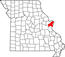
 Location of Eureka, Missouri | |
| Coordinates: 38°30′10″N 90°38′42″W / 38.50278°N 90.64500°W | |
| Country | United States |
| State | Missouri |
| County | St. Louis |
| Area[1] | |
| • Total | 10.45 sq mi (27.07 km2) |
| • Land | 10.35 sq mi (26.81 km2) |
| • Water | 0.10 sq mi (0.26 km2) |
| Elevation | 456 ft (139 m) |
| Population (2010)[2] | |
| • Total | 10,189 |
| • Estimate (2016)[3] | 10,534 |
| • Density | 980/sq mi (380/km2) |
| Time zone | UTC−6 (Central (CST)) |
| • Summer (DST) | UTC−5 (CDT) |
| FIPS code | 29-22834[4] |
| GNIS feature ID | 0756031[5] |
| Website | City of Eureka official website |
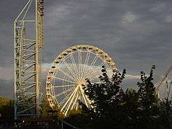
Eureka is a city located in St. Louis County, Missouri, United States between the cities of St. Louis and Pacific along Interstate 44. It is a portion of the Greater St. Louis metro area. As of the 2010 census, the city had a population of 10,189.[6] Since 1971, Eureka has been known as the home of the amusement park Six Flags St. Louis.
History
The village of Eureka was platted in 1858[7] along the route of the Pacific Railroad. By 1890, the village consisted of about 100 homes. According to the Eureka Chamber of Commerce, railroad workers while clearing way for the track and the next railroad camp saw Eureka, level land with little to clear, and declared, "Eureka!" Greek meaning "I have found it." Thus, Eureka was founded. In 1898, Eureka became home to the St. Louis Children's Industrial Farm, established to give children from St. Louis tenement neighborhoods a chance to experience life in a rural setting. It later became Camp Wyman (now part of Wyman Center) and is one of the oldest camps in the United States. Eureka was incorporated as a fourth-class city on April 7, 1954.
City of Allenton
The railroad town of Allenton is a former community on U.S. Route 66 located (now) at the junction of Interstate 44 and Business Loop 44 in western St. Louis County. In 1985, it was annexed by the city of Eureka. The town is currently rural, with adjacent farmland and forested Ozark ridges. This community was declared blighted by St. Louis County in 1973.
Geography
According to the United States Census Bureau, the city has a total area of 10.45 square miles (27.07 km2), of which, 10.35 square miles (26.81 km2) is land and 0.10 square miles (0.26 km2) is water.[1]
Demographics
| Historical population | |||
|---|---|---|---|
| Census | Pop. | %± | |
| 1880 | 141 | — | |
| 1960 | 1,134 | — | |
| 1970 | 2,384 | 110.2% | |
| 1980 | 3,862 | 62.0% | |
| 1990 | 4,683 | 21.3% | |
| 2000 | 7,676 | 63.9% | |
| 2010 | 10,189 | 32.7% | |
| Est. 2016 | 10,534 | [3] | 3.4% |
| U.S. Decennial Census[8] | |||
2010 census
As of the 2010 census,[2] there were 10,189 people, 3,474 households, and 2,758 families residing in the city. The population density was 984.4 inhabitants per square mile (380.1/km2). There were 3,683 housing units at an average density of 355.8 per square mile (137.4/km2). The racial makeup of the city was 94.9% White, 0.8% African American, 0.2% Native American, 1.9% Asian, 0.1% Pacific Islander, 0.3% from other races, and 1.7% from two or more races. Hispanic or Latino of any race were 2.0% of the population.
There were 3,474 households of which 46.9% had children under the age of 18 living with them, 66.2% were married couples living together, 9.3% had a female householder with no husband present, 3.9% had a male householder with no wife present, and 20.6% were non-families. 17.2% of all households were made up of individuals and 5.9% had someone living alone who was 65 years of age or older. The average household size was 2.87 and the average family size was 3.27.
The median age in the city was 37.1 years. 30.9% of residents were under the age of 18; 6% were between the ages of 18 and 24; 26.6% were from 25 to 44; 26.7% were from 45 to 64; and 9.6% were 65 years of age or older. The gender makeup of the city was 49.6% male and 50.4% female.
2000 census
As of the 2000 census,[4] there were 7,676 people in the city, organized into 2,487 households and two families. Its population density was 763.7 people per square mile (294.9/km²). There were 2,622 housing units at an average density of 260.9 per square mile (100.7/km²). The racial makeup of the city was 97.38% White, 0.82% Asian, 0.57% Black or African American, 0.20% Native American, no Pacific Islanders, 0.26% from other races, and 0.77% from two or more races. 1.22% of the population were Hispanic or Latino of any race.
There were 2,487 households out of which half have children under the age of 18 living with them, 71.6% were married couples living together, 8.2% had a female householder with no husband present, and 17.0% were non-families. 13.8% of all households were made up of individuals and 4.3% had someone living alone who was 65 years of age or older. The average household size was 2.98 and the average family size was 3.30.
In the city, the population was spread out with 31.9% under the age of 18, 5.7% from 18 to 24, 34.4% from 25 to 44, 19.5% from 45 to 64, and 8.5% 65 years of age or older. The median age was 34 years. For every 100 females, there were 94.9 males. For every 100 females age 18 and over, there were 89.6 males.
The median income for a household in the city was $74,301, and the median income for a family was $80,625. Males had a median income of $51,799 compared to $33,269 for females. The per-capita income for the city was $27,553. 2.2% of the population and 1.3% of families were below the poverty line. Out of the total population, 3.1% of those under the age of 18 and 5.9% of those 65 and older were living below the poverty line.
Education
- Eureka Elementary School
- Geggie Elementary School
- Blevins Elementary School
- Lasalle Springs Middle School
- St. Mark's Lutheran Church and School
- Sacred Heart Church and School
- Eureka High School
- St. Louis County Library Eureka Hills Branch is in Eureka.[9][10]

News media
Local news coverage for the town and some of its neighbors is provided by the Tri County Journal, the Eureka Pacific Current NewsMagazine, and the Washington Missourian.
Notable people
- Bob Klinger, Major League Baseball player
- Aaron Schnurbusch, Major League Baseball player[11]
- Rissi Palmer, Country Western singer
- Cam Janssen, National Hockey League player
References
- 1 2 "US Gazetteer files 2010". United States Census Bureau. Archived from the original on January 24, 2012. Retrieved July 8, 2012.
- 1 2 "American FactFinder". United States Census Bureau. Retrieved July 8, 2012.
- 1 2 "Population and Housing Unit Estimates". Retrieved June 9, 2017.
- 1 2 "American FactFinder". United States Census Bureau. Archived from the original on September 11, 2013. Retrieved 2008-01-31.
- ↑ "US Board on Geographic Names". United States Geological Survey. 2007-10-25. Retrieved 2008-01-31.
- ↑ "Race, Hispanic or Latino, Age, and Housing Occupancy: 2010 Census Redistricting Data (Public Law 94-171) Summary File (QT-PL), Eureka city, Missouri". U.S. Census Bureau, American FactFinder 2. Archived from the original on September 11, 2013. Retrieved October 21, 2011.
- ↑ Eaton, David Wolfe (1918). How Missouri Counties, Towns and Streams Were Named. The State Historical Society of Missouri. p. 360.
- ↑ "Census of Population and Housing". Census.gov. Archived from the original on May 12, 2015. Retrieved June 4, 2015.
- ↑ "Eureka Hills Branch Archived September 16, 2009, at the Wayback Machine.." St. Louis County Library. Retrieved on August 18, 2009.
- ↑ "Eureka city, Missouri." U.S. Census Bureau. Retrieved on August 18, 2009.
- ↑ "Aaron Schnurbusch Stats, Highlights, Bio | MiLB.com Stats | The Official Site of Minor League Baseball". MiLB.com. Retrieved 2017-07-19.