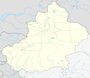
Bole, Xinjiang
| Bole 博乐市 بورتالا شەھىرى | |
|---|---|
| County-level city | |
 Sayram Lake | |
 Bole Location in Xinjiang | |
| Coordinates: 44°54′13.6″N 82°04′14.93″E / 44.903778°N 82.0708139°ECoordinates: 44°54′13.6″N 82°04′14.93″E / 44.903778°N 82.0708139°E | |
| Country | People's Republic of China |
| Autonomous region | Xinjiang |
| Autonomous prefecture | Bortala (Mongol) |
| Area | |
| • Total | 7,801.68 km2 (3,012.25 sq mi) |
| Elevation | 662 m (2,172 ft) |
| Population (2011) | |
| • Total | 106,400 |
| • Density | 14/km2 (35/sq mi) |
| Postal code | 833400 |
| Area code(s) | 909 |
| Vehicle registration | 新E |
| Website |
www |
| Bole, Xinjiang | |||||||||||
| Chinese name | |||||||||||
|---|---|---|---|---|---|---|---|---|---|---|---|
| Simplified Chinese | 博乐 | ||||||||||
| Traditional Chinese | 博樂 | ||||||||||
| |||||||||||
| Alternative Chinese name | |||||||||||
| Simplified Chinese | 博尔塔拉 | ||||||||||
| Traditional Chinese | 博爾塔拉 | ||||||||||
| |||||||||||
| Mongolian name | |||||||||||
| Mongolian script | ᠪᠣᠷᠣᠲᠠᠯᠠ | ||||||||||
| Uyghur name | |||||||||||
| Uyghur |
بۆرتالا | ||||||||||
| |||||||||||
Bole as the official romanized name, also transliterated from Mongolian as Bortala is a county-level city in Xinjiang, China. The city covers an area of 7,517 square kilometres (2,902 sq mi) and as of 2003 had a total population of 403,700 (2003). Bortala means "brown grasslands/steppe" in Mongolian. Bortala is the seat of Bortala Mongol Autonomous Prefecture, which borders Kazakhstan. The Northern Xinjiang Railway runs through the city along with highways to Urumqi.
External links
- (in Chinese) Official website
- (in Mongolian) Official website
This article is issued from
Wikipedia.
The text is licensed under Creative Commons - Attribution - Sharealike.
Additional terms may apply for the media files.