Athis-Val-de-Rouvre
| Athis-Val-de-Rouvre | |
|---|---|
| Commune | |
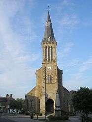 The church in Athis-Val-de-Rouvre | |
 Athis-Val-de-Rouvre Location within Normandy region  Athis-Val-de-Rouvre | |
| Coordinates: 48°48′40″N 0°29′56″W / 48.811°N 0.499°WCoordinates: 48°48′40″N 0°29′56″W / 48.811°N 0.499°W | |
| Country | France |
| Region | Normandy |
| Department | Orne |
| Arrondissement | Argentan |
| Canton | Athis-de-l'Orne |
| Intercommunality | Flers Agglo |
| Government | |
| • Mayor (2016-2020) | Alain Lange |
| Area1 | 76.97 km2 (29.72 sq mi) |
| Population (2015)2 | 4,295 |
| • Density | 56/km2 (140/sq mi) |
| Time zone | UTC+1 (CET) |
| • Summer (DST) | UTC+2 (CEST) |
| INSEE/Postal code | 61007 /61430, 61100 |
|
1 French Land Register data, which excludes lakes, ponds, glaciers > 1 km2 (0.386 sq mi or 247 acres) and river estuaries. 2 Population without double counting: residents of multiple communes (e.g., students and military personnel) only counted once. | |
Athis-Val-de-Rouvre is a commune in the department of Orne, northwestern France. The municipality was established on 1 January 2016 by merger of the former communes of Athis-de-l'Orne (the seat), Bréel, La Carneille, Notre-Dame-du-Rocher, Ronfeugerai, Ségrie-Fontaine, Taillebois and Les Tourailles.[1]
See also
References
| Wikimedia Commons has media related to Athis-Val de Rouvre. |
- ↑ Arrêté préfectoral 16 December 2015 (in French)
This article is issued from
Wikipedia.
The text is licensed under Creative Commons - Attribution - Sharealike.
Additional terms may apply for the media files.