Le Bouillon
| Le Bouillon | |
|---|---|
| Commune | |
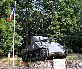 A Sherman tank at the cross of Médavy | |
 Le Bouillon Location within Normandy region  Le Bouillon | |
| Coordinates: 48°33′44″N 0°06′15″E / 48.5622°N 0.1042°ECoordinates: 48°33′44″N 0°06′15″E / 48.5622°N 0.1042°E | |
| Country | France |
| Region | Normandy |
| Department | Orne |
| Arrondissement | Alençon |
| Canton | Sées |
| Intercommunality | Pays de Sées |
| Government | |
| • Mayor (2008–2014) | André Drouaire |
| Area1 | 17.77 km2 (6.86 sq mi) |
| Population (2008)2 | 141 |
| • Density | 7.9/km2 (21/sq mi) |
| Time zone | UTC+1 (CET) |
| • Summer (DST) | UTC+2 (CEST) |
| INSEE/Postal code | 61056 /61500 |
| Elevation |
197–393 m (646–1,289 ft) (avg. 400 m or 1,300 ft) |
|
1 French Land Register data, which excludes lakes, ponds, glaciers > 1 km2 (0.386 sq mi or 247 acres) and river estuaries. 2 Population without double counting: residents of multiple communes (e.g., students and military personnel) only counted once. | |
Le Bouillon is a commune in the Orne department in northwestern France.
Population
| Historical population | ||
|---|---|---|
| Year | Pop. | ±% |
| 1962 | 146 | — |
| 1968 | 154 | +5.5% |
| 1975 | 158 | +2.6% |
| 1982 | 138 | −12.7% |
| 1990 | 156 | +13.0% |
| 1999 | 151 | −3.2% |
| 2006 | 145 | −4.0% |
| 2008 | 141 | −2.8% |
See also
References
| Wikimedia Commons has media related to Le Bouillon. |
This article is issued from
Wikipedia.
The text is licensed under Creative Commons - Attribution - Sharealike.
Additional terms may apply for the media files.