Champcerie
| Champcerie | |
|---|---|
| Commune | |
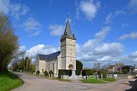 The church in Champcerie | |
 Champcerie Location within Normandy region  Champcerie | |
| Coordinates: 48°48′39″N 0°13′26″W / 48.8108°N 0.2239°WCoordinates: 48°48′39″N 0°13′26″W / 48.8108°N 0.2239°W | |
| Country | France |
| Region | Normandy |
| Department | Orne |
| Arrondissement | Argentan |
| Canton | Athis-de-l'Orne |
| Intercommunality | Communauté de communes du Val d'Orne |
| Government | |
| • Mayor (2008–2014) | Dominique Pichonnier |
| Area1 | 8.94 km2 (3.45 sq mi) |
| Population (2012)2 | 138 |
| • Density | 15/km2 (40/sq mi) |
| Time zone | UTC+1 (CET) |
| • Summer (DST) | UTC+2 (CEST) |
| INSEE/Postal code | 61084 /61210 |
| Elevation | 159–231 m (522–758 ft) |
|
1 French Land Register data, which excludes lakes, ponds, glaciers > 1 km2 (0.386 sq mi or 247 acres) and river estuaries. 2 Population without double counting: residents of multiple communes (e.g., students and military personnel) only counted once. | |
Champcerie is a commune in the Orne department in north-western France.
See also
References
| Wikimedia Commons has media related to Champcerie. |
This article is issued from
Wikipedia.
The text is licensed under Creative Commons - Attribution - Sharealike.
Additional terms may apply for the media files.