Bretoncelles
| Bretoncelles | ||
|---|---|---|
| Commune | ||
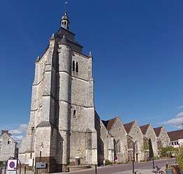 The church in Bretoncelles | ||
| ||
 Bretoncelles Location within Normandy region  Bretoncelles | ||
| Coordinates: 48°25′57″N 0°53′18″E / 48.4325°N 0.8883°ECoordinates: 48°25′57″N 0°53′18″E / 48.4325°N 0.8883°E | ||
| Country | France | |
| Region | Normandy | |
| Department | Orne | |
| Arrondissement | Mortagne-au-Perche | |
| Canton | Bretoncelles | |
| Intercommunality | Perche rémalardais | |
| Government | ||
| • Mayor (2008–2014) | Patrick Pinloche | |
| Area1 | 40.21 km2 (15.53 sq mi) | |
| Population (2009)2 | 1,431 | |
| • Density | 36/km2 (92/sq mi) | |
| Time zone | UTC+1 (CET) | |
| • Summer (DST) | UTC+2 (CEST) | |
| INSEE/Postal code | 61061 /61110 | |
| Elevation |
120–266 m (394–873 ft) (avg. 155 m or 509 ft) | |
|
1 French Land Register data, which excludes lakes, ponds, glaciers > 1 km2 (0.386 sq mi or 247 acres) and river estuaries. 2 Population without double counting: residents of multiple communes (e.g., students and military personnel) only counted once. | ||

Bretoncelles is a commune in the Orne department in northwestern France.
Population
| Historical population | ||
|---|---|---|
| Year | Pop. | ±% |
| 1962 | 1,112 | — |
| 1968 | 1,215 | +9.3% |
| 1975 | 1,285 | +5.8% |
| 1982 | 1,270 | −1.2% |
| 1990 | 1,221 | −3.9% |
| 1999 | 1,343 | +10.0% |
| 2006 | 1,400 | +4.2% |
| 2009 | 1,431 | +2.2% |
See also
References
| Wikimedia Commons has media related to Bretoncelles. |
This article is issued from
Wikipedia.
The text is licensed under Creative Commons - Attribution - Sharealike.
Additional terms may apply for the media files.