Bellou-le-Trichard
| Bellou-le-Trichard | |
|---|---|
| Commune | |
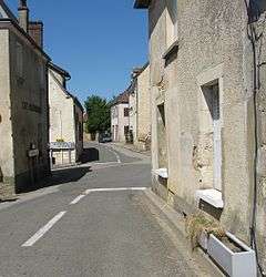 A street in Bellou-le-Trichard | |
 Bellou-le-Trichard Location within Normandy region  Bellou-le-Trichard | |
| Coordinates: 48°16′07″N 0°32′50″E / 48.2686°N 0.5472°ECoordinates: 48°16′07″N 0°32′50″E / 48.2686°N 0.5472°E | |
| Country | France |
| Region | Normandy |
| Department | Orne |
| Arrondissement | Mortagne-au-Perche |
| Canton | Ceton |
| Intercommunality | Val d'Huisne |
| Government | |
| • Mayor (2008–2014) | Michaël Leblanc |
| Area1 | 9.67 km2 (3.73 sq mi) |
| Population (2006)2 | 240 |
| • Density | 25/km2 (64/sq mi) |
| Time zone | UTC+1 (CET) |
| • Summer (DST) | UTC+2 (CEST) |
| INSEE/Postal code | 61041 /61130 |
| Elevation |
110–196 m (361–643 ft) (avg. 180 m or 590 ft) |
|
1 French Land Register data, which excludes lakes, ponds, glaciers > 1 km2 (0.386 sq mi or 247 acres) and river estuaries. 2 Population without double counting: residents of multiple communes (e.g., students and military personnel) only counted once. | |
Bellou-le-Trichard is a commune in the Orne department in northwestern France.
Population
| Historical population | ||
|---|---|---|
| Year | Pop. | ±% |
| 1962 | 297 | — |
| 1968 | 274 | −7.7% |
| 1975 | 221 | −19.3% |
| 1982 | 190 | −14.0% |
| 1990 | 180 | −5.3% |
| 1999 | 202 | +12.2% |
| 2006 | 240 | +18.8% |
| 2009 | 239 | −0.4% |
See also
References
External links
| Wikimedia Commons has media related to Bellou-le-Trichard. |
This article is issued from
Wikipedia.
The text is licensed under Creative Commons - Attribution - Sharealike.
Additional terms may apply for the media files.