Chahains
| Chahains | |
|---|---|
| Commune | |
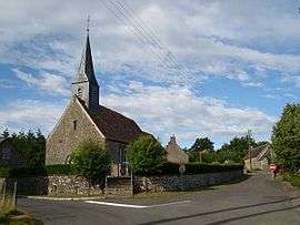 The church in Chahains | |
 Chahains Location within Normandy region  Chahains | |
| Coordinates: 48°33′46″N 0°06′46″W / 48.5628°N 0.1128°WCoordinates: 48°33′46″N 0°06′46″W / 48.5628°N 0.1128°W | |
| Country | France |
| Region | Normandy |
| Department | Orne |
| Arrondissement | Alençon |
| Canton | Magny-le-Désert |
| Intercommunality | Communauté de communes du Bocage Carrougien |
| Government | |
| • Mayor (2008–2014) | Françoise Reig-Hamelin |
| Area1 | 7.65 km2 (2.95 sq mi) |
| Population (2006)2 | 98 |
| • Density | 13/km2 (33/sq mi) |
| Time zone | UTC+1 (CET) |
| • Summer (DST) | UTC+2 (CEST) |
| INSEE/Postal code | 61080 /61320 |
| Elevation |
271–395 m (889–1,296 ft) (avg. 340 m or 1,120 ft) |
|
1 French Land Register data, which excludes lakes, ponds, glaciers > 1 km2 (0.386 sq mi or 247 acres) and river estuaries. 2 Population without double counting: residents of multiple communes (e.g., students and military personnel) only counted once. | |
Chahains is a commune in the Orne department in north-western France.
See also
References
| Wikimedia Commons has media related to Chahains. |
This article is issued from
Wikipedia.
The text is licensed under Creative Commons - Attribution - Sharealike.
Additional terms may apply for the media files.