Annerley, Queensland
| Annerley Brisbane, Queensland | |||||||||||||||
|---|---|---|---|---|---|---|---|---|---|---|---|---|---|---|---|
 Ipswich Road near the junction of Annerley Road | |||||||||||||||
| Population | 11,336 (2016 census)[1] | ||||||||||||||
| • Density | 4,050/km2 (10,490/sq mi) | ||||||||||||||
| Postcode(s) | 4103 | ||||||||||||||
| Area | 2.8 km2 (1.1 sq mi) | ||||||||||||||
| Location | 4 km (2 mi) from Brisbane CBD | ||||||||||||||
| LGA(s) |
City of Brisbane (Coorparoo Ward,[2] Tennyson Ward)[3] | ||||||||||||||
| State electorate(s) | |||||||||||||||
| Federal Division(s) | |||||||||||||||
| |||||||||||||||
Annerley is a suburb of the City of Brisbane, Queensland, Australia.[4] Annerley is located 4 kilometres (2.5 mi) south of the Brisbane CBD. In the 2011 census, Annerley had a population of 10,664 people.[5]
Geography
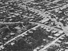
Much of the suburb is elevated, lying on a ridge that gives views of the city. For many years it was a somewhat rundown suburb, particularly close to main roads and with a lot of social housing, but with gentrification and the rise in the cost of housing, many of the original 'Queenslanders' have been restored to their former glory, giving the suburb an eclectic mix of residences for all socio-economic levels.
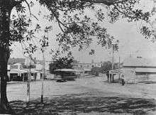
The suburb is of medium population density with many apartment blocks, guest houses and fast-food outlets. The major road in the suburb is Ipswich Road, one of Brisbane's main southerly traffic arteries. Until 13 April 1969 the suburb was served by electric trams, which ran along Ipswich Road.
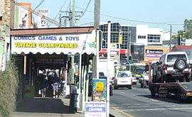
The area where Ipswich Road intersects with Annerley Road (formerly Boggo Road) is commonly known as Annerley Junction which in turn gave its name to the local state primary school Junction Park State School.
History
The area was originally used for dairy farms. One of the first residential subdivisions was the St Kilda Estate bounded by Cornwall Street to the north, Boggo Road (now Annerley Road) to the west and Ipswich Road to the south.[6] In 1866, the Junction Hotel was opened on the triangular corner of Ipswich Road and Boggo Road (now Annerley Road).[7]
Post office
Around 1880 a postal receiving office was opened at Boggo, which became Boggo Post Office on 1 May 1882. There was a proposal to rename it Richmond Post Office but this was rejected owing to the potential for confusion with Richmond, North Queensland and Richmond, New South Wales and new alternative names were sought. At this point it is believed that Digby Denham, then a member of the Stephens Divisional Board (and later a Premier of Queensland), proposed to call it Annerley after the township variously spelled Annerley, Annerly or Anerly in Surrey, England.[4][8][9] The post office was renamed Annerley Post Office in November 1892.[10][11][12][13]
St Philip's Anglican Church


St Philip's Anglican church was dedicated on 18 October 1886 by Archbishop of Brisbane William Webber. It was designed by architect John Henry Burley and was built by J.W. Stranson. The church bell was a gift of Abraham Fleetwood Luya and the baptismal font was the gift of stonemason Andrew Lang Petrie.[14] On 7 December the church was "reduced to ruin" by a severe storm which caused extensive flooding and the death of two children.[15][16] It was extended and re-dedicated on 1 April 1906 by St. Clair Donaldson, Archbishop of Brisbane, with Henry Wallace Atkinson as architect. The old church was destroyed by fire 28 November 1954 after work on the new church had begun. The current church was consecrated by the Archbishop of Brisbane on 1 December 1955.
There were at least two parishioners that lost their lives at Gallipoli. "At St Philips we know of only two of our parishioners who were part of this landing at Gallipoli who later died on 5th April 1918 in France. The two were good mates and brother and brother in law. They died on the same day in the same battle recorded by the historian Charles Bean. ....Reginald Verry and his brother in law James Victor Atkinson."[17][18][19]
A state funeral was held at the church for Gordon Brown who was a Senator for Queensland from 1932 to 1965 (as a member of the Australia Labor Party); his ashes are kept in the church's columbarium.
Schools
Thompson Estate Provisional School opened on 30 April 1888 in a four-roomed cottage in Oxford Street with 52 pupils. In 1889 the school occupied a hall in Regent Street to cater for the growing number of students. It became a state school on 31 Jan 1891 under head teacher James Joseph Dempsey with an average attendance of 461 pupils. It relocated to its present site in Waldheim Street on 31 March 1891. It was renamed Junction Park State School in 1893 with 737 pupils (the current site no longer being within Thompson Estate). Growing student numbers resulted in the creation of a separate but adjacent Junction State Infants School which opened on 1 July 1948 for Grade 1 and 2 pupils. From 1 January 1875, the infants school was reabsorbed into the main school, but the separate grounds and buildings continued to be used for the younger pupils within Junction Park State School. Later declining enrolment numbers lead to the infants school buildings being surplus to the school's needs and the land was sold for residential housing.[20][21][22][23]
The Ipswich Road Convent School was opened on 30 April 1917 by the Society of the Sacred Heart (a teaching order of Roman Catholic nuns) using the church building as the classroom. In 1919, the Sisters of the Sacred Heart relocated to Stuartholme and the Sisters of St Joseph of the Sacred Heart (founded by Saint Mary MacKillop) took over the school, renaming it St Joseph's Convent School. When the present church was built in 1932 on the corner of Ipswich Road and Ferndale Street (adjacent to the former church), separate class rooms were included on a lower level. In the 1950s the school was renamed Mary Immaculate Catholic Primary School to reflect the name of the church with which it was associated. Since 1954, further buildings have been added to the site specifically for use by the school, including the Marymac Community Centre in the 1970s. The school was operated by the Sisters of St Joseph until 1991, after which the school was operated by the Archdiocese of Brisbane Catholic Education Council (commonly known as Brisbane Catholic Education).[24]
In 1964 the Sisters of St Joseph also opened a secondary school for girls called Our Lady's College. Since 1976, the school has been operated by Brisbane Catholic Education.[25]
Local government
Annerley was the seat of the Shire of Stephens. The shire offices were located on Ipswich Road between Victoria Terrace and Junction Terrace (27°30′25″S 153°02′05″E / 27.506925°S 153.034682°E). After the shire became part of the City of Brisbane in 1925, the land was sold and the offices relocated on the block to become a residence at 15 Ealing Street.[26][27]
Heritage listings
There are a number of heritage-listed sites in Annerley, including:
- 260 Annerley Road: Hefferan Park Air Raid Shelter[28]
- 391 Annerley Road: Ingleside, former residence of Digby Denham, Premier of Queensland[29]
- 34 Brisbane Street: Residence [30]
- 151 Cornwall Street (corner King Street): Apostolic church (formerly Methodist church)[31]
- 29 Cracknell Road: Annerley Uniting Church [32]
- 158 Dudley Street: former Annerley Army Reserve Depot[33]
- 15 Ealing Street: former Stephens Shire office[34]
- 68 Emperor Street: Residence [35]
- 413 Ipswich Road: Tram substation (part of the infrastructure of Brisbane's former tramways, now used as a hotel restaurant)[36]
- 413 Ipswich Road: Fig tree (the sole survivor of an avenue of fig trees planted on Ipswich Road in Annerley between 1911 and 1955)[37]
- 444 Ipswich Road: Police Station (built in 1925 and still in use as a police station)[38][39]
- 448 Ipswich Road: Annerley Library & Community Centre (designed in 1956 by architect James Birrell)[40]
- 616 Ipswich Road: Mary Immaculate Catholic Church (a notable city landmark due to its prominent position its imposing interwar Gothic architecture)[41]
- 770 Ipswich Road: Shops [42]
- 22 Junction Terrace: Residence [43]
- 23 Junction Terrace: Residence [44]
- 23 King Street: St John's Presbyterian Church [45]
- 20 Laurier Street: Residence [46]
- 35 Waldheim Street: former Stephen's Farm Homestead [47]
- 50 Waldheim Street: Junction Park State School[48][49]
- 6 Young Street: Residence Cambrae [50]
- 11 Young Street: Residence Cockerill [51]
- 12 Young Street: Duplex Coombie [52]
- 17 Young Street: Residence [53]
- 34 Young Street: Duplex Kama Lodge [54]
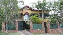
In addition there are many period homes, which, although not heritage-listed, contribute to the aesthetics of the suburb, including:
- 607 Ipswich Road: Rockmont (house)[55]
Education
Junction Park State School is a government co-educational primary (P-7) school located at 50 Waldheim Street (27°30′35″S 153°02′07″E / 27.509771°S 153.035212°E).[56] In 2012, the school had an enrolment of 373 students with 29 teachers (22.9 full-time equivalent).[57]
Mary Immaculate Catholic Primary School is a Roman Catholic co-educational primary (P-7) school located at 616 Ipswich Road (27°31′00″S 153°01′49″E / 27.516593°S 153.030209°E).[56] In 2013, the school had an enrolment of 140 students with 17 teachers (10.9 full-time equivalent).[58] The school's long-standing nickname is Mary Mac or Marymac, so much so that Marymac was chosen as the official name of the community hall on the school's site.[24][59]
Our Lady's College is a Roman Catholic girls secondary (8-12) school located at 15 Chester Road (27°30′56″S 153°01′53″E / 27.515563°S 153.031499°E).[56] In 2013, the school had an enrolment of 347 students with 32 teachers (32.68 full-time equivalent).[60]
Events
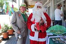
Annerley Junction now hosts a number of yearly events which are organised by the Annerley Junction Traders' Association. The first Christmas event "Junction Fair" was first hosted on 8 December 2012. The first "Junction Jumble Sale" was held on 22 June 2012. Both events were more successful than expected and Junction Fair was rebranded as the "Annerley Junction Christmas Fair" and was held on 7 December 2013.
Demographics
In the 2011 census, Annerley recorded a population of 10,664 people, 50.2% female and 49.8% male.[5] The median age of the Annerley population was 32 years, 5 years below the national median of 37.[5] 62.1% of people living in Annerley were born in Australia, compared to the national average of 69.8%; the next most common countries of birth were India 3.6%, New Zealand 3.5%, England 3%, China 1.6%, Vietnam 1.5%.[5] 70.1% of people spoke only English at home; the next most popular languages were 2.2% Mandarin, 2% Greek, 1.8% Vietnamese, 1.2% Malayalam, 1.2% Cantonese.[5]
Amenities
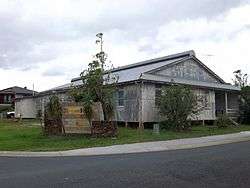
The Brisbane City Council operates a public library in Annerley at 450 Ipswich Road.[61] The library opened in 1957.[62]
Notable residents
- Digby Denham, Premier of Queensland lived at Ingleside, 391 Annerley Road
- Ainsley Gotto, political secretary and interior designer born here in 14th February 1946
References
- ↑ Australian Bureau of Statistics (27 June 2017). "Annerley (State Suburb)". 2016 Census QuickStats. Retrieved 13 April 2018.

- ↑ "Coorparoo Ward". Brisbane City Council. Brisbane City Council. Archived from the original on 4 February 2017. Retrieved 12 March 2017.
- ↑ "Tennyson Ward". Brisbane City Council. Brisbane City Council. Archived from the original on 4 March 2017. Retrieved 19 March 2017.
- 1 2 "Annerley (entry 43065)". Queensland Place Names. Queensland Government. Retrieved 15 March 2014.
- 1 2 3 4 5 Australian Bureau of Statistics (31 October 2012). "Annerley (SSC)". 2011 Census QuickStats. Retrieved 18 June 2014.
- ↑ "TELEGRAPHIC NEWS". The Brisbane Courier. National Library of Australia. 11 June 1864. p. 2. Retrieved 21 June 2014.
- ↑ "Annerley". Queensland Places. Centre for the Government of Queensland, University of Queensland. Archived from the original on 27 December 2013. Retrieved 26 December 2013.
- ↑ "History of Annerley". Archived from the original on 13 December 2014. Retrieved 20 June 2014.
- ↑ "BRISBANE'S SUBURBAN BEAUTIES". The Brisbane Courier. National Library of Australia. 4 August 1906. p. 12. Retrieved 21 June 2014.
- ↑ Premier Postal History. "Post Office List". Premier Postal Auctions. Archived from the original on 15 May 2014. Retrieved 18 June 2014.
- ↑ "The Brisbane Courier". The Brisbane Courier. National Library of Australia. 22 February 1884. p. 4. Retrieved 21 June 2014.
- ↑ "STEPHENS DIVISIONAL BOARD". The Brisbane Courier. National Library of Australia. 17 August 1892. p. 2. Retrieved 21 June 2014.
- ↑ "Current News". The Queenslander. National Library of Australia. 12 November 1892. p. 954. Retrieved 21 June 2014.
- ↑ "INTERCOLONIAL". The Brisbane Courier. XLII, (8, 962). Queensland, Australia. 5 October 1886. p. 6. Retrieved 21 November 2017 – via National Library of Australia.
- ↑ "Storm and Flood". The Telegraph (10, 315). Queensland, Australia. 8 December 1905. p. 7. Retrieved 21 November 2017 – via National Library of Australia.
- ↑ "DESTRUCTION OF ST. PHILIP'S, THOMPSON ESTATE". The Brisbane Courier. LXII, (14, 955). Queensland, Australia. 16 December 1905. p. 4. Retrieved 21 November 2017 – via National Library of Australia.
- ↑ Bean, C. E. W. (Charles Edwin Woodrow), 1879-1968. Story of Anzac; Bean, C. E. W. (Charles Edwin Woodrow), 1879-1968. A.I.F. in France; Gullett, Henry, Sir, 1878-1940. A.I.F. in Sinai and Palestine; Jose, Arthur W. (Arthur Wilberforce), 1863-1934. Royal Australian Navy, 1914-1918; Mackenzie, Seaforth Simpson, 1883-1955. Australians at Rabaul; Scott, Ernest, 1868-1939. Australia during the war; Cutlack, F. M. (Frederic Morley), 1886-1967. Australian Flying Corps (1921), Official history of Australia in the war of 1914-1918 (PDF), Angus and Robertson, p. 405, archived (PDF) from the original on 19 January 2018, retrieved 19 January 2018
- ↑ "Lieutenant VERRY, REGINALD HERBERT". Commonwealth War Graves. Archived from the original on 19 January 2018. Retrieved 19 January 2018.
- ↑ "Captain ATKINSON, JAMES VICTOR". Commonwealth War Graves. Archived from the original on 19 January 2018. Retrieved 19 January 2018.
- ↑ "History". Junction Park State School. Junction Park State School. Archived from the original on 9 March 2015. Retrieved 20 June 2014.
- ↑ "Opening and closing dates of Queensland Schools". Queensland Government. Retrieved 18 June 2014.
- ↑ "Agency ID5363, Junction Park State School". Queensland State Archives. Retrieved 21 June 2014.
- ↑ "Agency ID5364, Junction Park Infants State School". Queensland State Archives. Retrieved 21 June 2014.
- 1 2 "School History". Mary Immaculate Catholic Primary School. Mary Immaculate Catholic Primary School. Archived from the original on 1 November 2014. Retrieved 20 June 2014.
- ↑ "School history". Our Lady's College. Our Lady's College. Archived from the original on 14 March 2014. Retrieved 20 June 2014.
- ↑ "Stephens Shire". Queensland Places. Centre for the Government of Queensland, University of Queensland. Archived from the original on 27 December 2013. Retrieved 26 December 2013.
- ↑ "Stephens Shire Office". Brisbane Heritage Register. Brisbane City Council. Retrieved 20 June 2014.
- ↑ "Hefferan Park Air Raid Shelter (entry 602472)". Queensland Heritage Register. Queensland Heritage Council. Retrieved 19 June 2013.
- ↑ "Ingleside". Brisbane Heritage Register. Brisbane City Council. Retrieved 20 June 2014.
- ↑ "Residence". Brisbane Heritage Register. Brisbane City Council.
- ↑ "Apostolic Church of Qld". Brisbane Heritage Register. Brisbane City Council.
- ↑ "Annerley Uniting Church". Brisbane Heritage Register. Brisbane City Council.
- ↑ "Annerley Army Reserve Depot (former) (entry 602216)". Queensland Heritage Register. Queensland Heritage Council. Retrieved 19 June 2013.
- ↑ "Residence". Brisbane Heritage Register. Brisbane City Council. Retrieved 20 June 2014.
- ↑ "Residence". Brisbane Heritage Register. Brisbane City Council.
- ↑ "Tram substation (former)". Brisbane Heritage Register. Brisbane City Council. Retrieved 2 January 2014.
- ↑ "Fig tree". Brisbane Heritage Register. Brisbane City Council. Retrieved 2 January 2014.
- ↑ "Police Station". Brisbane Heritage Register. Brisbane City Council. Retrieved 2 January 2014.
- ↑ "Annerley Station" (PDF). Queensland Police Service. Archived from the original (PDF) on 13 December 2013. Retrieved 2 January 2014.
- ↑ "Annerley Library & Community Centre". Brisbane Heritage Register. Brisbane City Council. Retrieved 2 January 2014.
- ↑ "Mary Immaculate Catholic Church". Brisbane Heritage Register. Brisbane City Council. Retrieved 2 January 2014.
- ↑ "Shops, 770 Ipswich Road". Brisbane Heritage Register. Brisbane City Council. Retrieved 2 January 2014.
- ↑ "Residence". Brisbane Heritage Register. Brisbane City Council.
- ↑ "Residence". Brisbane Heritage Register. Brisbane City Council.
- ↑ "St John's Presbyterian Church". Brisbane Heritage Register. Brisbane City Council.
- ↑ "Residence". Brisbane Heritage Register. Brisbane City Council.
- ↑ "Stephen's Farm Homestead (former)". Brisbane Heritage Register. Brisbane City Council.
- ↑ "Junction Park State School (entry 650023)". Queensland Heritage Register. Queensland Heritage Council. Retrieved 24 January 2018.
- ↑ "Junction Park State School". Brisbane Heritage Register. Brisbane City Council.
- ↑ "Residence 'Cambrae'". Brisbane Heritage Register. Brisbane City Council.
- ↑ "Residence 'Cockerill'". Brisbane Heritage Register. Brisbane City Council.
- ↑ "Duplex 'Coombie'". Brisbane Heritage Register. Brisbane City Council.
- ↑ "Residence". Brisbane Heritage Register. Brisbane City Council.
- ↑ "Duplex 'Kama Lodge'". Brisbane Heritage Register. Brisbane City Council.
- ↑ Johnson, Ben (19 April 2012). "Slice of Brisbane history in Annerley". Quest Newspapers. Retrieved 20 June 2014.
- 1 2 3 "Queensland State and Non-State Schools". Queensland Government. Archived from the original on 8 May 2014. Retrieved 18 June 2014.
- ↑ "2012 School Annual Report" (PDF). Junction Park State School. Junction Park State School. Archived (PDF) from the original on 21 March 2015. Retrieved 20 June 2014.
- ↑ "Annual School Reporting – 2013" (PDF). Mary Immaculate Catholic Primary School. Mary Immaculate Catholic Primary School. Archived (PDF) from the original on 18 January 2015. Retrieved 20 June 2014.
- ↑ "South Brisbane Junior CC". Queensland Cricket. Archived from the original on 25 March 2012. Retrieved 20 June 2014.
- ↑ "Annual School Reporting – 2013" (PDF). Our Lady's College. Our Lady's College. Archived (PDF) from the original on 11 March 2015. Retrieved 20 June 2014.
- ↑ "Annerley Library". Public Libraries Connect. Archived from the original on 15 January 2018. Retrieved 15 January 2018.
- ↑ "Public Libraries Statistical Bulletin 2016-17" (PDF). Public Libraries Connect. Archived (PDF) from the original on 30 January 2018. Retrieved 15 January 2018.
External links
| Wikimedia Commons has media related to Annerley, Queensland. |
- University of Queensland: Queensland Places: Annerley
- "Annerley". BRISbites. Brisbane City Council. Archived from the original on 29 August 2007.
- "Annerley". Our Brisbane. Brisbane City Council.
- Annerley: Community Page