| [2] |
Name on the Register |
Image |
Date listed[3] |
Location |
City or town |
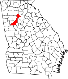
Description |
|---|
| 1 |
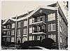
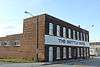
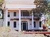
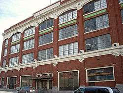
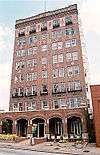
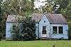
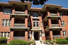
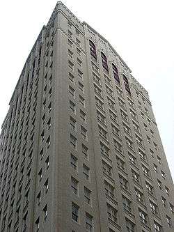
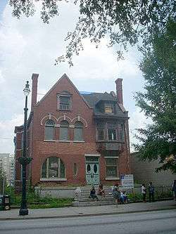
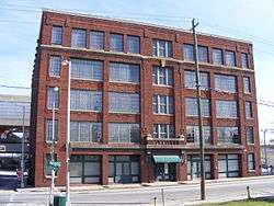
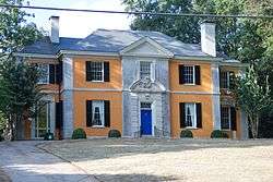
61 16th Street Apartment Building |
|
August 30, 2006
(#06000732) |
61 16th St.
33°47′34″N 84°23′03″W / 33.792778°N 84.384167°W / 33.792778; -84.384167 (61 16th Street Apartment Building) |
Atlanta |
|
| 2 |
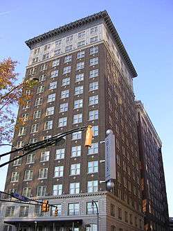
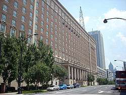
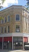
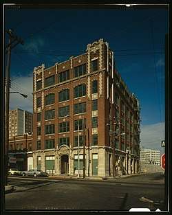
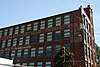
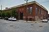
63 Magnum Street Industrial Building |
|
June 28, 1996
(#96000696) |
63–69 Mangum St.–398–400 Markham St.
33°45′09″N 84°24′01″W / 33.7525°N 84.400278°W / 33.7525; -84.400278 (63 Magnum Street Industrial Building) |
Atlanta |
|
| 3 |
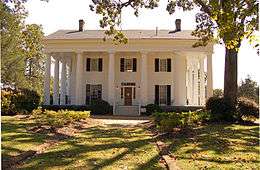
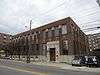
696 Peachtree Street Apartments |
|
May 8, 2013
(#13000240) |
826 Peachtree St.
33°46′39″N 84°23′04″W / 33.777506°N 84.384398°W / 33.777506; -84.384398 (696 Peachtree Street Apartments) |
Atlanta |
|
| 4 |
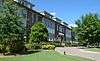
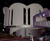
705 Piedmont Avenue Apartments |
|
December 19, 1991
(#91001853) |
705 Piedmont Ave.
33°46′25″N 84°22′52″W / 33.773611°N 84.381111°W / 33.773611; -84.381111 (705 Piedmont Avenue Apartments) |
Atlanta |
Designed by architect Russell Conklin in 1924. |
| 5 |
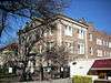
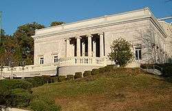
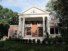
Academy of Medicine |
|
April 30, 1980
(#80001070) |
875 W. Peachtree St., NE.
33°46′45″N 84°23′13″W / 33.779167°N 84.386944°W / 33.779167; -84.386944 (Academy of Medicine) |
Atlanta |
|
| 6 |
Adair Park Historic District |
|
June 2, 2000
(#00000563) |
Bounded by Metropolitan Parkway, Lexington Ave., Norfolk Southern RR and Shelton Ave.
33°43′52″N 84°24′34″W / 33.731111°N 84.409444°W / 33.731111; -84.409444 (Adair Park Historic District) |
Atlanta |
|
| 7 |
Charles R. Adams Park |
|
January 14, 2013
(#12001167) |
1690 Delowe Dr.
33°42′37″N 84°27′48″W / 33.710311°N 84.463204°W / 33.710311; -84.463204 (Charles R. Adams Park) |
Atlanta |
|
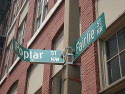
| 8 |
Jack and Helen Adams Lustron House |
|
March 18, 1996
(#96000212) |
832 Burchill St., SW.
33°42′44″N 84°24′57″W / 33.712222°N 84.415833°W / 33.712222; -84.415833 (Jack and Helen Adams Lustron House) |
Atlanta |
A Lustron house |
| 9 |
Alberta Drive-Mathieson Drive-West Shadowlawn Avenue Historic District |
|
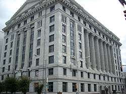
January 27, 2015
(#14001208) |
Roughly centered on W. Shadowlawn Ave., Alberta & Mathieson Drs., NE.
33°50′42″N 84°22′36″W / 33.845°N 84.3767°W / 33.845; -84.3767 (Alberta Drive-Mathieson Drive-West Shadowlawn Avenue Historic District) |
Atlanta |
|
| 10 |
Cecil and Hermione Alexander House |
|
March 25, 2010
(#10000116) |
2232 Mt. Paran Rd, N.W.
33°51′23″N 84°26′15″W / 33.8564°N 84.4376°W / 33.8564; -84.4376 (Cecil and Hermione Alexander House) |
Atlanta |
|
| 11 |
Ansley Park Historic District |
|
April 20, 1979
(#79000717) |
Roughly bounded by RR tracks, Beverly Rd., Piedmont Ave., Spring, 15th & Peachtree Sts.
33°47′34″N 84°22′45″W / 33.792875°N 84.379181°W / 33.792875; -84.379181 (Ansley Park Historic District) |
Atlanta |
|
| 12 |
Apartments at 2 Collier Road |
|
September 10, 2007
(#07000937) |
2 Collier Rd.
33°48′31″N 84°23′39″W / 33.808611°N 84.394167°W / 33.808611; -84.394167 (Apartments at 2 Collier Road) |
Atlanta |
|
| 13 |
Apartments at 22–24 Collier Road |
|
September 10, 2007
(#07000938) |
22-24 Collier Rd.
33°48′32″N 84°23′42″W / 33.808889°N 84.395°W / 33.808889; -84.395 (Apartments at 22–24 Collier Road) |
Atlanta |
|
| 14 |
Thomas P. Arnold House |
|
May 10, 1984
(#84001074) |
518 S. Main St.
33°30′40″N 84°40′18″W / 33.511111°N 84.671667°W / 33.511111; -84.671667 (Thomas P. Arnold House) |
Palmetto |
|
| 15 |
Ashby Street Car Barn |
|
August 6, 1998
(#98000972) |
981 Ashby St. NW.
33°47′02″N 84°25′01″W / 33.783889°N 84.416944°W / 33.783889; -84.416944 (Ashby Street Car Barn) |
Atlanta |
|
| 16 |
Atkins Park District |
|
August 30, 1982
(#82004619) |
St. Augustine St., St. Charles, and St. Louis Pls. between N. Highland Ave. and Briarcliff Rd.
33°46′31″N 84°21′01″W / 33.775278°N 84.350278°W / 33.775278; -84.350278 (Atkins Park District) |
Atlanta |
|
| 17 |
Atlanta and West Point Railroad Freight Depot |
|
March 26, 1976
(#76000620) |
215 Decatur St.
33°45′32″N 84°22′58″W / 33.758889°N 84.382778°W / 33.758889; -84.382778 (Atlanta and West Point Railroad Freight Depot) |
Atlanta |
|
| 18 |
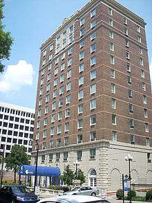
Atlanta Biltmore Hotel and Biltmore Apartments |
|
January 20, 1980
(#80001071) |
817 W. Peachtree St.
33°46′36″N 84°23′11″W / 33.776667°N 84.386389°W / 33.776667; -84.386389 (Atlanta Biltmore Hotel and Biltmore Apartments) |
Atlanta |
|
| 19 |
Atlanta Buggy Company and Warehouse-Hatcher Bros. Furniture Company |
|
August 21, 1992
(#92001070) |
530–544 Means St.
33°46′21″N 84°24′20″W / 33.7725°N 84.405556°W / 33.7725; -84.405556 (Atlanta Buggy Company and Warehouse-Hatcher Bros. Furniture Company) |
Atlanta |
|
| 20 |
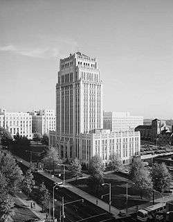
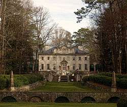
Atlanta City Hall |
|
July 13, 1983
(#83000227) |
68 Mitchell St. SW.
33°44′56″N 84°23′25″W / 33.748889°N 84.390278°W / 33.748889; -84.390278 (Atlanta City Hall) |
Atlanta |
|
| 21 |
Atlanta Spring and Bed Company-Block Candy Company |
|
July 28, 1995
(#95000910) |
512 Means St.
33°46′20″N 84°24′19″W / 33.772222°N 84.405278°W / 33.772222; -84.405278 (Atlanta Spring and Bed Company-Block Candy Company) |
Atlanta |
|
| 22 |
Atlanta Stockade |
|
June 25, 1987
(#87000948) |
760 Glenwood Ave.
33°44′30″N 84°21′44″W / 33.741667°N 84.362222°W / 33.741667; -84.362222 (Atlanta Stockade) |
Atlanta |
|
| 23 |
Atlanta University Center District |
|
July 12, 1976
(#76000621) |
Roughly bounded by transit right-of-way, Northside Dr., Walnut, Fair, Roach, W. End Dr., Euralee and Chestnut Sts.
33°45′00″N 84°24′33″W / 33.75°N 84.409167°W / 33.75; -84.409167 (Atlanta University Center District) |
Atlanta |
|
| 24 |
Atlanta Waterworks Hemphill Avenue Station |
|
March 29, 1978
(#78000982) |
1210 Hemphill Ave., NW.
33°47′14″N 84°24′30″W / 33.787222°N 84.408333°W / 33.787222; -84.408333 (Atlanta Waterworks Hemphill Avenue Station) |
Atlanta |
|
| 25 |
Atlanta Women's Club |
|
January 31, 1979
(#79000718) |
1150 Peachtree St., NE.
33°47′09″N 84°22′59″W / 33.785833°N 84.383056°W / 33.785833; -84.383056 (Atlanta Women's Club) |
Atlanta |
|
| 26 |
Levi Ballard House |
|
October 22, 1980
(#80001080) |
U.S. 29 and GA 154
33°31′46″N 84°39′43″W / 33.529444°N 84.661944°W / 33.529444; -84.661944 (Levi Ballard House) |
Palmetto |
Evidently torn down, according to a facebook page. |
| 27 |
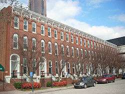
Baltimore Block |
|
June 3, 1976
(#76000622) |
5,7,9,11,13,15,17,19 Baltimore Pl.
33°46′06″N 84°23′16″W / 33.768333°N 84.387778°W / 33.768333; -84.387778 (Baltimore Block) |
Atlanta |
|
| 28 |
Barrington Hall |
|
December 9, 1971
(#71000275) |
60 Marietta St.
34°00′47″N 84°21′50″W / 34.013056°N 84.363889°W / 34.013056; -84.363889 (Barrington Hall) |
Roswell |
|
| 29 |
Bass Furniture Building |
|
January 8, 1979
(#79000719) |
142–150 Mitchell St.
33°45′07″N 84°23′32″W / 33.751944°N 84.392222°W / 33.751944; -84.392222 (Bass Furniture Building) |
Atlanta |
|
| 30 |
John F. Beavers House |
|
March 29, 1984
(#84001075) |
Northwest of Fairburn off GA 92
33°39′14″N 84°40′16″W / 33.653889°N 84.671111°W / 33.653889; -84.671111 (John F. Beavers House) |
Fairburn |
|
| 31 |
Berkeley Park Historic District |
|
June 23, 2003
(#03000536) |
Roughly bounded by Bellemeade Rd., Northside Dr., Atlanta Waterworks and Howell Mill Rd.
33°48′00″N 84°24′47″W / 33.8°N 84.413056°W / 33.8; -84.413056 (Berkeley Park Historic District) |
Atlanta |
|
| 32 |
Dr. Brailsford R. Brazeal House |
|
April 8, 2005
(#05000278) |
193 Joseph E. Lowery Boulevard
33°45′03″N 84°25′05″W / 33.750833°N 84.418056°W / 33.750833; -84.418056 (Dr. Brailsford R. Brazeal House) |
Atlanta |
|
| 33 |
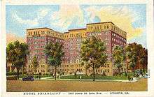
Briarcliff Hotel |
|
September 9, 1982
(#82002415) |
1050 Ponce de Leon Ave.
33°46′26″N 84°21′11″W / 33.773889°N 84.353056°W / 33.773889; -84.353056 (Briarcliff Hotel) |
Atlanta |
|
| 34 |
Dr. Marion Luther Brittain, Sr., House |
|
September 23, 1993
(#93000999) |
1109 W. Peachtree St.
33°47′06″N 84°23′15″W / 33.785009°N 84.387420°W / 33.785009; -84.387420 (Dr. Marion Luther Brittain, Sr., House) |
Atlanta |
Demolished in 2017.[4] |
| 35 |
Brookhaven Historic District |
|
January 24, 1986
(#86000134) |
East of Peachtree-Dunwoody and north and east of Peachtree Rds.
33°51′49″N 84°21′02″W / 33.863611°N 84.350556°W / 33.863611; -84.350556 (Brookhaven Historic District) |
Atlanta |
|
| 36 |
Brookwood Hills Historic District |
|
December 21, 1979
(#79003776) |
Off U.S. 19 and GA 9
33°48′21″N 84°23′23″W / 33.805833°N 84.389722°W / 33.805833; -84.389722 (Brookwood Hills Historic District) |
Atlanta |
|
| 37 |
Building at 161 Spring St. |
|
June 14, 2001
(#01000644) |
161 Spring St., NW.
33°45′37″N 84°23′23″W / 33.760278°N 84.389722°W / 33.760278; -84.389722 (Building at 161 Spring St.) |
Atlanta |
|
| 38 |
Building at 760-768 Confederate Avenue |
|
October 2, 2018
(#100003037) |
760 Confederate Avenue SE.
33°44′01″N 84°21′54″W / 33.7335°N 84.3649°W / 33.7335; -84.3649 (Building at 760-768 Confederate Avenue) |
Atlanta |
|
| 39 |
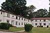
Bulloch Hall |
|
May 27, 1971
(#71000276) |
Bulloch Ave.
34°00′55″N 84°22′04″W / 34.015278°N 84.367778°W / 34.015278; -84.367778 (Bulloch Hall) |
Roswell |
|
| 40 |
Burns Cottage |
|
December 1, 1983
(#83003572) |
988 Alloway Pl., SE.
33°43′37″N 84°21′20″W / 33.726944°N 84.355556°W / 33.726944; -84.355556 (Burns Cottage) |
Atlanta |
|
| 41 |
Butler Street Colored Methodist Episcopal Church |
|
May 9, 1983
(#83000228) |
23 Butler St., SE.
33°45′13″N 84°22′51″W / 33.753611°N 84.380833°W / 33.753611; -84.380833 (Butler Street Colored Methodist Episcopal Church) |
Atlanta |
|
| 42 |
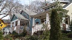
Cabbagetown District |
|
January 1, 1976
(#76000623) |
Bounded by Boulevard, Pearl St., Memorial Dr., and railroad tracks
33°44′59″N 84°21′59″W / 33.749722°N 84.366389°W / 33.749722; -84.366389 (Cabbagetown District) |
Atlanta |
|
| 43 |
Campbell County Courthouse |
|
March 26, 1976
(#76000634) |
E. Broad and Cole Sts.
33°34′00″N 84°34′46″W / 33.566667°N 84.579444°W / 33.566667; -84.579444 (Campbell County Courthouse) |
Fairburn |
Courthouse for the defunct Campbell County, Georgia |
| 44 |
Candler Building |
|
August 24, 1977
(#77000424) |
127 Peachtree St., NE.
33°45′26″N 84°23′16″W / 33.757222°N 84.387778°W / 33.757222; -84.387778 (Candler Building) |
Atlanta |
|
| 45 |
Canton Apartments |
|
December 8, 1980
(#80004456) |
2846–2840 Peachtree Rd.
33°49′57″N 84°23′04″W / 33.8325°N 84.384444°W / 33.8325; -84.384444 (Canton Apartments) |
Atlanta |
|
| 46 |
Capital City Club |
|
September 15, 1977
(#77000425) |
7 Harris St., NW.
33°45′39″N 84°23′16″W / 33.760833°N 84.387778°W / 33.760833; -84.387778 (Capital City Club) |
Atlanta |
|
| 47 |
Capitol View Historic District |
|
April 22, 2016
(#16000195) |
Roughly bounded by Hartford Pl., Fairbanks St., Perkerson Park, Sylvan Rd., and Division Pl.
33°42′59″N 84°25′01″W / 33.716303°N 84.417044°W / 33.716303; -84.417044 (Capitol View Historic District) |
Atlanta |
|
| 48 |
Capitol View Manor Historic District |
|
December 3, 2013
(#13000876) |
Roughly bounded by Norfolk Southern RR, Hillside Dr., SW., I-75, Deckner Ave., SW. & Metropolitan Pkwy., SW.
33°43′03″N 84°24′20″W / 33.717629°N 84.405688°W / 33.717629; -84.405688 (Capitol View Manor Historic District) |
Atlanta |
|
| 49 |
Castleberry Hill Historic District |
|
August 8, 1985
(#85001742) |
Roughly bounded by Nelson St., Southern & Central of Georgia RR, McDaniel, Peters & Walker Sts.
33°44′52″N 84°24′03″W / 33.747778°N 84.400833°W / 33.747778; -84.400833 (Castleberry Hill Historic District) |
Atlanta |
|
| 50 |
Central Presbyterian Church |
|
March 13, 1986
(#86000366) |
201 Washington St. SW.
33°44′59″N 84°23′21″W / 33.749722°N 84.389167°W / 33.749722; -84.389167 (Central Presbyterian Church) |
Atlanta |
|
| 51 |
Church of the Sacred Heart of Jesus |
|
May 13, 1976
(#76000625) |
335 Ivy St. [Peachtree Center], NE.
33°45′50″N 84°23′07″W / 33.763889°N 84.385278°W / 33.763889; -84.385278 (Church of the Sacred Heart of Jesus) |
Atlanta |
|
| 52 |
Citizens and Southern Bank Building |
|
August 18, 1977
(#77000426) |
35 Broad St.
33°45′17″N 84°23′23″W / 33.754722°N 84.389722°W / 33.754722; -84.389722 (Citizens and Southern Bank Building) |
Atlanta |
|
| 53 |
Coca-Cola Building Annex |
|
October 18, 1996
(#96001138) |
187 Edgewood Ave.
33°45′21″N 84°22′53″W / 33.755833°N 84.381389°W / 33.755833; -84.381389 (Coca-Cola Building Annex) |
Atlanta |
|
| 54 |
College Park Historic District |
|
November 15, 1996
(#96001338) |
Roughly bounded by Vesta Ave., Yale Ave., Madison St., Harris St., and Washington Rd.
33°39′38″N 84°27′12″W / 33.660556°N 84.453333°W / 33.660556; -84.453333 (College Park Historic District) |
College Park |
|
| 55 |
College Street School |
|
July 21, 1995
(#95000902) |
580 College St.
33°39′20″N 84°24′31″W / 33.655556°N 84.408611°W / 33.655556; -84.408611 (College Street School) |
Hapeville |
|
| 56 |
Collier Heights Historic District |
|
June 23, 2009
(#09000457) |
Bounded approximately by Hamilton E. Holmes Drive on the east, Donald Lee Hollowell Parkway on the north, Interstate 285 on the west, and Interstate 20 on the south
33°46′19″N 84°29′02″W / 33.771944°N 84.483889°W / 33.771944; -84.483889 (Collier Heights Historic District) |
Atlanta |
|
| 57 |
F. J. Cooledge and Sons, Company-Hastings' Seed Company |
|
October 31, 1995
(#95001229) |
434 Marietta St.
33°45′53″N 84°23′52″W / 33.764722°N 84.397778°W / 33.764722; -84.397778 (F. J. Cooledge and Sons, Company-Hastings' Seed Company) |
Atlanta |
|
| 58 |
Cox-Carlton Hotel |
|
November 1, 2006
(#06000960) |
683 Peachtree St., NE.
33°46′28″N 84°23′05″W / 33.774444°N 84.384722°W / 33.774444; -84.384722 (Cox-Carlton Hotel) |
Atlanta |
Designed by Atlanta architectural firm Pringle and Smith in 1925 |
| 59 |
Crescent Apartments |
|
June 21, 1996
(#96000649) |
979 Crescent Ave., NW.
33°46′52″N 84°23′04″W / 33.781111°N 84.384444°W / 33.781111; -84.384444 (Crescent Apartments) |
Atlanta |
Where Margaret Mitchell wrote much of Gone With the Wind |
| 60 |
William H. Crogman School |
|
July 14, 2005
(#05000692) |
1093 West Ave SW
33°43′30″N 84°23′47″W / 33.7249°N 84.3963°W / 33.7249; -84.3963 (William H. Crogman School) |
Atlanta |
|
| 61 |
Cyclorama of the Battle of Atlanta |
|
December 9, 1971
(#71000274) |
Cherokee Ave., Grant Park
33°43′33″N 84°22′16″W / 33.725833°N 84.371111°W / 33.725833; -84.371111 (Cyclorama of the Battle of Atlanta) |
Atlanta |
|
| 62 |
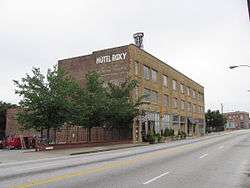
H. B. Davis Building-Hotel Roxy |
|
September 11, 1997
(#97001123) |
764–772 Marietta St.
33°46′32″N 84°24′16″W / 33.775556°N 84.404444°W / 33.775556; -84.404444 (H. B. Davis Building-Hotel Roxy) |
Atlanta |
|
| 63 |
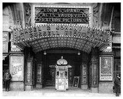
Degive's Grand Opera House |
|
June 17, 1977
(#77000427) |
157 Peachtree St., NE.
33°45′27″N 84°23′13″W / 33.7575°N 84.386944°W / 33.7575; -84.386944 (Degive's Grand Opera House) |
Atlanta |
|
| 64 |
Dixie Coca-Cola Bottling Company Plant |
|
July 20, 1977
(#77000428) |
125 Edgewood Ave.
33°45′16″N 84°23′03″W / 33.754444°N 84.384167°W / 33.754444; -84.384167 (Dixie Coca-Cola Bottling Company Plant) |
Atlanta |
National Historic Landmark |
| 65 |
East Point Industrial District |
|
September 5, 1985
(#85001971) |
Roughly bounded by Martin and Taylor Sts. Norman Berry Dr. and RR tracks
33°40′42″N 84°26′19″W / 33.678333°N 84.438611°W / 33.678333; -84.438611 (East Point Industrial District) |
East Point |
|
| 66 |
Rutherford and Martha Ellis House |
|
May 6, 2009
(#09000269) |
543 W. Wesley Rd., NW.
33°49′47″N 84°24′20″W / 33.829814°N 84.405536°W / 33.829814; -84.405536 (Rutherford and Martha Ellis House) |
Atlanta |
|
| 67 |
Empire Manufacturing Company Building |
|
February 20, 2002
(#02000078) |
575 Glen Iris Dr., NE.
33°46′19″N 84°22′01″W / 33.771944°N 84.366944°W / 33.771944; -84.366944 (Empire Manufacturing Company Building) |
Atlanta |
|
| 68 |
English-American Building |
|
March 26, 1976
(#76000626) |
74 Peachtree St.
33°45′22″N 84°23′19″W / 33.756111°N 84.388611°W / 33.756111; -84.388611 (English-American Building) |
Atlanta |
|
| 69 |
Thomas and Rae Epting Lustron House |
|
March 18, 1996
(#96000210) |
1692 Brewer Boulevard, SW.
33°42′31″N 84°25′01″W / 33.708611°N 84.416944°W / 33.708611; -84.416944 (Thomas and Rae Epting Lustron House) |
Atlanta |
A Lustron house |
| 70 |
Fairburn Commercial Historic District |
|
October 20, 1988
(#88002015) |
Roughly along W. Broad St. and RR tracks between Smith and Dood Sts.
33°34′00″N 84°34′54″W / 33.566667°N 84.581667°W / 33.566667; -84.581667 (Fairburn Commercial Historic District) |
Fairburn |
|
| 71 |
Fairlie-Poplar Historic District |
|
September 9, 1982
(#82002416) |
Roughly bounded by Peachtree, Luckie, Cone, and Marietta Sts.
33°45′22″N 84°23′24″W / 33.756111°N 84.39°W / 33.756111; -84.39 (Fairlie-Poplar Historic District) |
Atlanta |
|
| 72 |
Farlinger |
|
September 30, 1982
(#82002417) |
343 Peachtree St., NE.
33°45′49″N 84°23′09″W / 33.763611°N 84.385833°W / 33.763611; -84.385833 (Farlinger) |
Atlanta |
|
| 73 |
Fire Station No. 11 |
|
February 12, 1980
(#80001073) |
30 North Ave.
33°46′17″N 84°23′09″W / 33.771389°N 84.385833°W / 33.771389; -84.385833 (Fire Station No. 11) |
Atlanta |
Architects were Morgan & Dillon. Built 1907. First fire station to respond to Winecoff Hotel fire in 1946. |
| 74 |
First Congregational Church |
|
January 19, 1979
(#79000720) |
105 Courtland St., NE.
33°45′27″N 84°23′01″W / 33.7575°N 84.383611°W / 33.7575; -84.383611 (First Congregational Church) |
Atlanta |
|
| 75 |
First Methodist Episcopal Church, South |
|
December 7, 2010
(#10001000) |
360 Peachtree St., NW
33°45′52″N 84°23′09″W / 33.764444°N 84.385833°W / 33.764444; -84.385833 (First Methodist Episcopal Church, South) |
Atlanta |
|
| 76 |
Ford Motor Company Assembly Plant |
|
May 10, 1984
(#84001080) |
699 Ponce de Leon Ave.
33°46′22″N 84°21′52″W / 33.772778°N 84.364444°W / 33.772778; -84.364444 (Ford Motor Company Assembly Plant) |
Atlanta |
|
| 77 |
Forscom Command Sergeant Major's Quarters |
|
February 25, 1975
(#75000595) |
Bldg. 532
33°42′44″N 84°26′14″W / 33.712222°N 84.437222°W / 33.712222; -84.437222 (Forscom Command Sergeant Major's Quarters) |
Fort McPherson |
|
| 78 |
Fort Peace |
|
September 18, 2018
(#100002982) |
87 15th St.
33°47′18″N 84°23′05″W / 33.7884°N 84.3848°W / 33.7884; -84.3848 (Fort Peace) |
Atlanta |
|
| 79 |
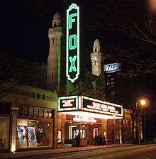
Fox Theatre |
|
May 17, 1974
(#74002230) |
600 Peachtree St.
33°46′20″N 84°23′12″W / 33.772222°N 84.386667°W / 33.772222; -84.386667 (Fox Theatre) |
Atlanta |
National Historic Landmark |
| 80 |
Fox Theatre Historic District |
|
October 7, 1978
(#78003178) |
Peachtree St. and Ponce de Leon Ave.
33°46′20″N 84°23′12″W / 33.772222°N 84.386667°W / 33.772222; -84.386667 (Fox Theatre Historic District) |
Atlanta |
|
| 81 |
Freeman Ford Building |
|
August 6, 1998
(#98000968) |
75 John Wesley Dobbs Ave.
33°45′31″N 84°23′04″W / 33.758611°N 84.384444°W / 33.758611; -84.384444 (Freeman Ford Building) |
Atlanta |
|
| 82 |
Fulton County Almshouse |
|
February 8, 2014
(#13001169) |
215 W. Wieuca Rd., NW.
33°52′31″N 84°23′34″W / 33.8753683°N 84.3928313°W / 33.8753683; -84.3928313 (Fulton County Almshouse) |
Atlanta |
|
| 83 |
Fulton County Courthouse |
|
September 18, 1980
(#80001074) |
160 Pryor St., SW.
33°45′03″N 84°23′27″W / 33.750833°N 84.390833°W / 33.750833; -84.390833 (Fulton County Courthouse) |
Atlanta |
|
| 84 |
Garden Hills Historic District |
|
August 17, 1987
(#87001362) |
Roughly bounded by Delmont and Brentwood and N. Hills Drs., Piemont, E. Wesley, and Peachtree Rds.
33°49′54″N 84°22′45″W / 33.831667°N 84.379167°W / 33.831667; -84.379167 (Garden Hills Historic District) |
Atlanta |
|
| 85 |
Garrison Apartments |
|
January 29, 1979
(#79000721) |
1325–1327 Peachtree St., NE.
33°47′27″N 84°23′05″W / 33.790833°N 84.384722°W / 33.790833; -84.384722 (Garrison Apartments) |
Atlanta |
|
| 86 |
General Electric Company Repair Shop Warehouse |
|
October 10, 2008
(#08000968) |
488 Glenn Ave.
33°44′17″N 84°24′13″W / 33.738136°N 84.403533°W / 33.738136; -84.403533 (General Electric Company Repair Shop Warehouse) |
Fulton |
|
| 87 |
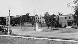
Georgia Institute of Technology Historic District |
|
August 25, 1978
(#78000983) |
225 North Ave.
33°46′21″N 84°23′40″W / 33.7725°N 84.394444°W / 33.7725; -84.394444 (Georgia Institute of Technology Historic District) |
Atlanta |
|
| 88 |
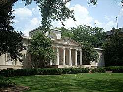
Georgia State Capitol |
|
December 9, 1971
(#71001099) |
Capitol Sq.
33°44′56″N 84°23′17″W / 33.748889°N 84.388056°W / 33.748889; -84.388056 (Georgia State Capitol) |
Atlanta |
National Historic Landmark |
| 89 |
Jeremiah S. Gilbert House |
|
April 17, 1980
(#80001075) |
2238 Perkerson Rd., SW.
33°41′36″N 84°24′38″W / 33.693333°N 84.410556°W / 33.693333; -84.410556 (Jeremiah S. Gilbert House) |
Atlanta |
|
| 90 |
Glenn Building |
|
April 29, 2008
(#08000350) |
110 Marietta St.
33°45′25″N 84°23′34″W / 33.756992°N 84.392672°W / 33.756992; -84.392672 (Glenn Building) |
Atlanta |
|
| 91 |
May Patterson Goodrum House |
|
May 1, 2013
(#13000215) |
320 West Paces Ferry Rd., NW.
33°50′38″N 84°23′46″W / 33.843865°N 84.396114°W / 33.843865; -84.396114 (May Patterson Goodrum House) |
Atlanta |
|
| 92 |
Grady Hospital |
|
August 13, 1981
(#81000652) |
36 Butler St., SE.
33°45′12″N 84°22′51″W / 33.753333°N 84.380833°W / 33.753333; -84.380833 (Grady Hospital) |
Atlanta |
|
| 93 |
Grant Park Historic District |
|
July 20, 1979
(#79000722) |
Roughly bounded by Glenwood and Atlanta Aves., Kelly and Eloise Sts.
33°44′10″N 84°22′18″W / 33.736111°N 84.371667°W / 33.736111; -84.371667 (Grant Park Historic District) |
Atlanta |
|
| 94 |
Grant Park North |
|
March 17, 1986
(#86000462) |
Roughly bounded by Woodward Ave., Boulevard, I-20, and Hill St.
33°44′42″N 84°22′25″W / 33.745°N 84.373611°W / 33.745; -84.373611 (Grant Park North) |
Atlanta |
|
| 95 |
W. D. Grant Building |
|
January 8, 1979
(#79003318) |
44 Broad St., NW.
33°45′20″N 84°23′24″W / 33.755556°N 84.39°W / 33.755556; -84.39 (W. D. Grant Building) |
Atlanta |
|
| 96 |
Great Atlantic & Pacific Tea Company |
|
October 27, 2004
(#04001183) |
881 Memorial Dr.
33°44′52″N 84°21′44″W / 33.747778°N 84.362222°W / 33.747778; -84.362222 (Great Atlantic & Pacific Tea Company) |
Atlanta |
|
| 97 |
Griffith School of Music |
|
May 12, 1999
(#99000552) |
650 Bonaventore Ave., NE.
33°46′26″N 84°21′41″W / 33.773889°N 84.361389°W / 33.773889; -84.361389 (Griffith School of Music) |
Atlanta |
|
| 98 |
Habersham Memorial Hall |
|
June 7, 1974
(#74000676) |
15th St., west of the junction with Piedmont Ave.
33°47′18″N 84°22′40″W / 33.788333°N 84.377778°W / 33.788333; -84.377778 (Habersham Memorial Hall) |
Atlanta |
|
| 99 |
Hapeville Historic District |
|
October 14, 2009
(#09000824) |
Bounded by I-75 on the east, Mt. Zion Rd. on the north, I-85 on the west, Airport Loop Rd. on the south, and Sylvan and Springdale Rds. west of I-85
33°39′36″N 84°24′37″W / 33.660108°N 84.410206°W / 33.660108; -84.410206 (Hapeville Historic District) |
Hapeville |
|
| 100 |
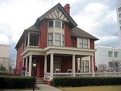
Joel Chandler Harris House |
|
October 15, 1966
(#66000281) |
1050 Gordon St., SW.
33°44′16″N 84°25′20″W / 33.73764°N 84.42219°W / 33.73764; -84.42219 (Joel Chandler Harris House) |
Atlanta |
National Historic Landmark |
| 101 |
Healey Building |
|
August 12, 1977
(#77000429) |
57 Forsyth St.
33°45′22″N 84°23′23″W / 33.756111°N 84.389722°W / 33.756111; -84.389722 (Healey Building) |
Atlanta |
|
| 102 |
Herndon Home |
|
February 16, 2000
(#00000261) |
587 University Place, NW.
33°45′21″N 84°24′25″W / 33.75581°N 84.40686°W / 33.75581; -84.40686 (Herndon Home) |
Atlanta |
National Historic Landmark |
| 103 |
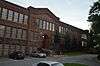
Highland School |
|
November 1, 2006
(#06000959) |
978 North Ave., NE.
33°46′22″N 84°21′19″W / 33.772778°N 84.355278°W / 33.772778; -84.355278 (Highland School) |
Atlanta |
|
| 104 |
Home Park School |
|
July 26, 1989
(#89000851) |
1031 State St., NW.
33°46′58″N 84°23′54″W / 33.782778°N 84.398333°W / 33.782778; -84.398333 (Home Park School) |
Atlanta |
|
| 105 |
Hotel Row Historic District |
|
July 20, 1989
(#89000802) |
205–235 Mitchell St.
33°45′08″N 84°23′43″W / 33.752222°N 84.395278°W / 33.752222; -84.395278 (Hotel Row Historic District) |
Atlanta |
|
| 106 |
Howell Interlocking Historic District |
|
July 25, 2003
(#03000676) |
Roughly centered on Howell Interlocking at Marietta, W. Marietta Sts., Howell Mill Rd. and Lowery Boulevard
33°47′03″N 84°24′51″W / 33.784167°N 84.414167°W / 33.784167; -84.414167 (Howell Interlocking Historic District) |
Atlanta |
|
| 107 |
Howell Station Historic District |
|
April 17, 1997
(#97000352) |
Roughly bounded by W. Marietta, Rice, Baylor, and Herndon Sts., Niles Cir., and Longley Ave.
33°47′06″N 84°25′11″W / 33.785°N 84.419722°W / 33.785; -84.419722 (Howell Station Historic District) |
Atlanta |
|
| 108 |
Mrs. George Arthur Howell, Jr., House |
|
January 11, 1991
(#90002101) |
400 W. Paces Ferry Rd. NW.
33°50′38″N 84°23′52″W / 33.844026°N 84.397780°W / 33.844026; -84.397780 (Mrs. George Arthur Howell, Jr., House) |
Atlanta |
|
| 109 |
Hurt Building |
|
April 13, 1977
(#77000431) |
45 Edgewood Ave., NE.
33°45′15″N 84°23′13″W / 33.754167°N 84.386944°W / 33.754167; -84.386944 (Hurt Building) |
Atlanta |
|
| 110 |
Imperial Hotel |
|
March 31, 1983
(#83000229) |
355 Peachtree St.
33°45′50″N 84°23′08″W / 33.763889°N 84.385556°W / 33.763889; -84.385556 (Imperial Hotel) |
Atlanta |
|
| 111 |
Inman Park Historic District |
|
July 23, 1973
(#73000621) |
Roughly bounded by I-485, DeKalb and Lake Aves.; also roughly bounded by Lake, Hurt, and DeKalb Aves. and Krog St.
33°45′20″N 84°21′34″W / 33.755556°N 84.359444°W / 33.755556; -84.359444 (Inman Park Historic District) |
Atlanta |
Second set of boundaries represents a boundary increase of September 16, 2001 |
| 112 |
Inman Park-Moreland Historic District |
|
June 5, 1986
(#86001209) |
Roughly bounded by N. Highland, Seminole and Euclid, DeKalb, and Degress and Nashita Aves.; also roughly bounded by Cleburne, Moreland and DeKalb Aves., Battery Place, and a city park
33°45′50″N 84°21′07″W / 33.763889°N 84.351944°W / 33.763889; -84.351944 (Inman Park-Moreland Historic District) |
Atlanta |
Extends into DeKalb County. Second set of boundaries represents a boundary increase of October 13, 2003 |
| 113 |
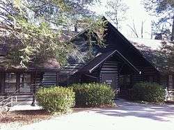
Island Ford Lodge |
|
November 4, 2016
(#16000747) |
1978 Island Ford Parkway
33°59′14″N 84°19′31″W / 33.987172°N 84.325333°W / 33.987172; -84.325333 (Island Ford Lodge) |
Sandy Springs |
In the Chattahoochee River National Recreation Area. |
| 114 |
King Plow Company |
|
March 28, 1996
(#96000337) |
887 W. Marietta St.
33°46′53″N 84°24′58″W / 33.781389°N 84.416111°W / 33.781389; -84.416111 (King Plow Company) |
Atlanta |
|
| 115 |
Martin Luther King, Jr., Historic District |
|
May 2, 1974
(#74000677) |
Bounded roughly by Irwin, Randolph, Edgewood, Jackson, and Auburn Aves.; also roughly bounded by Freedom Parkway, John Wesley Dobbs Ave., Decatur St., the former Southern railroad tracks, and Interstates 75/85
33°45′18″N 84°22′20″W / 33.755°N 84.372222°W / 33.755; -84.372222 (Martin Luther King, Jr., Historic District) |
Atlanta |
Second set of boundaries represents a boundary increase of June 12, 2001, is a National Historic Landmark |
| 116 |
Martin Luther King, Jr., National Historic Site and Preservation District |
|
October 10, 1980
(#80000435) |
Roughly bounded by Courtland, Randolph, Chamberlain Sts. and Irwin Ave.
33°45′18″N 84°22′20″W / 33.755°N 84.372222°W / 33.755; -84.372222 (Martin Luther King, Jr., National Historic Site and Preservation District) |
Atlanta |
|
| 117 |
William and Ruth Knight Lustron House |
|
March 18, 1996
(#96000208) |
9166 Northside Dr.
33°49′06″N 84°24′28″W / 33.818333°N 84.407778°W / 33.818333; -84.407778 (William and Ruth Knight Lustron House) |
Atlanta |
A Lustron house |
| 118 |
Knox Apartments, Cauthorn House and Peachtree Road Apartments Historic District |
|
March 19, 1998
(#98000248) |
2214–2230 Peachtree Rd.
33°48′54″N 84°23′31″W / 33.815°N 84.391944°W / 33.815; -84.391944 (Knox Apartments, Cauthorn House and Peachtree Road Apartments Historic District) |
Atlanta |
|
| 119 |
Victor H. Kriegshaber House |
|
January 8, 1979
(#79000723) |
292 Moreland Ave., NE.
33°45′44″N 84°20′58″W / 33.762222°N 84.349444°W / 33.762222; -84.349444 (Victor H. Kriegshaber House) |
Atlanta |
|
| 120 |
Lakewood Heights Historic District |
|
July 5, 2002
(#02000712) |
Junction of Jonesboro Rd. and Lakewood Ave.
33°42′23″N 84°22′53″W / 33.706389°N 84.381389°W / 33.706389; -84.381389 (Lakewood Heights Historic District) |
Atlanta |
|
| 121 |
Lindridge-Martin Manor Historic District |
|
July 14, 2015
(#15000412) |
Roughly bounded by Armand Rd., NE., Lindridge, Melante, & Cardova Drs., NE., Armand Ct., NE.
33°49′07″N 84°21′22″W / 33.8187°N 84.356°W / 33.8187; -84.356 (Lindridge-Martin Manor Historic District) |
Atlanta |
|
| 122 |
Crawford W. Long Memorial Hospital |
|
September 1, 1988
(#88001465) |
35 Linden Ave., NE.
33°46′10″N 84°23′09″W / 33.769444°N 84.385833°W / 33.769444; -84.385833 (Crawford W. Long Memorial Hospital) |
Atlanta |
Davis-Fischer Sanitarium (Crawford Long Hospital) designed by Atlanta architect Eugene C. Wachendorff in 1911. |
| 123 |
Means Street Historic District |
|
June 14, 2001
(#01000648) |
Bounded by Marietta St., Bankhead and Ponders Aves., and the Southern rail liNE.
33°46′22″N 84°24′18″W / 33.772778°N 84.405°W / 33.772778; -84.405 (Means Street Historic District) |
Atlanta |
|
| 124 |
Medical Arts Building |
|
December 6, 2016
(#16000816) |
384 Peachtree St. NE.
33°45′54″N 84°23′09″W / 33.764880°N 84.385718°W / 33.764880; -84.385718 (Medical Arts Building) |
Atlanta |
|
| 125 |
Memorial to the Six Million |
|
April 21, 2008
(#08000351) |
1173 Cascade Ave. SW.
33°43′26″N 84°26′57″W / 33.723994°N 84.449103°W / 33.723994; -84.449103 (Memorial to the Six Million) |
Atlanta |
|
| 126 |
Midtown Historic District |
|
February 12, 1999
(#99000161) |
Roughly bounded by 10th St., Ponce de Leon Ave., Piedmont Ave., and Lakeview Ave.
33°46′40″N 84°22′28″W / 33.777778°N 84.374444°W / 33.777778; -84.374444 (Midtown Historic District) |
Atlanta |
|
| 127 |
Mozley Park Historic District |
|
August 11, 1995
(#95000909) |
Roughly bounded by Westview Dr., West Lake Ave., Seaboard Coast Line RR tracks and M. L. King and Rockmart Dr.
33°45′04″N 84°26′14″W / 33.751111°N 84.437222°W / 33.751111; -84.437222 (Mozley Park Historic District) |
Atlanta |
|
| 128 |
National NuGrape Company |
|
December 20, 1996
(#96001502) |
794 Ralph McGill Boulevard
33°46′09″N 84°21′42″W / 33.769167°N 84.361667°W / 33.769167; -84.361667 (National NuGrape Company) |
Atlanta |
|
| 129 |
New Hope African Methodist Episcopal Church and Cemetery |
|
January 9, 2009
(#08001281) |
3012 Arden Rd., NW.
33°50′15″N 84°24′14″W / 33.837586°N 84.40395°W / 33.837586; -84.40395 (New Hope African Methodist Episcopal Church and Cemetery) |
Atlanta |
|
| 130 |
Newtown Elementary School |
|
August 30, 2006
(#06000739) |
3115 Old Alabama Rd.
34°01′14″N 84°16′08″W / 34.020556°N 84.268889°W / 34.020556; -84.268889 (Newtown Elementary School) |
Alpharetta |
|
| 131 |
William P. Nicolson House |
|
March 25, 1977
(#77000432) |
821 Piedmont Ave.
33°46′36″N 84°22′52″W / 33.776667°N 84.381111°W / 33.776667; -84.381111 (William P. Nicolson House) |
Atlanta |
|
| 132 |
North Avenue Presbyterian Church |
|
November 17, 1978
(#78000984) |
607 Peachtree Ave., NE.
33°46′16″N 84°23′04″W / 33.771111°N 84.384444°W / 33.771111; -84.384444 (North Avenue Presbyterian Church) |
Atlanta |
Designed by Bruce & Morgan. Built 1900. |
| 133 |
Oakland Cemetery |
|
April 28, 1976
(#76000627) |
248 Oakland Ave., SE.
33°44′55″N 84°22′17″W / 33.748611°N 84.371389°W / 33.748611; -84.371389 (Oakland Cemetery) |
Atlanta |
|
| 134 |
Oakland City Historic District |
|
April 11, 2003
(#03000198) |
Bounded by Donnelly St., Lee St., Campbellton Rd., and Ingram Rd., Cascade Ave., Westmont Rd., and Epworth Rd.
33°43′41″N 84°25′40″W / 33.728056°N 84.427778°W / 33.728056; -84.427778 (Oakland City Historic District) |
Atlanta |
|
| 135 |
Odd Fellows Building and Auditorium |
|
May 2, 1975
(#75000594) |
228–250 Auburn Ave., NE.
33°45′20″N 84°22′46″W / 33.755556°N 84.379444°W / 33.755556; -84.379444 (Odd Fellows Building and Auditorium) |
Atlanta |
|
| 136 |
Omega Chapter of the Chi Phi Fraternity |
|
June 17, 1982
(#82002419) |
720 Fowler St., NW.
33°46′27″N 84°23′38″W / 33.774167°N 84.393889°W / 33.774167; -84.393889 (Omega Chapter of the Chi Phi Fraternity) |
Atlanta |
|
| 137 |
J. K. Orr Shoe Company |
|
September 29, 1995
(#95001135) |
16 William Holmes Borders, Sr. Ave.
33°45′14″N 84°22′29″W / 33.753889°N 84.374722°W / 33.753889; -84.374722 (J. K. Orr Shoe Company) |
Atlanta |
|
| 138 |
Palmer House and Phelan House Apartments |
|
October 27, 2004
(#04001182) |
952 Peachtree St. and 81 and 93 Peachtree Place
33°46′56″N 84°23′04″W / 33.782222°N 84.384444°W / 33.782222; -84.384444 (Palmer House and Phelan House Apartments) |
Atlanta |
|
| 139 |
Park Street Methodist Episcopal Church, South |
|
May 9, 1997
(#97000405) |
793 Park St., SW.
33°44′38″N 84°24′49″W / 33.743889°N 84.413611°W / 33.743889; -84.413611 (Park Street Methodist Episcopal Church, South) |
Atlanta |
|
| 140 |
Peachtree Center Historic District |
|
March 19, 2018
(#100002207) |
Roughly bounded by Andrew Young International Blvd, Peachtree Center Ave, Courtland St., Baker St, and Williams St.
33°45′40″N 84°23′15″W / 33.761010°N 84.387632°W / 33.761010; -84.387632 (Peachtree Center Historic District) |
Atlanta |
|
| 141 |
Peachtree Christian Church |
|
May 17, 1984
(#84001082) |
1580 Peachtree St. NW.
33°47′48″N 84°23′22″W / 33.796667°N 84.389444°W / 33.796667; -84.389444 (Peachtree Christian Church) |
Atlanta |
|
| 142 |
Peachtree Heights Park |
|
December 8, 1980
(#80004457) |
Peachtree, Habersham, and Wesley Rds., Andrews Dr., and Peachtree Battle Ave.
33°49′34″N 84°23′34″W / 33.826111°N 84.392778°W / 33.826111; -84.392778 (Peachtree Heights Park) |
Atlanta |
|
| 143 |
Peachtree Highlands Historic District |
|
June 5, 1986
(#86001252) |
Roughly bounded by Highland Dr., Martina Dr., E. Pace Ferry, and Piedmont Rds.
33°50′32″N 84°22′02″W / 33.842222°N 84.367222°W / 33.842222; -84.367222 (Peachtree Highlands Historic District) |
Atlanta |
Superseded in 2008 by the larger Peachtree Highlands-Peachtree Park Historic District |
| 144 |
Peachtree Highlands-Peachtree Park Historic District |
|
April 25, 2008
(#08000325) |
Roughly bounded by Piedmont & Peachtree Rds., GA 400 & MARTA N-S line.
33°50′08″N 84°21′50″W / 33.835472°N 84.363992°W / 33.835472; -84.363992 (Peachtree Highlands-Peachtree Park Historic District) |
Atlanta |
|
| 145 |
Peachtree Southern Railway Station |
|
September 14, 1976
(#76000628) |
1688 Peachtree St., NW.
33°47′58″N 84°23′34″W / 33.79938°N 84.39275°W / 33.79938; -84.39275 (Peachtree Southern Railway Station) |
Atlanta |
Southern Railway's 1918 facility, named Peachtree Station but known locally as Brookwood Station, has been Atlanta's only long-distance passenger rail stop since 1970. Amtrak took over Southern's Crescent route in the '70s, which (as of 2015) continues to operate between New Orleans and N.Y. City. |
| 146 |
Edward C. Peters House |
|
January 20, 1972
(#72000384) |
179 Ponce de Leon Ave.
33°46′51″N 84°22′50″W / 33.780833°N 84.380556°W / 33.780833; -84.380556 (Edward C. Peters House) |
Atlanta |
A Queen Anne style house |
| 147 |
Piedmont Park |
|
May 13, 1976
(#76000629) |
Bounded by 10th St., Southern Rwy. and Piedmont Rd.
33°47′17″N 84°22′27″W / 33.788056°N 84.374167°W / 33.788056; -84.374167 (Piedmont Park) |
Atlanta |
|
| 148 |
Piedmont Park Apartments |
|
October 28, 2003
(#03001104) |
266 11th St.
33°46′58″N 84°22′43″W / 33.782739°N 84.378611°W / 33.782739; -84.378611 (Piedmont Park Apartments) |
Atlanta |
Designed by Leila Ross Wilburn |
| 149 |
Thomas H. Pitts House and Dairy |
|
June 27, 1979
(#79000724) |
3105 Cascade Rd., SW.
33°43′16″N 84°29′22″W / 33.721111°N 84.489444°W / 33.721111; -84.489444 (Thomas H. Pitts House and Dairy) |
Atlanta |
|
| 150 |
Pittsburgh Historic District |
|
June 14, 2006
(#06000503) |
Roughly bordered by Shelton Ave. Stewart Ave., University Ave., and the RR
33°43′44″N 84°24′07″W / 33.728889°N 84.401944°W / 33.728889; -84.401944 (Pittsburgh Historic District) |
Atlanta |
|
| 151 |
William G. Raoul House |
|
December 15, 1986
(#86003298) |
848 Peachtree St.
33°46′40″N 84°23′06″W / 33.777778°N 84.385°W / 33.777778; -84.385 (William G. Raoul House) |
Atlanta |
|
| 152 |
Retail Credit Company Home Office Building |
|
January 8, 1980
(#80001076) |
90 Fairlie St., SW.
33°45′25″N 84°23′24″W / 33.756944°N 84.39°W / 33.756944; -84.39 (Retail Credit Company Home Office Building) |
Atlanta |
|
| 153 |
Reynoldstown Historic District |
|
April 3, 2003
(#02001405) |
Roughly bounded by the CSX rail line, Memorial Dr., Pearl St., and Moreland
33°45′07″N 84°21′16″W / 33.751944°N 84.354444°W / 33.751944; -84.354444 (Reynoldstown Historic District) |
Atlanta |
|
| 154 |
Rhodes Memorial Hall |
|
March 1, 1974
(#74000678) |
1516 Peachtree St.
33°47′45″N 84°23′18″W / 33.795833°N 84.388333°W / 33.795833; -84.388333 (Rhodes Memorial Hall) |
Atlanta |
|
| 155 |
Rhodes-Haverty Building |
|
January 19, 1979
(#79000725) |
134 Peachtree St., NW.
33°45′26″N 84°23′17″W / 33.757222°N 84.388056°W / 33.757222; -84.388056 (Rhodes-Haverty Building) |
Atlanta |
Architects: Pringle and Smith (1929) |
| 156 |
Isaac Roberts House |
|
April 10, 2008
(#08000262) |
9725 Roberts Dr.
34°00′12″N 84°20′55″W / 34.0032°N 84.3486°W / 34.0032; -84.3486 (Isaac Roberts House) |
Sandy Springs |
[5] |
| 157 |
Rock Spring Presbyterian Church |
|
May 24, 1990
(#90000804) |
1824 Piedmont Ave. NE.
33°48′17″N 84°22′05″W / 33.804722°N 84.368056°W / 33.804722; -84.368056 (Rock Spring Presbyterian Church) |
Atlanta |
|
| 158 |
Roscoe-Dunaway Gardens Historic District |
|
December 6, 1996
(#96001414) |
Roughly bounded by the Chattahoochee R., Cedar Cr., Hood Branch, and White Oak Cr.
33°29′54″N 84°50′00″W / 33.498333°N 84.833333°W / 33.498333; -84.833333 (Roscoe-Dunaway Gardens Historic District) |
Roscoe |
|
| 159 |
Rufus M. Rose House |
|
September 20, 1977
(#77000433) |
537 Peachtree St.
33°46′08″N 84°23′05″W / 33.768889°N 84.384722°W / 33.768889; -84.384722 (Rufus M. Rose House) |
Atlanta |
Designed by architect Emil Charles Seiz. Built in 1901. Late Victorian/simplified Queen-Anne. Rare 19th-century town house of the affluent. Tiny yard is singular survivor from Peachtree Road's residential heyday. |
| 160 |
Roswell Historic District |
|
May 2, 1974
(#74000682) |
Roughly bounded by Big Creek, King and Dam Sts., SW along New Marietta Hwy.
34°00′54″N 84°21′42″W / 34.015°N 84.361667°W / 34.015; -84.361667 (Roswell Historic District) |
Roswell |
|
| 161 |
Simeon and Jane Rucker Log House |
|
April 18, 1997
(#97000353) |
755 Old Rucker Rd.
34°04′43″N 84°20′23″W / 34.078611°N 84.339722°W / 34.078611; -84.339722 (Simeon and Jane Rucker Log House) |
Alpharetta |
|
| 162 |
St. Andrews Apartments |
|
June 13, 1986
(#86001260) |
1041 W. Peachtree St.
33°47′04″N 84°23′14″W / 33.784444°N 84.387222°W / 33.784444; -84.387222 (St. Andrews Apartments) |
Atlanta |
|
| 163 |
St. Mark Methodist Church |
|
November 2, 1987
(#87001911) |
781 Peachtree St.
33°46′37″N 84°23′02″W / 33.776944°N 84.383889°W / 33.776944; -84.383889 (St. Mark Methodist Church) |
Atlanta |
Architect: Willis Franklin Denny. Built 1902-1903. |
| 164 |
Sardis Methodist Church and Cemetery |
|
October 9, 2012
(#12000840) |
3725 Powers Ferry Road
33°51′27″N 84°23′01″W / 33.857498°N 84.383647°W / 33.857498; -84.383647 (Sardis Methodist Church and Cemetery) |
Atlanta |
|
| 165 |
Charles E. Sciple House |
|
March 1, 1984
(#84001084) |
1112 Peachtree St.
33°47′06″N 84°23′00″W / 33.785°N 84.383333°W / 33.785; -84.383333 (Charles E. Sciple House) |
Atlanta |
|
| 166 |
Sears, Roebuck and Co. Mail-Order Warehouse and Retail Store |
|
November 15, 2016
(#16000769) |
675 Ponce de Leon Ave., NE.
33°46′23″N 84°21′58″W / 33.773146°N 84.365995°W / 33.773146; -84.365995 (Sears, Roebuck and Co. Mail-Order Warehouse and Retail Store) |
Atlanta |
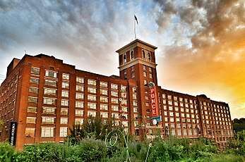
Now Ponce City Market |
| 167 |
Selig Company Building |
|
February 22, 1996
(#96000158) |
330-346 Marietta St.
33°45′43″N 84°23′49″W / 33.761944°N 84.396944°W / 33.761944; -84.396944 (Selig Company Building) |
Atlanta |
|
| 168 |
Shrine of the Immaculate Conception |
|
December 12, 1976
(#76000630) |
48 Hunter St., SW.
33°45′01″N 84°23′22″W / 33.750278°N 84.389444°W / 33.750278; -84.389444 (Shrine of the Immaculate Conception) |
Atlanta |
|
| 169 |
Archibald Smith House |
|
August 30, 2006
(#06000740) |
935 Alpharetta St.
34°01′26″N 84°21′36″W / 34.023889°N 84.36°W / 34.023889; -84.36 (Archibald Smith House) |
Roswell |
|
| 170 |
Tullie Smith House |
|
November 20, 1970
(#70000204) |
3099 Andrews Dr., NW.
33°50′26″N 84°23′08″W / 33.840556°N 84.385556°W / 33.840556; -84.385556 (Tullie Smith House) |
Atlanta |
|
| 171 |
Southern Bell Telephone Company Building |
|
December 1, 1978
(#78000985) |
51 Ivy St., NE.
33°45′20″N 84°23′08″W / 33.755556°N 84.385556°W / 33.755556; -84.385556 (Southern Bell Telephone Company Building) |
Atlanta |
|
| 172 |
Southern Belting Company Building |
|
August 10, 1988
(#88001174) |
236 Forsyth St., SW.
33°44′53″N 84°23′48″W / 33.748056°N 84.396667°W / 33.748056; -84.396667 (Southern Belting Company Building) |
Atlanta |
|
| 173 |
Southern Dairies |
|
August 21, 2002
(#02000872) |
593 Glen Iris Dr.
33°46′21″N 84°22′03″W / 33.7725°N 84.3675°W / 33.7725; -84.3675 (Southern Dairies) |
Atlanta |
|
| 174 |
Southern Railway North Avenue Yards Historic District |
|
July 16, 2002
(#02000539) |
539 John St. NW.
33°46′09″N 84°24′00″W / 33.769167°N 84.4°W / 33.769167; -84.4 (Southern Railway North Avenue Yards Historic District) |
Atlanta |
|
| 175 |
Southern Spring Bed Company |
|
March 1, 2007
(#07000088) |
300 Martin Luther King, Jr., Dr.
33°44′57″N 84°22′33″W / 33.749167°N 84.375833°W / 33.749167; -84.375833 (Southern Spring Bed Company) |
Atlanta |
|
| 176 |
Spotswood Hall |
|
February 5, 2002
(#01001556) |
555 Argonne Dr., NW.
33°50′13″N 84°24′19″W / 33.836944°N 84.405278°W / 33.836944; -84.405278 (Spotswood Hall) |
Atlanta |
|
| 177 |
Staff Row and Old Post Area-Fort McPherson |
|
November 5, 1974
(#74000679) |
NE corner of Fort McPherson; also 1777 Hardee Avenue
33°42′40″N 84°25′50″W / 33.711111°N 84.430556°W / 33.711111; -84.430556 (Staff Row and Old Post Area-Fort McPherson) |
Atlanta |
Second set of boundaries represents a boundary increase of September 6, 2013 |
| 178 |
Stewart Avenue Methodist Episcopal Church South |
|
March 2, 1989
(#89000154) |
867 Stewart Ave., SW.
33°43′52″N 84°24′30″W / 33.731111°N 84.408333°W / 33.731111; -84.408333 (Stewart Avenue Methodist Episcopal Church South) |
Atlanta |
|
| 179 |
Stone Hall, Atlanta University |
|
December 2, 1974
(#74000680) |
Morris-Brown College campus
33°45′16″N 84°24′31″W / 33.75444°N 84.40861°W / 33.75444; -84.40861 (Stone Hall, Atlanta University) |
Atlanta |
National Historic Landmark |
| 180 |
Swan House |
|
September 13, 1977
(#77000434) |
3099 Andrews Dr., NW.
33°50′25″N 84°23′17″W / 33.840278°N 84.388056°W / 33.840278; -84.388056 (Swan House) |
Atlanta |
|
| 181 |
Sweet Auburn Historic District |
|
December 8, 1976
(#76000631) |
Auburn Ave.
33°45′14″N 84°22′52″W / 33.753889°N 84.381111°W / 33.753889; -84.381111 (Sweet Auburn Historic District) |
Atlanta |
National Historic Landmark |
| 182 |
Techwood Homes Historic District |
|
June 29, 1976
(#76000632) |
Roughly bounded by North Ave., Parker, Williams, and Lovejoy Sts.
33°46′04″N 84°23′30″W / 33.767778°N 84.391667°W / 33.767778; -84.391667 (Techwood Homes Historic District) |
Atlanta |
|
| 183 |
The Temple |
|
September 9, 1982
(#82002420) |
1589 Peachtree St.
33°47′52″N 84°23′21″W / 33.797778°N 84.389167°W / 33.797778; -84.389167 (The Temple) |
Atlanta |
|
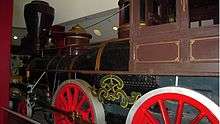
| 184 |
The Texas |
|
June 19, 1973
(#73002234) |
Cyclorama Bldg., Grant Park
33°44′02″N 84°22′15″W / 33.733889°N 84.370833°W / 33.733889; -84.370833 (The Texas) |
Atlanta |
Steam locomotive that chased in the Great Locomotive Chase |
| 185 |
Albert E. Thornton House |
|
December 8, 1980
(#80004458) |
105 W. Paces Ferry Rd.
33°50′41″N 84°23′27″W / 33.844722°N 84.390833°W / 33.844722; -84.390833 (Albert E. Thornton House) |
Atlanta |
|
| 186 |
Thorton Building |
|
February 23, 1984
(#84001107) |
10 Pryor St. (10 Park Place South)
33°45′15″N 84°23′19″W / 33.754167°N 84.388611°W / 33.754167; -84.388611 (Thorton Building) |
Atlanta |
|
| 187 |
Henry B. Tompkins House |
|
December 12, 1976
(#76000633) |
125 W. Wesley Rd., NW.
33°49′44″N 84°23′29″W / 33.828889°N 84.391389°W / 33.828889; -84.391389 (Henry B. Tompkins House) |
Atlanta |
|
| 188 |
Trio Steam Laundry |
|
September 18, 1997
(#97001122) |
19 Hilliard St.
33°41′32″N 84°22′46″W / 33.692222°N 84.379444°W / 33.692222; -84.379444 (Trio Steam Laundry) |
Atlanta |
|
| 189 |
Troy Peerless Laundry Building |
|
September 9, 1999
(#99001100) |
650 Glen Iris Dr.
33°46′32″N 84°22′05″W / 33.775556°N 84.368056°W / 33.775556; -84.368056 (Troy Peerless Laundry Building) |
Atlanta |
|
| 190 |
Trust Company of Georgia Northeast Freeway Branch |
|
February 20, 2018
(#100002093) |
2160 Monroe Dr. NE
33°48′39″N 84°22′12″W / 33.810801°N 84.369978°W / 33.810801; -84.369978 (Trust Company of Georgia Northeast Freeway Branch) |
Atlanta |
Built in 1962[6] |
| 191 |
Trygveson |
|
December 8, 1980
(#80004241) |
3418 Pinestream Rd., NW.
33°50′54″N 84°25′21″W / 33.848333°N 84.4225°W / 33.848333; -84.4225 (Trygveson) |
Atlanta |
|
| 192 |
Mary Elizabeth Tyler House |
|
January 30, 2006
(#05001598) |
2887 Howell Mill Rd.
33°50′02″N 84°25′03″W / 33.833889°N 84.4175°W / 33.833889; -84.4175 (Mary Elizabeth Tyler House) |
Atlanta |
|
| 193 |
Tyree Building |
|
July 15, 1982
(#82002421) |
679 Durant Pl., NE.
33°46′23″N 84°22′31″W / 33.773056°N 84.375278°W / 33.773056; -84.375278 (Tyree Building) |
Atlanta |
|
| 194 |
U.S. Post Office and Courthouse |
|
May 2, 1974
(#74000681) |
76 Forsyth St.
33°45′23″N 84°23′25″W / 33.75644°N 84.39027°W / 33.75644; -84.39027 (U.S. Post Office and Courthouse) |
Atlanta |
Many key cases from the civil rights movement first heard here, is a National Historic Landmark |
| 195 |
Underground Atlanta Historic District |
|
July 24, 1980
(#80001077) |
Roughly bounded by Martin Luther King, Jr., Dr., Central Ave., Wall and Peachtree Sts.
33°45′07″N 84°23′21″W / 33.751944°N 84.389167°W / 33.751944; -84.389167 (Underground Atlanta Historic District) |
Atlanta |
|
| 196 |
United States Post Office, Federal Annex |
|
February 10, 2006
(#04001217) |
77 Forsyth St.
33°45′16″N 84°23′40″W / 33.754444°N 84.394444°W / 33.754444; -84.394444 (United States Post Office, Federal Annex) |
Atlanta |
|
| 197 |
Utoy Cemetery |
|
February 23, 2015
(#15000025) |
1465 Cahaba Dr.
33°42′57″N 84°26′59″W / 33.7158°N 84.4498°W / 33.7158; -84.4498 (Utoy Cemetery) |
Atlanta |
|
| 198 |
E. Van Winkle Gin and Machine Works |
|
September 10, 1979
(#79000726) |
Foster St.
33°47′08″N 84°24′59″W / 33.785556°N 84.416389°W / 33.785556; -84.416389 (E. Van Winkle Gin and Machine Works) |
Atlanta |
Goat Farm Arts Center |
| 199 |
Villa Lamar |
|
June 8, 1988
(#88001152) |
801 West Paces Ferry Rd.
33°51′01″N 84°24′47″W / 33.850278°N 84.413056°W / 33.850278; -84.413056 (Villa Lamar) |
Atlanta |
|
| 200 |
Virginia-Highland Historic District |
|
May 10, 2005
(#05000402) |
Roughly bounded by Amsterdam Ave., Rosedale Rd., Ponce de Leon Ave., and the Norfolk Southern Railroad
33°46′59″N 84°21′25″W / 33.783056°N 84.356944°W / 33.783056; -84.356944 (Virginia-Highland Historic District) |
Atlanta |
|
| 201 |
Anne Wallace Branch-Carnegie Library of Atlanta |
|
December 4, 2003
(#03001223) |
523 Luckie St. NW.
33°46′14″N 84°23′46″W / 33.770556°N 84.396111°W / 33.770556; -84.396111 (Anne Wallace Branch-Carnegie Library of Atlanta) |
Atlanta |
|
| 202 |
Washington Park Historic District |
|
February 28, 2000
(#00000071) |
Junction of Martin Luther King, Jr. Dr. and Ashby St.
33°45′36″N 84°25′16″W / 33.76°N 84.421111°W / 33.76; -84.421111 (Washington Park Historic District) |
Atlanta |
|
| 203 |
Booker T. Washington High School |
|
March 18, 1986
(#86000437) |
45 Whitehouse Dr. SW.
33°45′12″N 84°25′18″W / 33.753333°N 84.421667°W / 33.753333; -84.421667 (Booker T. Washington High School) |
Atlanta |
|
| 204 |
West End Historic District |
|
February 25, 1999
(#97000621) |
Roughly Bounded by US 20, Lee, White, and Langhorn Sts.
33°44′16″N 84°25′23″W / 33.737778°N 84.423056°W / 33.737778; -84.423056 (West End Historic District) |
Atlanta |
|
| 205 |
Western and Atlantic Railroad Zero Milepost |
|
September 19, 1977
(#77000435) |
Central Ave. between Wall St. and Railroad Ave.
33°45′08″N 84°23′19″W / 33.752222°N 84.388611°W / 33.752222; -84.388611 (Western and Atlantic Railroad Zero Milepost) |
Atlanta |
|
| 206 |
Western Electric Company Building |
|
November 8, 2000
(#00001329) |
820 Ralph McGill Boulevard
33°46′11″N 84°21′40″W / 33.769722°N 84.361111°W / 33.769722; -84.361111 (Western Electric Company Building) |
Atlanta |
|
| 207 |
Westinghouse Electric Company Building |
|
February 9, 2001
(#01000080) |
426 Marietta St., NW.
33°46′00″N 84°23′52″W / 33.766667°N 84.397778°W / 33.766667; -84.397778 (Westinghouse Electric Company Building) |
Atlanta |
|
| 208 |
Whittier Mills Historic District |
|
September 13, 2001
(#01000972) |
Roughly the junction of Bolton Rd. and Parrot Ave., approximately 7 miles (11 km) northwest of the central business district of Atlanta
33°48′42″N 84°29′01″W / 33.811667°N 84.483611°W / 33.811667; -84.483611 (Whittier Mills Historic District) |
Atlanta |
|
| 209 |
Judge William Wilson House |
|
February 15, 1980
(#80001078) |
501 Fairburn Rd., SW.
33°44′46″N 84°30′41″W / 33.746111°N 84.511389°W / 33.746111; -84.511389 (Judge William Wilson House) |
Atlanta |
|
| 210 |
Winecoff Hotel |
|
March 31, 2009
(#09000185) |
179 Peachtree Street, NW.
33°49′29″N 84°23′16″W / 33.824861°N 84.387778°W / 33.824861; -84.387778 (Winecoff Hotel) |
Atlanta |
|
| 211 |
George, Jr., and Emily Winship House |
|
May 10, 2005
(#05000404) |
2626 Brookwood Dr., NE.
33°49′40″N 84°22′53″W / 33.827778°N 84.381389°W / 33.827778; -84.381389 (George, Jr., and Emily Winship House) |
Atlanta |
|
| 212 |
Stuart Witham House |
|
December 22, 1978
(#78000986) |
2922 Andrews Dr., NW.
33°50′06″N 84°23′35″W / 33.835°N 84.393056°W / 33.835; -84.393056 (Stuart Witham House) |
Atlanta |
|
| 213 |
Wynne--Claughton Building |
|
March 26, 2012
(#12000148) |
141 Carnegie Way, NW.
33°45′30″N 84°23′18″W / 33.758224°N 84.388215°W / 33.758224; -84.388215 (Wynne--Claughton Building) |
Atlanta |
|
| 214 |
Yonge Street School |
|
January 24, 1980
(#80001079) |
89 Yonge St.
33°45′06″N 84°22′31″W / 33.751667°N 84.375278°W / 33.751667; -84.375278 (Yonge Street School) |
Atlanta |
|
.JPG)
.jpg)
.jpg)
%2C_Boulevard%2C_Pearl_Street%2C_Memorial_Drive%2C_%26_Railroa%2C_Atlanta_(Fulton_County%2C_Georgia).jpg)
.jpg)
_now_the_J._Mack_Robinson_College_of_Business_Administration_Building.jpeg)
.jpg)
.jpg)
_Atlanta_Georgia.JPG)
.jpg)
.jpg)
.jpg)

.jpg)