Acacia Ridge, Queensland
| Acacia Ridge Brisbane, Queensland | |||||||||||||||
|---|---|---|---|---|---|---|---|---|---|---|---|---|---|---|---|
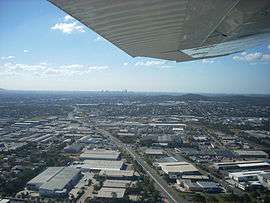 Warehouses in industrial areas of the suburb | |||||||||||||||
 Acacia Ridge | |||||||||||||||
| Coordinates | 27°35′S 153°2′E / 27.583°S 153.033°ECoordinates: 27°35′S 153°2′E / 27.583°S 153.033°E | ||||||||||||||
| Population | 7,429 (2016 census)[1] | ||||||||||||||
| Postcode(s) | 4110 | ||||||||||||||
| Location | 15 km (9 mi) from Brisbane GPO | ||||||||||||||
| LGA(s) |
City of Brisbane (Moorooka Ward)[2] | ||||||||||||||
| State electorate(s) | |||||||||||||||
| Federal Division(s) | Moreton | ||||||||||||||
| |||||||||||||||
Acacia Ridge is a suburb of the City of Brisbane, Queensland, Australia. Acacia Ridge is 15 kilometres (9 mi) south of the central business district. It is within the local government area of City of Brisbane.[3]
Primarily residential, Acacia Ridge is also known for its heavy industrial area in the suburb's east, occupying much of the suburb's area east of Beaudesert Road. Acacia Ridge is home to one of Brisbane's few ice skating rinks.
History
The name Acacia Ridge derives from the number of Acacia species growing in the area.[3] The suburb was established after the Second World War to house returning servicemen and their families. Many of the original post-war dwellings still stand today.
Demographics
In the 2011 census, Acacia Ridge recorded a population of 6,945 people, 50.1% female and 49.9% male.[4] The median age of the Acacia Ridge population was 34 years, 3 years below the national median of 37. 61.6% of people living in Acacia Ridge were born in Australia, compared to the national average of 69.8%; the next most common countries of birth were New Zealand 3.8%, England 2.9%, India 2%, Philippines 1.5%, Vietnam 1.2%. 67.8% spoke only English at home; the next most popular languages were 2% Vietnamese, 2% Arabic, 1.5% Spanish, 1.3% Bosnian, 1.2% Samoan.[4]
Industry
From 1966 until the mid-1980s, Acacia Ridge accommodated one of Holden's main vehicle manufacturing plants, which produced both full-sized and smaller models including the Holden Gemini. When local production of the Gemini ceased in October 1984, the manufacturing plant closed down.[5] The manufacturer remained, retaining a small area of the site for its regional headquarters until the early 2000s, when it relocated to Murarrie. Since closure of the plant, Woolworths occupied the area, utilising its space as a regional distribution centre until recently, when an independent retail grocery chain resumed the site for similar purposes.
On the opposite side of Beaudesert Road from the former manufacturing plant, Toyota has based its southern Queensland regional headquarters. This site is primarily used for managerial and distribution related duties, as opposed to vehicle production.
Transport
Acacia Ridge is home to one of Queensland's largest railway freight yards, dealing with interstate freight and the break-of-gauge from 1,067 mm (3 ft 6 in) to 1,435 mm (4 ft 8 1⁄2 in). In 2008, the Beaudesert Road level crossing was replaced by an overbridge, so that the sidings in the yard could be extended for the shunting of longer 1500m trains.[6] Because space is not available for all potential users of this yard, another hub at Bromelton has been proposed. In 2009, the line between Acacia Ridge and Bromelton was converted to dual gauge to suit a break-of-gauge hub at Bromelton. Acacia Ridge also borders one corner of Archerfield Airport; a small, privately owned airport.
Education
Watson Road State School at Acacia Ridge opened on 23 January 1967.[7][8] Acacia Ridge State School is a Prep to Year 6 school and it opened on 1 April 1869.[9][10] The Catholic Primary School, Our Lady of Fatima is on Mortimer Road, Acacia Ridge.[11] It caters for Prep to Year 6 and was opened on 25 January 1954.[12] The Murri School, previously known as the Aboriginal and Islander Independent Community School was opened 1 January 1986.[13] It caters for students from Prep to Year 12.[14]
Acacia Ridge State High School opened on 25 January 1971 and closed on 31 December 1997. It amalgamated with Salisbury State High School to form Nyanda State High School.[15]
Heritage listings

Acacia Ridge has a number of heritage-listed sites, including:
- 174 Mortimer Road: Acacia Ridge Air Raid Shelter[16]
Notable people
See also
References
- ↑ Australian Bureau of Statistics (27 June 2017). "Acacia Ridge (State Suburb)". 2016 Census QuickStats. Retrieved 13 April 2018.

- ↑ "Moorooka Ward". Brisbane City Council. Brisbane City Council. Retrieved 12 March 2017.
- 1 2 "Acacia Ridge (entry 46543)". Queensland Place Names. Queensland Government. Retrieved 8 January 2014.
- 1 2 Australian Bureau of Statistics (31 October 2012). "Acacia Ridge (State Suburb)". 2011 Census QuickStats. Retrieved 28 February 2008.
- ↑ "Acacia Ridge—in retrospect" (PDF), People, GMH Public Affairs Department (Oct/Nov 1984): 3
- ↑ http://www.railpage.com.au/f-t11347186.htm
- ↑ "Queensland schools opening dates". Education Queensland. 1 August 2013. Retrieved 29 January 2018.
- ↑ "Watson Road State School". Retrieved 29 January 2018.
- ↑ "Acacia Ridge State School". Retrieved 29 January 2018.
- ↑ "Queensland schools opening dates". Education Queensland. 1 August 2013. Retrieved 29 January 2018.
- ↑ "Our Lady of Fatima Catholic Primary School". Retrieved 29 January 2018.
- ↑ "Queensland schools opening dates". Education Queensland. 1 August 2013. Retrieved 29 January 2018.
- ↑ "Queensland schools opening dates". Education Queensland. 1 August 2013. Retrieved 29 January 2018.
- ↑ "The Murri School". Retrieved 29 January 2018.
- ↑ "Opening and closing dates of Queensland schools". Education Queensland. 1 August 2013. Retrieved 12 March 2018.
- ↑ "Acacia Ridge Air Raid Shelter (entry 602487)". Queensland Heritage Register. Queensland Heritage Council. Retrieved 19 June 2013.
External links
| Wikimedia Commons has media related to Acacia Ridge, Queensland. |