Tappahannock, Virginia
Tappahannock is the oldest town in Essex County, Virginia, United States. The population was 2,375 at the 2010 census,[5] up from 2,068 at the 2000 census. Located on the Rappahannock River, Tappahannock is the county seat of Essex County.[6] Its name comes from an Algonquian language word lappihanne (also noted as toppehannock), meaning "Town on the rise and fall of water" or "where the tide ebbs and flows." In 1608 John Smith landed in Tappahannock and fought with the local Rappahannock tribe. After defeating them, he later made peace.[7][8][9][10]
Tappahannock, Virginia | |
|---|---|
| Town of Tappahannock | |
 The historic district of Tappahannock | |
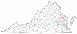 Location in Virginia | |
| Coordinates: 37°55′20″N 76°51′47″W | |
| Country | United States |
| State | Virginia |
| County | Essex |
| Government | |
| • Mayor | Roy Gladding |
| Area | |
| • Total | 2.75 sq mi (7.11 km2) |
| • Land | 2.67 sq mi (6.91 km2) |
| • Water | 0.08 sq mi (0.20 km2) |
| Elevation | 46 ft (14 m) |
| Population (2010) | |
| • Total | 2,375 |
| • Estimate (2018)[2] | 2,397 |
| • Density | 898.09/sq mi (346.72/km2) |
| Time zone | UTC−5 (Eastern (EST)) |
| • Summer (DST) | UTC−4 (EDT) |
| ZIP code | 22560 |
| Area code(s) | 804 |
| FIPS code | 51-77568[3] |
| GNIS feature ID | 1498542[4] |
| Website | www |
History
In 1682 a local man, Jacob Hobbs, established a trading post in the now extinct Rappahannock County[11] (in the vicinity of present-day Tappahannock). This area became known as "Hobbs Hole". The town comprised 50 acres (20 ha) divided into half-acre squares.[12] The port was established at Hobbs Hole and called "New Plymouth",[12] later changed back to the Native American name "Tappahannock". As part of the Tobacco Inspection Act of 1730 public warehouses for inspection and exportation of tobacco were established at Hobbs Hole.
The Tappahannock Historic District and Sabine Hall are listed on the National Register of Historic Places.[13]
On February 24, 2016, the town was hit by a large EF3 tornado causing massive damage.[14]
Geography
Tappahannock is located on the east side of Essex County at 37°55′20″N 76°51′47″W (37.922180, −76.863158),[15] on the southwest bank of the Rappahannock River.
U.S. Routes 17 and 360 pass through the town. US 17 passes through the center of town as Church Lane, leading northwest 47 miles (76 km) to Fredericksburg and southeast 70 miles (110 km) to Newport News. US 360 runs through town with US 17 on Church Lane, but turns east on Queen Street and crosses the mile-wide Rappahannock, continuing east 39 miles (63 km) to its terminus in Reedville near the Chesapeake Bay. US 360 leads southwest from Tappahannock 45 miles (72 km) to Richmond, the state capital.
According to the United States Census Bureau, the town 2.7 square miles (6.9 km2), of which 2.6 square miles (6.7 km2) is land and 0.077 square miles (0.2 km2), or 2.84%, is water.[5]
Demographics
| Historical population | |||
|---|---|---|---|
| Census | Pop. | %± | |
| 1880 | 574 | — | |
| 1890 | 452 | −21.3% | |
| 1900 | 554 | 22.6% | |
| 1910 | 478 | −13.7% | |
| 1920 | 422 | −11.7% | |
| 1930 | 427 | 1.2% | |
| 1940 | 783 | 83.4% | |
| 1950 | 1,011 | 29.1% | |
| 1960 | 1,086 | 7.4% | |
| 1970 | 1,111 | 2.3% | |
| 1980 | 1,821 | 63.9% | |
| 1990 | 1,550 | −14.9% | |
| 2000 | 2,068 | 33.4% | |
| 2010 | 2,375 | 14.8% | |
| Est. 2018 | 2,397 | [2] | 0.9% |
| U.S. Decennial Census[16] | |||
As of the census of 2000, there were 2,068 people, 857 households, and 495 families residing in the town.[3] The population density was 793.6 people per square mile (305.9/km²). There were 946 housing units at an average density of 363.0 per square mile (139.9/km²). The racial makeup of the town was 54.60% White, 41.60% African American, 0.10% Native American, 2.50% Asian, 0.10% from other races, and 1.00% from two or more races. Hispanic or Latino of any race were 0.40% of the population.
There were 857 households out of which 27.8% had children under the age of 18 living with them, 36.6% were married couples living together, 18.0% had a female householder with no husband present, and 42.2% were non-families. 35.8% of all households were made up of individuals and 14.4% had someone living alone who was 65 years of age or older. The average household size was 2.23 and the average family size was 2.91.
In the town, the population was spread out with 22.4% under the age of 18, 8.5% from 18 to 24, 27.0% from 25 to 44, 20.7% from 45 to 64, and 21.4% who were 65 years of age or older. The median age was 39 years. For every 100 females, there were 78.1 males. For every 100 females age 18 and over, there were 73.6 males.
The median income for a household in the town was $33,688, and the median income for a family was $41,579. Males had a median income of $28,409 versus $20,431 for females. The per capita income for the town was $17,862. About 10.6% of families and 14.5% of the population were below the poverty line, including 26.6% of those under age 18 and 6.7% of those age 65 or over.
Places
- The Tappahannock–Essex County Airport is located approximately 4 miles (6 km) south of Tappahannock and opened in 2007. Prior to the opening of the new airport, the old Tappahannock Municipal Airport was located inside town limits.
- Lowery's, a seafood restaurant, has been open since 1938.
- June Parker Marina, a small working marina located on what was originally known as Hobbs His Hole Harbor on Brockenborough Gut. This was the original port of Tappahannock. The town was designed around this harbor to efficiently transport tobacco from Marsh Street and being able to make one single left turn onto Water Lane which ends at Hobbs His Hole Harbor, now June Parker Marina. Thousands of pounds of English ballast stone lies on the bottom of the River there which was discarded hundreds of years ago in return for Essex Tobacco.
- Tappahannock is located on the banks of the Rappahannock River. People traveling on U.S. Highway 360 from the northeast cross the Rappahannock via the Thomas Downing Bridge.
- The town is home to St. Margaret's School, a private boarding school.
- There is a historic debtors' prison, constructed sometime before 1769. It is one of three such structures remaining in Virginia, along with those in Accomac[17] and Worsham.[18] The prison building is part of the Tappahannock Historic District, and as such was listed on the National Register of Historic Places in 1973.[18]
Notable residents
- Chris Brown, Grammy Award-winning R&B pop star, actor, songwriter, dancer
- Lorenzo Bundy, Major League Baseball coach
- Bill Dennis, NASCAR driver, Winston Cup Rookie of the Year, 1970
- Darryl Hammond, Arena Football Hall of Fame member
- Audrey Long, actress, attended school in Tappahannock
- William "Bill" Moore, blues artist[19]
- Stacy Tutt, former New York Jets running back[20]
References
- "2018 U.S. Gazetteer Files". United States Census Bureau. Retrieved Feb 16, 2020.
- "Population and Housing Unit Estimates". Retrieved June 4, 2019.
- "U.S. Census website". United States Census Bureau. Retrieved 2008-01-31.
- "US Board on Geographic Names". United States Geological Survey. 2007-10-25. Retrieved 2008-01-31.
- "Geographic Identifiers: 2010 Census Summary File 1 (G001): Tappahannock town, Virginia". American Factfinder. U.S. Census Bureau. Archived from the original on February 13, 2020. Retrieved April 8, 2016.
- "Find a County". National Association of Counties. Retrieved 2011-06-07.
- "Early Settlement Up the... Rappahannock?". www.virginiaplaces.org. Retrieved 24 May 2018.
- "John Smith 400". www.johnsmith400.org. Retrieved 24 May 2018.
- "Second Voyage - Captain John Smith Chesapeake National Historic Trail (U.S. National Park Service)". www.nps.gov. Retrieved 24 May 2018.
- "Amoroleck Encounters John Smith N-38 - Fredericksburg, Stafford, Spotsylvania Historical Markers". fredmarkers.umwblogs.org. Retrieved 24 May 2018.
- "Essex County Virginia -History of Essex County". Archived from the original on 14 April 2013. Retrieved 24 May 2018.
- http://www.vawterfamily.org/Georgine/Bartholomew%201-99.pdf
- "National Register Information System". National Register of Historic Places. National Park Service. July 9, 2010.
- "Tappahannock 'a mess' after tornado strike". www.richmond.com. Retrieved March 30, 2016.
- "US Gazetteer files: 2010, 2000, and 1990". United States Census Bureau. 2011-02-12. Retrieved 2011-04-23.
- "Census of Population and Housing". Census.gov. Retrieved June 4, 2015.
- Virginia Historic Landmarks Commission staff (June 1976). "National Register of Historic Places Inventory-Nomination: Debtor's Prison" (pdf). Virginia Department of Historic Resources. Virginia Department of Historic Resources.
- "National Register nomination form" (PDF). Virginia Department of Historic Resources. Virginia Department of Historic Resources. 2008-07-15..
- "" Archived 2008-07-08 at the Wayback Machine
- McConnell, Jim. "Big Apple beckons for Tutt." The Free Lance-Star. May 3, 2006. Retrieved on March 6, 2009.
External links
Municipalities and communities of Essex County, Virginia, United States | ||
|---|---|---|
| Town | 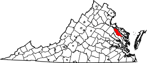 Map of Virginia highlighting Essex County | |
| Unincorporated communities | ||
| Footnotes | ‡This populated place also has portions in an adjacent county or counties | |
| Authority control |
|
|---|