Netrokona Sadar Upazila
Netrokona Sadar (Bengali: নেত্রকোণা সদর) is an Upazila of Netrokona District[2] in the Division of Mymensingh, Bangladesh.
Netrokona Sadar নেত্রকোণা সদর | |
|---|---|
Upazila | |
 Netrokona Sadar Location in Bangladesh | |
| Coordinates: 24°52.5′N 90°44′E | |
| Country | |
| Division | Mymensingh Division |
| District | Netrokona District |
| Area | |
| • Total | 340.35 km2 (131.41 sq mi) |
| Population (2011) | |
| • Total | 372,785[1] |
| Time zone | UTC+6 (BST) |
| Website | Official Map of Netrakona Sadar |
Geography
Netrakona Sadar information is located at 24.8750°N 90.7333°E . It has 51039 households and total area 340.35 km².
Demographics
According to 2011 Bangladesh census, Netrakona Sadar had a population of 372,785. Males constituted 50.17% of the population and females 49.83%. Muslims formed 90.33% of the population, Hindus 9.61%, Christians 0.03% and others 0.03%. Netrakona Sadar had a literacy rate of 45.97% for the population 7 years and above.[3]
As of the 1991 Bangladesh census, Netrakona Sadar has a population of 265643. Males constitute 51.36% of the population, and females 48.64%. This Upazila's eighteen up population is 134197. Netrakona Sadar has an average litemracy rate of 28.4% (7+ years), and the national average of 32.4% literate.[4]
Administration
Netrakona Sadar has 11 Unions/Wards, 317 Mauzas/Mahallas, and 344 villages.
See also
- Upazilas of Bangladesh
- Districts of Bangladesh
- Divisions of Bangladesh
References
- http://www.citypopulation.de/php/bangladesh-admin.php?adm2id=7274
- Syed Marufuzzaman (2012), "Netrokona Sadar Upazila", in Sirajul Islam and Ahmed A. Jamal (ed.), Banglapedia: National Encyclopedia of Bangladesh (Second ed.), Asiatic Society of Bangladesh
- "Bangladesh Population and Housing Census 2011: Zila Report – Netrokona" (PDF). Table P01 : Household and Population by Sex and Residence, Table P05 : Population by Religion, Age group and Residence, Table P09 : Literacy of Population 7 Years & Above by Religion, Sex and Residence. Bangladesh Bureau of Statistics (BBS), Ministry of Planning, Government of the People’s Republic of Bangladesh. Retrieved 14 December 2018.
- "Population Census Wing, BBS". Archived from the original on 2005-03-27. Retrieved November 10, 2006.
| Upazila/Thana: | ||
|---|---|---|
Headquarters: Mymensingh | ||
| Jamalpur District | 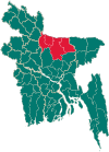 | |
| Mymensingh District | ||
| Netrokona District | ||
| Sherpur District | ||