Kendua Upazila
Kendua (Bengali: কেন্দুয়া) is an Upazila of Netrokona District[1] in the Division of Mymensingh, Bangladesh.
Kendua কেন্দুয়া | |
|---|---|
Upazila | |
 Kendua Location in Bangladesh | |
| Coordinates: 24°39′N 90°50.5′E | |
| Country | |
| Division | Mymensingh Division |
| District | Netrokona District |
| Area | |
| • Total | 303.6 km2 (117.2 sq mi) |
| Population (2011) | |
| • Total | 304,729 |
| • Density | 1,000/km2 (2,600/sq mi) |
| Time zone | UTC+6 (BST) |
| Website | kendua.netrokona.gov.bd |
Geography
Kendua is located at 24.6500°N 90.8417°E . It has 51221 households and total area 303.6 km².
Demographics
According to 2011 Bangladesh census, Kendua had a population of 304,729. Males constituted 49.24% of the population and females 50.76%. Muslims formed 96.16% of the population, Hindus 3.72% and others 0.13%. Kendua had a literacy rate of 37.58% for the population 7 years and above.[2]
As of the 1991 Bangladesh census, Kendua has a population of 265628. Males constitute 50.58% of the population, and females 49.42%. This Upazila's eighteen up population is 133969. Kendua has an average literacy rate of 37.1% (7+ years), and the national average of 32.4% literate.[3]
Administration
Kendua has 13 Unions/Wards, 227 Mauzas/Mahallas, and 331 villages.[4]
Unions
- Asujia Union (Bengali: আশুজিয়া)
- Dalpa(Bengali: দলপা)
- Garadoba(Bengali: গড়াডোবা)
- Ganda(Bengali: গন্ডা)
- Sandikona(Bengali: সান্দিকোণা)
- Mashka(Bengali: মাস্কা)
- Balaishimul(Bengali: বলাইশিমূল)
- Noapara(Bengali: নওপাড়া)
- Kandiura(Bengali: কান্দিউড়া)
- Chirang Bazar(Bengali: চিরাং বাজার)
- Roailbari(Bengali: রোয়াইলবাড়ী)
- Paikura (Bengali: পাইকুড়া)
- Muzaffarpur(Bengali: মোজাফরপুর)
Villages
There are 331 villages in kendua. A few of them are given below:
| Village Name | Village Name | Roghunathpur (Template:রঘুনাথপুর) |
|---|---|---|
| Mozaffarpur (Bengali: মোজাফরপুর} | Kawali Kanda (Bengali: কাওয়ালীকান্দা) | Bairati (Bengali: বৈরাটী) |
| Shohagpur (Bengali: সোহাগপুর) | Deopara (Bengali: দেওপাড়া) | Noupara (Bengali: নওপাড়া) |
| Khalijura (Bengali: খালিজুড়া) | Chitua (Bengali: চিটুয়া) | Barla (Bengali: বাড়লা) |
| Pubail (Bengali: পূবাইল) | Korimghatee (Bengali: করিমখাঁগাতী) | Paikura (Bengali: পাইকুড়া) |
| Taluk Mohesh (Bengali: তালুকমহেশ) | Nagdora (Bengali: নাগডরা) | Nouhati (Bengali: নওহাটা) |
| Uttar bobanipur (Bengali: উত্তরবানীপুর) | Dokkin bobanipur (Bengali: দক্ষিণবানীপুর) | Pechundori (Bengali: পেচুন্দরী) |
| Pemoi (Bengali: পেমই) | Harar kandi (Bengali: হারারকান্দি) | Brahmonjat (Bengali: ব্রাহ্মণজাত) |
See also
- bn:কেন্দুয়া উপজেলা
- Upazilas of Bangladesh
- Districts of Bangladesh
- Divisions of Bangladesh
References
- Md Abul Hasem Khan (2012). "Kendua Upazila". In Sirajul Islam and Ahmed A. Jamal (ed.). Banglapedia: National Encyclopedia of Bangladesh (Second ed.). Asiatic Society of Bangladesh.
- "Bangladesh Population and Housing Census 2011: Zila Report – Netrakona" (PDF). Table P01 : Household and Population by Sex and Residence, Table P05 : Population by Religion, Age group and Residence, Table P09 : Literacy of Population 7 Years & Above by Religion, Sex and Residence. Bangladesh Bureau of Statistics (BBS), Ministry of Planning, Government of the People’s Republic of Bangladesh. Retrieved 14 December 2018.
- "Population Census Wing, BBS". Archived from the original on 2005-03-27. Retrieved November 10, 2006.
- "এক নজরে কেন্দুয়া". kendua.netrokona.gov.bd. Retrieved 5 November 2018.
| Upazila/Thana: | ||
|---|---|---|
Headquarters: Mymensingh | ||
| Jamalpur District | 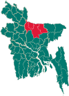 | |
| Mymensingh District | ||
| Netrokona District | ||
| Sherpur District | ||