National Register of Historic Places listings in Shelby County, Kentucky
This is a list of the National Register of Historic Places listings in Shelby County, Kentucky.
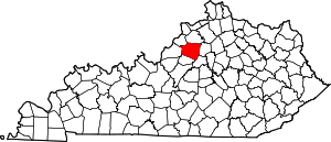
Location of Shelby County in Kentucky
This is intended to be a complete list of the properties and districts on the National Register of Historic Places in Shelby County, Kentucky, United States. The locations of National Register properties and districts for which the latitude and longitude coordinates are included below, may be seen in an online map.[1]
There are 139 properties and districts listed on the National Register in the county, 1 of which is a National Historic Landmark. Another 2 properties were once listed but have been removed.
- This National Park Service list is complete through NPS recent listings posted June 19, 2020.[2]
Current listings
| [3] | Name on the Register | Image | Date listed[4] | Location | City or town | Description |
|---|---|---|---|---|---|---|
| 1 | Allen Dale Farm | November 17, 1983 (#83003821) |
Off U.S. Route 60 38°09′08″N 85°14′53″W |
Shelbyville | ||
| 2 | J. B. Allen House |  J. B. Allen House |
December 27, 1988 (#88002867) |
Kentucky Route 53, 0.5 miles (0.80 km) north of Chestnut Grove 38°18′40″N 85°15′50″W |
Chestnut Grove | |
| 3 | William H. Ballard House | December 27, 1988 (#88002936) |
Kentucky Route 53, 0.5 miles (0.80 km) east of McMakin Rd. 38°09′05″N 85°12′40″W |
Shelbyville | ||
| 4 | Bank of Simpsonville | 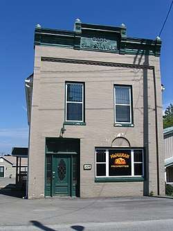 Bank of Simpsonville |
December 27, 1988 (#88002878) |
3rd and Railroad Sts. 38°13′29″N 85°21′17″W |
Simpsonville | |
| 5 | Basket Farm | December 27, 1988 (#88002848) |
Kentucky Route 395, 1 mile (1.6 km) south of Kentucky Route 1779 38°12′42″N 85°03′52″W |
Clay Village | ||
| 6 | Bayne House |  Bayne House |
September 28, 1984 (#84001989) |
37 Main St. 38°12′39″N 85°12′34″W |
Shelbyville | |
| 7 | Bethel AME Church | 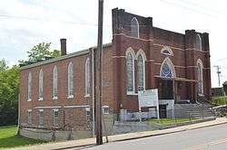 Bethel AME Church |
September 28, 1984 (#84001990) |
414 Henry Clay St. 38°12′36″N 85°12′54″W |
Shelbyville | |
| 8 | Bethel Church | December 27, 1988 (#88002907) |
U.S. Route 60, 1 mile (1.6 km) west of Clay Village 38°11′45″N 85°07′37″W |
Clay Village | ||
| 9 | Bird Octagonal Mule Barn | December 27, 1988 (#88002858) |
Kentucky Route 43, 3 miles (4.8 km) south of Cropper 38°17′16″N 85°07′38″W |
Cropper | ||
| 10 | Bird's Nest | December 27, 1988 (#88002859) |
Kentucky Route 43, 3 miles (4.8 km) south of Cropper 38°16′54″N 85°07′18″W |
Cropper | ||
| 11 | Philomen Bird House | December 27, 1988 (#88002917) |
Kentucky Route 1005/Vigo Rd., east of Beards Rd. 38°14′41″N 85°06′52″W |
Bagdad | ||
| 12 | William Blades House | December 27, 1988 (#88002924) |
Kentucky Route 1005, 0.5 miles (0.80 km) west of Kentucky Route 395 38°14′51″N 85°04′35″W |
Bagdad | ||
| 13 | Bland Farm | December 27, 1988 (#88002882) |
Vigo Rd., 1 mile (1.6 km) west of Kentucky Route 1005 38°15′02″N 85°04′50″W |
Bagdad | ||
| 14 | Blaydes House | December 27, 1988 (#88002852) |
Blaydes Ln., 1 mile (1.6 km) north of Kentucky Route 1779 38°14′24″N 85°03′11″W |
Bagdad | ||
| 15 | Samuel Booker House | December 27, 1988 (#88002868) |
Clore-Jackson Rd., 1.5 miles (2.4 km) west of Kentucky Route 55 38°19′35″N 85°13′26″W |
Chestnut Grove | ||
| 16 | Booker-Giltner House | December 27, 1988 (#88002870) |
Kentucky Route 322, 1.5 miles (2.4 km) south of Henry County line 38°20′07″N 85°14′37″W |
Chestnut Grove | ||
| 17 | Cameron Brown Farm | December 27, 1988 (#88002914) |
Kentucky Route 55 at Clear Creek 38°15′14″N 85°11′51″W |
Shelbyville | ||
| 18 | John C. Brown House | December 27, 1988 (#88002856) |
Kentucky Route 43, 0.5 miles (0.80 km) north of Kentucky Route 12 38°16′26″N 85°08′25″W |
Mulberry | ||
| 19 | Bryan House | December 27, 1988 (#88002880) |
U.S. Route 60, 0.5 miles (0.80 km) west of Simpsonville 38°13′09″N 85°21′33″W |
Simpsonville | ||
| 20 | Buck Creek Rosenwald School | March 27, 2013 (#13000113) |
6712 Taylorsville Rd. 38°08′13″N 85°19′16″W |
Finchville | ||
| 21 | Building at Jct. of KY 395 and 1779 | December 27, 1988 (#88002885) |
Kentucky Routes 395 and 1779 38°13′32″N 85°03′57″W |
Bagdad | ||
| 22 | Burton House | December 27, 1988 (#88002896) |
Burks Branch Rd., 1 mile (1.6 km) south of Fox Run Rd. 38°15′55″N 85°13′33″W |
Chestnut Grove | ||
| 23 | David Burton House | December 27, 1988 (#88002866) |
Burks Branch Rd., 3 miles (4.8 km) north of Shelbyville 38°15′21″N 85°13′42″W |
Shelbyville | ||
| 24 | Caldwell House |  Caldwell House |
December 27, 1988 (#88002939) |
U.S. Route 60 at Kentucky Route 53 38°12′36″N 85°12′11″W |
Shelbyville | |
| 25 | Calloway House | December 27, 1988 (#88002886) |
Clear Creek Rd., 2 miles (3.2 km) south of the Henry County line 38°19′24″N 85°10′26″W |
Eminence | ||
| 26 | Carnegie Public Library | 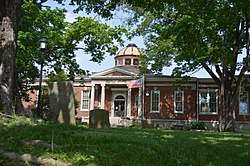 Carnegie Public Library |
June 12, 1985 (#85001253) |
8th and Washington Sts. 38°12′44″N 85°13′11″W |
Shelbyville | |
| 27 | Carpenter House | December 27, 1988 (#88002928) |
Kentucky Route 148, 1 mile (1.6 km) south of Clark Station 38°10′39″N 85°23′59″W |
Clark Station | ||
| 28 | Carriss's Feed Store |  Carriss's Feed Store |
December 27, 1988 (#88002897) |
Kentucky Routes 44 and 55 38°06′35″N 85°11′00″W |
Southville | |
| 29 | Carriss's Store | December 27, 1988 (#88002898) |
Kentucky Routes 53 and 714 38°06′33″N 85°11′00″W |
Southville | ||
| 30 | Chiles-Bailey House | December 27, 1988 (#88002923) |
Kentucky Route 395, 0.5 miles (0.80 km) north of Benson Pike 38°13′58″N 85°03′38″W |
Bagdad | ||
| 31 | Church of the Annunciation |  Church of the Annunciation |
September 28, 1984 (#84002011) |
105 Main St. 38°12′39″N 85°12′38″W |
Shelbyville | |
| 32 | Henry Clay School | December 27, 1988 (#88002944) |
U.S. Route 60 38°11′27″N 85°06′00″W |
Clay Village | ||
| 33 | Coca-Cola Plant |  Coca-Cola Plant |
December 27, 1988 (#88002925) |
U.S. Route 60 at Clear Creek 38°12′36″N 85°12′24″W |
Shelbyville | |
| 34 | Collins House | December 27, 1988 (#88002876) |
Kentucky Route 362, 0.5 miles (0.80 km) west of Webb Rd. 38°17′17″N 85°23′12″W |
Todds Point | ||
| 35 | Courtney House | December 27, 1988 (#88002933) |
Southern end of Popes Corner Rd. 38°09′16″N 85°15′56″W |
Finchville | ||
| 36 | John Edward Crockett House | December 27, 1988 (#88002851) |
Logan Rd., 0.5 miles (0.80 km) south of Kentucky Route 12 38°15′15″N 85°07′44″W |
Mulberry | ||
| 37 | Cross Keys Tavern Kitchen and Quarters |  Cross Keys Tavern Kitchen and Quarters |
January 8, 1987 (#87000205) |
U.S. Route 60 38°11′52″N 85°07′31″W |
Shelbyville | |
| 38 | John Dale House | December 27, 1988 (#88002877) |
Webb Rd., 1.5 miles (2.4 km) north of U.S. Route 60 38°14′54″N 85°22′45″W |
Simpsonville | ||
| 39 | E. M. Davis Farm | December 27, 1988 (#88002919) |
Kentucky Route 43/Christiansburg Pike, 0.75 miles (1.21 km) east of Kentucky Route 55 38°13′56″N 85°11′08″W |
Shelbyville | ||
| 40 | Dependency on Mulberry Creek | January 8, 1987 (#87000167) |
Off Kentucky Route 1871 38°13′56″N 85°10′17″W |
Shelbyville | ||
| 41 | Marene Duvall House | December 27, 1988 (#88002905) |
Simpsonville-Buck Creek Rd. at Bullskin Creek 38°10′56″N 85°18′54″W |
Finchville | ||
| 42 | East Shelbyville District | 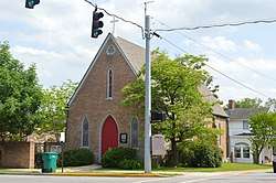 East Shelbyville District |
June 12, 1985 (#85001252) |
Roughly E. 3rd St. from Washington to Bradshaw St. 38°12′37″N 85°12′46″W |
Shelbyville | |
| 43 | Samuel Ellis House | December 27, 1988 (#88002872) |
Kentucky Route 53, 2 miles (3.2 km) west of Kentucky Route 322 38°20′23″N 85°16′30″W |
Chestnut Grove | ||
| 44 | Bushrod Figg House | December 27, 1988 (#88002915) |
Zaring Mill Rd., 0.7 miles (1.1 km) northwest of Kentucky Route 148 38°07′53″N 85°15′09″W |
Olive Branch | ||
| 45 | Froman Fry Farm | December 27, 1988 (#88002952) |
Kentucky Route 714, 1.5 miles (2.4 km) east of Southville 38°07′09″N 85°09′44″W |
Southville | ||
| 46 | L.C. Fry Farm | December 27, 1988 (#88002884) |
Kentucky Route 53, north of Harrington Mill Rd. 38°14′01″N 85°14′15″W |
Shelbyville | ||
| 47 | C.E. Frye Farm | December 27, 1988 (#88002883) |
Kentucky Route 714 and Rockbridge Rd. 38°07′48″N 85°08′29″W |
Southville | ||
| 48 | Fullenwider House | December 27, 1988 (#88002874) |
Anderson Ln., 1 mile (1.6 km) west of Hebron Rd. 38°15′48″N 85°18′18″W |
Todds Point | ||
| 49 | Peter Fullenwielder House | January 8, 1987 (#87000180) |
Off Aikens-Anderson Ln. west of Hebron-Scotts Station Rd. 38°15′58″N 85°18′25″W |
Shelbyville | ||
| 50 | S.D. Glass House | December 27, 1988 (#88002887) |
Kentucky Route 55, 0.5 miles (0.80 km) north of Fox Run Rd. 38°17′07″N 85°11′51″W |
Shelbyville | ||
| 51 | J.W. Goodman House | December 27, 1988 (#88002864) |
Kentucky Route 55, 1 mile (1.6 km) north of Kentucky Route 43 38°14′13″N 85°11′52″W |
Shelbyville | ||
| 52 | Graham House | December 27, 1988 (#88002849) |
Kentucky Route 1779, 1.5 miles (2.4 km) west of Kentucky Route 395 38°13′06″N 85°05′31″W |
Clay Village | ||
| 53 | Grasslands | August 12, 1977 (#77000645) |
4 miles (6.4 km) west of Finchville 38°10′54″N 85°22′43″W |
Finchville | ||
| 54 | Gray House | December 27, 1988 (#88002913) |
Zaring Mill Rd., 0.3 miles (0.48 km) south of Locust Grove Rd. 38°08′06″N 85°14′59″W |
Shelbyville | ||
| 55 | Grove Hill Cemetery Chapel |  Grove Hill Cemetery Chapel |
December 27, 1988 (#88002922) |
South of Shelbyville at Clear Creek 38°12′23″N 85°12′35″W |
Shelbyville | |
| 56 | John G. and William Hansbrough House | December 27, 1988 (#88002865) |
Burks Branch Rd., 1.5 miles (2.4 km) north of Shelbyville 38°14′06″N 85°13′25″W |
Shelbyville | ||
| 57 | Harbison House | December 27, 1988 (#88002875) |
Harrington Mill Pike, 1.5 miles (2.4 km) west of Kentucky Route 53 38°13′58″N 85°16′04″W |
Scotts Station | ||
| 58 | Harbison House | December 27, 1988 (#88002931) |
Zaring Mill Rd., 0.25 miles (0.40 km) south of Interstate 64 38°10′50″N 85°14′26″W |
Shelbyville | ||
| 59 | Hedden House | December 27, 1988 (#88002846) |
Kentucky Route 637 and Ditto Rd. 38°06′21″N 85°02′48″W |
Harrisonville | ||
| 60 | Helmwood Hall | March 20, 1986 (#86000463) |
Kentucky Route 55 at Moody Pike 38°18′02″N 85°11′48″W |
Shelbyville | ||
| 61 | Hinton-Scearce House | July 24, 2009 (#09000571) |
212 Adams Pike 38°17′53″N 85°14′32″W |
Shelbyville | ||
| 62 | Hornsby Bridge | December 27, 1988 (#88002906) |
Clore-Jackson Rd. over Fox Run, 0.5 miles (0.80 km) west of Kentucky Route 55 38°19′04″N 85°12′16″W |
Eminence | ||
| 63 | John A. Hornsby House | December 27, 1988 (#88002869) |
Clore-Jackson Rd., 0.5 miles (0.80 km) west of Kentucky Route 55 38°19′16″N 85°12′20″W |
Eminence | ||
| 64 | M.W. Huss House |  M.W. Huss House |
December 27, 1988 (#88002946) |
U.S. Route 60, 0.5 miles (0.80 km) east of Clay Village 38°11′26″N 85°05′39″W |
Clay Village | |
| 65 | Eli Jackson House | December 27, 1988 (#88002891) |
Kentucky Route 55 near the junction with Clore-Jackson Rd. 38°18′42″N 85°11′52″W |
Eminence | ||
| 66 | Johnston House | December 27, 1988 (#88002890) |
Kentucky Routes 714 and 1790 38°10′49″N 85°08′20″W |
Clay Village | ||
| 67 | M.J. King House | December 27, 1988 (#88002916) |
Bellview-Clear Creek Rd., 0.3 miles (0.48 km) west of Bellview Rd. 38°16′19″N 85°10′53″W |
Shelbyville | ||
| 68 | Knight-Stout House | August 19, 1975 (#75000829) |
1 mile (1.6 km) north of Finchville on Kentucky Route 55 38°09′44″N 85°18′21″W |
Finchville | ||
| 69 | Lincoln Institute Complex | 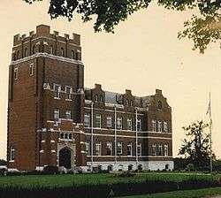 Lincoln Institute Complex |
December 27, 1988 (#88002926) |
U.S. Route 60 west of Simpsonville 38°13′02″N 85°22′32″W |
Simpsonville | |
| 70 | Logan House | .jpg) Logan House |
December 27, 1988 (#88002929) |
Brunerstown Rd. at Bullskin Creek 38°11′31″N 85°18′01″W |
Finchville | |
| 71 | D. T. Long House | December 27, 1988 (#88002902) |
U.S. Route 60 and Joyes Station Rd. 38°13′02″N 85°17′24″W |
Scotts Station | ||
| 72 | Martin House | December 27, 1988 (#88002937) |
Kentucky Route 53, 1 mile (1.6 km) south of Rockbridge Rd. 38°09′47″N 85°12′49″W |
Shelbyville | ||
| 73 | McMicken House | December 27, 1988 (#88002871) |
Kentucky Route 53, 2.5 miles (4.0 km) west of Kentucky Route 322 38°20′10″N 85°17′29″W |
Chestnut Grove | ||
| 74 | Henri Middleton House | December 27, 1988 (#88002847) |
Old U.S. Route 60, 0.75 miles (1.21 km) east of Peytona 38°07′04″N 85°03′30″W |
Peytona | ||
| 75 | Money Farm | December 27, 1988 (#88002910) |
Finchville Rd., 0.6 miles (0.97 km) south of Brunerstown Rd. 38°10′53″N 85°19′20″W |
Finchville | ||
| 76 | Montgomery House | December 27, 1988 (#88002948) |
Buzzard Roost Rd., 1.5 miles (2.4 km) south of U.S. Route 60 38°10′07″N 85°05′31″W |
Clay Village | ||
| 77 | Dr. William Morris Office and House | December 27, 1988 (#88002909) |
Kentucky Route 53 38°06′39″N 85°11′03″W |
Southville | ||
| 78 | Moxley Farm | December 27, 1988 (#88002932) |
Zaring Mill Rd. south of Interstate 64 38°10′53″N 85°13′53″W |
Shelbyville | ||
| 79 | Muir House | December 27, 1988 (#88002899) |
Montana St. at Clear Creek 38°11′56″N 85°14′09″W |
Shelbyville | ||
| 80 | Dr. Nash House |  Dr. Nash House |
December 27, 1988 (#88002903) |
U.S. Route 60 38°11′33″N 85°06′37″W |
Clay Village | |
| 81 | Neal-Hamblen House | December 27, 1988 (#88002873) |
Hinkle Ln., 2 miles (3.2 km) west of Kentucky Route 53 38°19′13″N 85°17′31″W |
Chestnut Grove | ||
| 82 | Newton House | December 27, 1988 (#88002943) |
U.S. Route 60 38°11′31″N 85°06′19″W |
Clay Village | ||
| 83 | Old Stone Inn |  Old Stone Inn |
October 8, 1976 (#76000944) |
East of Simpsonville on U.S. Route 60 38°13′21″N 85°20′52″W |
Simpsonville | |
| 84 | Olive Branch Methodist Episcopal Church | December 27, 1988 (#88002895) |
Zaring Mill Rd. and Kentucky Route 148 38°07′38″N 85°15′45″W |
Finchville | ||
| 85 | Brackett Owen House | December 27, 1988 (#88002940) |
Hooper Station Rd., 0.25 miles (0.40 km) east of Kentucky Route 53 38°12′12″N 85°12′02″W |
Shelbyville | ||
| 86 | Payne House | December 27, 1988 (#88002954) |
Kentucky Routes 44/53, 1.5 miles (2.4 km) north of Mount Eden 38°04′41″N 85°10′18″W |
Mount Eden | ||
| 87 | Pemberton Farm | December 27, 1988 (#88002908) |
Finchville-Clark Station Rd., 0.5 miles (0.80 km) east of Kentucky Route 148 38°09′50″N 85°22′51″W |
Clark | ||
| 88 | James A. Pickett House | December 27, 1988 (#88002930) |
Kentucky Route 55, 0.75 miles (1.21 km) south of Kentucky Route 148 38°08′12″N 85°19′15″W |
Finchville | ||
| 89 | Pugh House | December 27, 1988 (#88002935) |
Kentucky Route 44, 1 mile (1.6 km) west of Kentucky Route 53 38°06′41″N 85°12′13″W |
Southville | ||
| 90 | Radcliffe-Duvall Farm | December 27, 1988 (#88002920) |
Finchville-Buck Creek Rd., 0.5 miles (0.80 km) south of Brunnerstown Rd. 38°10′58″N 85°19′59″W |
Finchville | ||
| 91 | Ramsey House | December 27, 1988 (#88002934) |
Kentucky Route 148, 1.5 miles (2.4 km) west of Kentucky Route 44 38°06′46″N 85°14′23″W |
Southville | ||
| 92 | Redmon House | December 27, 1988 (#88002853) |
Kentucky Route 395, 2 miles (3.2 km) north of Bagdad 38°17′14″N 85°03′36″W |
Bagdad | ||
| 93 | Rice House | December 27, 1988 (#88002945) |
U.S. Route 60, 0.5 miles (0.80 km) north of Clay Village 38°11′58″N 85°06′19″W |
Clay Village | ||
| 94 | Robertson House |  Robertson House |
December 27, 1988 (#88002949) |
Buzzard Roost Rd., 1.5 miles (2.4 km) east of Hemp Ridge 38°09′27″N 85°06′03″W |
Hemp Ridge | |
| 95 | Rodgers House | December 27, 1988 (#88002918) |
Zaring Mill Rd., 1.5 miles (2.4 km) south of Popes Corner Rd. 38°09′06″N 85°14′41″W |
Shelbyville | ||
| 96 | Royalty-Smith Farm | December 27, 1988 (#88002901) |
Burks Branch Rd. north of Clear Creek 38°14′00″N 85°13′35″W |
Shelbyville | ||
| 97 | Saffell Funeral Home |  Saffell Funeral Home |
September 28, 1984 (#84002012) |
4th and Clay Sts. 38°12′35″N 85°12′50″W |
Shelbyville | Side passage plan building from c.1830. |
| 98 | St. John United Methodist Church |  St. John United Methodist Church |
September 28, 1984 (#84002016) |
College St. 38°12′48″N 85°13′27″W |
Shelbyville | |
| 99 | Salem Baptist Church | December 27, 1988 (#88002953) |
Kentucky Routes 44/53, 0.5 miles (0.80 km) south of Southville 38°06′19″N 85°10′44″W |
Southville | ||
| 100 | Scearce-Roush House | March 13, 2017 (#100000745) |
2460 Conner Station Rd. 38°12′29″N 85°23′46″W |
Simpsonville | ||
| 101 | Science Hill School |  Science Hill School |
September 18, 1975 (#75000831) |
Washington St. 38°12′44″N 85°13′01″W |
Shelbyville | |
| 102 | Seventh Street Historic District |  Seventh Street Historic District |
June 12, 1985 (#85001254) |
Main and 7th Sts. 38°12′41″N 85°13′06″W |
Shelbyville | |
| 103 | Shady Rest | December 27, 1988 (#88002947) |
U.S. Route 60, 0.5 miles (0.80 km) east of Clay Village 38°11′25″N 85°05′33″W |
Clay Village | ||
| 104 | Shelby Academy | September 18, 1975 (#75000830) |
Kentucky Routes 55 and 148 38°08′48″N 85°19′01″W |
Finchville | ||
| 105 | Shelby County Courthouse and Main Street Commercial District |  Shelby County Courthouse and Main Street Commercial District |
March 21, 1978 (#78001399) |
Roughly bounded by Washington, Clay, 4th, and 6th Sts. 38°12′39″N 85°13′01″W |
Shelbyville | |
| 106 | Shelbyville L&N Railroad Depot |  Shelbyville L&N Railroad Depot |
June 20, 1975 (#75000832) |
220 N. 7th St. 38°12′47″N 85°13′11″W |
Shelbyville | |
| 107 | Shropshire Farm | December 27, 1988 (#88002911) |
Kentucky Route 714/Hemp Ridge Rd., 1 mile (1.6 km) south of Interstate 64 38°09′12″N 85°07′55″W |
Hemp Ridge | ||
| 108 | Simpsonville Christian Church |  Simpsonville Christian Church |
December 27, 1988 (#88002881) |
U.S. Route 60 38°13′19″N 85°21′13″W |
Simpsonville | |
| 109 | Simpsonville Methodist Church | _Methodist_Church.jpg) Simpsonville Methodist Church |
December 27, 1988 (#88002879) |
1st St. 38°13′30″N 85°21′17″W |
Simpsonville | |
| 110 | William Sleadd Farm | December 27, 1988 (#88002941) |
Kentucky Route 1790, 0.5 miles (0.80 km) east of Hooper 38°10′42″N 85°08′58″W |
Hooper | ||
| 111 | Snook House | December 27, 1988 (#88002855) |
Kentucky Routes 12 and 43 38°15′54″N 85°08′32″W |
Mulberry | ||
| 112 | Van B. Snook House | December 27, 1988 (#88002863) |
Mulberry-Eminence Pike, 1 mile (1.6 km) north of Stoney Point Rd. 38°19′15″N 85°09′07″W |
Cropper | ||
| 113 | Stapleton Farm | December 27, 1988 (#88002912) |
Kentucky Route 1005/Vigo Rd., 0.5 miles (0.80 km) east of Logan Rd. 38°14′45″N 85°06′46″W |
Bagdad | ||
| 114 | G.W. Stewart House | December 27, 1988 (#88002888) |
Kentucky Route 55 38°15′42″N 85°12′29″W |
Shelbyville | ||
| 115 | Stone House on Clear Creek | January 8, 1987 (#87000141) |
Off Kentucky Route 55 west of Bellview Rd. 38°15′25″N 85°11′12″W |
Shelbyville | ||
| 116 | Sturgeon-Gregg House | November 29, 1984 (#84000418) |
U.S. Route 60 38°14′56″N 85°24′11″W |
Simpsonville | ||
| 117 | Swindler House | December 27, 1988 (#88002862) |
Mulberry-Eminence Pike, 0.5 miles (0.80 km) north of Stoney Point Rd. 38°18′42″N 85°09′09″W |
Cropper | ||
| 118 | Tevis Cottage |  Tevis Cottage |
September 28, 1984 (#84002018) |
607 Washington St. 38°12′43″N 85°13′03″W |
Shelbyville | |
| 119 | Thomas House | December 27, 1988 (#88002857) |
Kentucky Route 43, 0.25 miles (0.40 km) east of Mulberry-Eminence Pike 38°17′10″N 85°08′23″W |
Mulberry | ||
| 120 | William J. Thomas House | December 27, 1988 (#88002860) |
Off Kentucky Route 12, near the junction with Kentucky Route 43 38°16′22″N 85°09′06″W |
Mulberry | ||
| 121 | Thomas Threlkeld House | 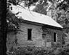 Thomas Threlkeld House |
May 14, 1984 (#84002021) |
Benson Pike 38°12′38″N 85°07′58″W |
Shelbyville | |
| 122 | Tindall House | December 27, 1988 (#88002904) |
U.S. Route 60 38°11′32″N 85°06′32″W |
Clay Village | ||
| 123 | Charles and Letitia Shelby Todd House | June 5, 1975 (#75000833) |
5 miles (8.0 km) north of Shelbyville on Kentucky Route 55 38°17′04″N 85°13′03″W |
Shelbyville | ||
| 124 | Undulata | June 22, 1980 (#80004519) |
South of Shelbyville on Old Zaring Mill Rd. 38°11′20″N 85°14′10″W |
Shelbyville | ||
| 125 | Vanatta House |  Vanatta House |
December 27, 1988 (#88002942) |
U.S. Route 60 38°11′32″N 85°06′28″W |
Clay Village | |
| 126 | Venable-Chase House | December 27, 1988 (#88002861) |
Kentucky Route 43, 2.5 miles (4.0 km) northeast of Shelbyville 38°14′08″N 85°10′52″W |
Shelbyville | ||
| 127 | Waddy Bank Building | February 14, 1978 (#78001400) |
Kentucky Route 395 38°08′14″N 85°04′27″W |
Waddy | ||
| 128 | Waddy Historic District | December 27, 1988 (#88002921) |
Roughly Kentucky Route 395/Main St. south of the Southern Railroad tracks 38°08′13″N 85°04′29″W |
Waddy | ||
| 129 | Charles Ware House | December 27, 1988 (#88002845) |
Pea Ridge Rd., 0.5 miles (0.80 km) west of Kentucky Route 395 38°05′30″N 85°05′46″W |
Harrisonville | ||
| 130 | Shelby D. Ware House | December 27, 1988 (#88002950) |
Kentucky Route 714, 0.5 miles (0.80 km) south of Hemp Ridge 38°08′27″N 85°06′56″W |
Hemp Ridge | ||
| 131 | Benjamin Washburn House | August 12, 1977 (#77000646) |
Bellevue Pike, 8 miles (13 km) north of Shelbyville 38°18′10″N 85°09′31″W |
Shelbyville | ||
| 132 | Thomas Weakley House | December 27, 1988 (#88002850) |
Kentucky Route 1779 and Beard Rd. 38°13′34″N 85°06′55″W |
Clay Village | ||
| 133 | Weissinger Mule Barn | December 27, 1988 (#88002938) |
Kentucky Route 53, 0.25 miles (0.40 km) south of Interstate 64 38°10′47″N 85°13′12″W |
Shelbyville | ||
| 134 | West Shelbyville District | 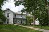 West Shelbyville District |
June 12, 1985 (#85001273) |
Roughly Main from Adair to 8th, Magnolia to Linden, 7th, 8th, 9th, 10th, and Bland Sts. 38°12′38″N 85°13′28″W |
Shelbyville | |
| 135 | White House |  White House |
December 27, 1988 (#88002854) |
Cropper Rd., 0.75 miles (1.21 km) south of Christianburg 38°16′09″N 85°06′22″W |
Christianburg | |
| 136 | Wickland | 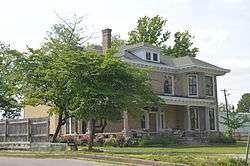 Wickland |
September 28, 1984 (#84002023) |
169 Kentucky St. 38°12′31″N 85°13′33″W |
Shelbyville | |
| 137 | Wise House | December 27, 1988 (#88002955) |
Kentucky Routes 44/53, 0.5 miles (0.80 km) north of Mount Eden 38°03′55″N 85°09′30″W |
Mount Eden | ||
| 138 | Wright House | December 27, 1988 (#88002927) |
Kentucky Route 1848, 1.5 miles (2.4 km) south of Simpsonville 38°11′55″N 85°20′56″W |
Simpsonville | ||
| 139 | Whitney M. Young, Jr. Birthplace | 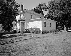 Whitney M. Young, Jr. Birthplace |
October 18, 1972 (#72000543) |
Southwest of Simpsonville off U.S. Route 60 38°13′22″N 85°22′20″W |
Simpsonville |
Former listings
| [3] | Name on the Register | Image | Date listed | Date removed | Location | City or town | Summary |
|---|---|---|---|---|---|---|---|
| 1 | Lester Gibbs House | November 15, 1988 (#88002889) | February 5, 1991 | Kentucky Route 55, 0.5 miles north of Kentucky Route 43 |
Shelbyville | ||
| 2 | Moesser Farm | December 27, 1988 (#88002900) | May 17, 1989 | Old Mount Eden Rd., 0.5 miles south of Grove Hill Cemetery |
Shelbyville | ||
| 3 | Rockbridge Church | December 27, 1988 (#88002951) | August 11, 1999 | Kentucky Route 714 and Rockbridge Rd. |
Hemp Ridge |
See also
| Wikimedia Commons has media related to National Register of Historic Places in Shelby County, Kentucky. |
References
- The latitude and longitude information provided in this table was derived originally from the National Register Information System, which has been found to be fairly accurate for about 99% of listings. Some locations in this table may have been corrected to current GPS standards.
- "National Register of Historic Places: Weekly List Actions". National Park Service, United States Department of the Interior. Retrieved on June 19, 2020.
- Numbers represent an ordering by significant words. Various colorings, defined here, differentiate National Historic Landmarks and historic districts from other NRHP buildings, structures, sites or objects.
- The eight-digit number below each date is the number assigned to each location in the National Register Information System database, which can be viewed by clicking the number.
| Topics | |
|---|---|
| Lists by state |
|
| Lists by insular areas | |
| Lists by associated state | |
| Other areas | |
| Related | |
| |
Municipalities and communities of Shelby County, Kentucky, United States | ||
|---|---|---|
| Cities | Location of Shelby County, Kentucky | |
| Unincorporated communities | ||
| Footnotes | ‡This populated place also has portions in an adjacent county or counties | |
This article is issued from Wikipedia. The text is licensed under Creative Commons - Attribution - Sharealike. Additional terms may apply for the media files.