National Register of Historic Places listings in Franklin County, Kentucky
This is a list of the National Register of Historic Places listings in Franklin County, Kentucky.

Location of Franklin County in Kentucky
This is intended to be a complete list of the properties and districts on the National Register of Historic Places in Franklin County, Kentucky, United States. The locations of National Register properties and districts for which the latitude and longitude coordinates are included below, may be seen in a map.[1]
There are 55 properties and districts listed on the National Register in the county, of which 3 are National Historic Landmarks.
- This National Park Service list is complete through NPS recent listings posted June 19, 2020.[2]
Current listings
| [3] | Name on the Register | Image | Date listed[4] | Location | City or town | Description |
|---|---|---|---|---|---|---|
| 1 | Col. R.T.P. Allen House |  Col. R.T.P. Allen House |
July 10, 1979 (#79000984) |
South of Frankfort on Johnson Rd. 38°10′14″N 84°51′40″W |
Frankfort | |
| 2 | Archeological Site 15 Fr 26 | March 31, 1978 (#78001331) |
Address Restricted |
Harvieland | ||
| 3 | Archeological Site 15 Fr 34 | February 17, 1978 (#78001326) |
Address Restricted |
Frankfort | ||
| 4 | Archeological Site 15 Fr 52 | February 14, 1978 (#78001330) |
Address Restricted |
Harvieland | ||
| 5 | Archeological Site 15 FR 368 | September 12, 1985 (#85002370) |
Address Restricted |
Frankfort | Fort Hill, a Civil War fort[5] | |
| 6 | Arrowhead | September 28, 1989 (#89001597) |
U.S. Route 60, 0.5 miles (0.80 km) south of Hanley Ln. 38°10′44″N 84°49′10″W |
Frankfort | ||
| 7 | Beeches | February 9, 1979 (#79000985) |
Off U.S. Route 421 38°12′46″N 84°52′01″W |
Frankfort | ||
| 8 | George F. Berry House | 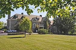 George F. Berry House |
September 6, 2002 (#02000915) |
700 Louisville Rd. 38°11′15″N 84°52′57″W |
Frankfort | |
| 9 | Blanton-Crutcher Farm | October 29, 1975 (#75000757) |
5 miles (8.0 km) southeast of Frankfort off U.S. Route 60 38°09′37″N 84°49′13″W |
Frankfort | ||
| 10 | Bridgeport School | January 8, 2014 (#13001049) |
555 Bridgeport Rd. 38°09′38″N 84°56′54″W |
Bridgeport | ||
| 11 | Brown-Henry House | 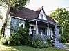 Brown-Henry House |
January 8, 2014 (#13001050) |
818 Fields Ave. 38°12′42″N 84°51′24″W |
Frankfort | |
| 12 | Central Frankfort Historic District | 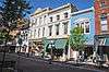 Central Frankfort Historic District |
July 28, 2009 (#09000570) |
Bounded by E. and W. 2nd St., Logan St., the Kentucky River, High St., and Mero St. 38°11′44″N 84°52′34″W |
Frankfort | |
| 13 | Colored Soldiers Monument in Frankfort | 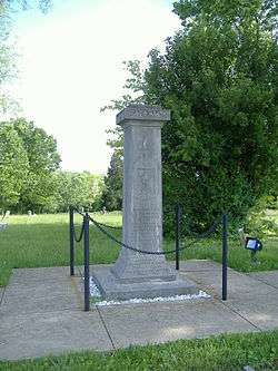 Colored Soldiers Monument in Frankfort |
July 17, 1997 (#97000701) |
Greenhill Cemetery, 0.1 miles (0.16 km) southeast of the junction of E. Main St. and Myrtle Ave. 38°12′18″N 84°50′18″W |
Frankfort | |
| 14 | Confederate Monument in Frankfort | 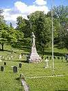 Confederate Monument in Frankfort |
July 17, 1997 (#97000702) |
215 E. Main St. 38°11′48″N 84°52′05″W |
Frankfort | |
| 15 | Corner in Celebrities Historic District | 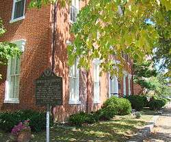 Corner in Celebrities Historic District |
March 11, 1971 (#71000343) |
Roughly bounded by the Kentucky River on the south and the west, St. Clair and Main Sts. 38°11′57″N 84°52′46″W |
Frankfort | |
| 16 | Dills Site | March 21, 1978 (#78001327) |
Address Restricted |
Frankfort | ||
| 17 | Frankfort Barracks District | 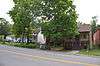 Frankfort Barracks District |
November 20, 1975 (#75000758) |
Bounded by New, Shelby, and Coke Sts., and Woodland Ave. 38°11′19″N 84°52′38″W |
Frankfort | |
| 18 | Frankfort Cemetery and Chapel | 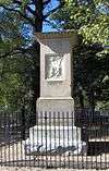 Frankfort Cemetery and Chapel |
July 12, 1974 (#74000872) |
215 E. Main St. 38°11′38″N 84°51′56″W |
Frankfort | |
| 19 | Frankfort Commercial Historic District |  Frankfort Commercial Historic District |
May 10, 1979 (#79000986) |
Both sides of the Kentucky River at Bridge St. 38°11′54″N 84°52′39″W |
Frankfort | |
| 20 | Frankfort Greenhouses |  Frankfort Greenhouses |
October 9, 1997 (#97000233) |
210, 212, and 216 E. Main St. 38°11′54″N 84°52′01″W |
Frankfort | |
| 21 | Frankfort Storage Building-Armory |  Frankfort Storage Building-Armory |
September 6, 2002 (#02000929) |
208 Maryland Ave. 38°11′48″N 84°51′31″W |
Frankfort | |
| 22 | Giltner-Holt House | May 5, 1978 (#78001328) |
5 miles (8.0 km) north of Frankfort 38°15′03″N 84°50′01″W |
Frankfort | ||
| 23 | Glen Willis |  Glen Willis |
June 13, 1972 (#72000531) |
Leestown Pike 38°12′37″N 84°52′20″W |
Frankfort | |
| 24 | Gooch House | 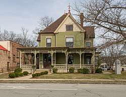 Gooch House |
April 30, 1980 (#80001528) |
104 2nd St. 38°11′42″N 84°52′29″W |
Frankfort | |
| 25 | Haggin Farm | June 23, 1983 (#83002773) |
KY 1685 38°11′24″N 84°44′25″W |
Midway | ||
| 26 | Andrew Hearn Log House and Farm | 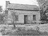 Andrew Hearn Log House and Farm |
August 11, 1976 (#76000886) |
3 miles (4.8 km) southwest of Jett on Hanley Lane 38°09′26″N 84°50′08″W |
Jett | |
| 27 | E.E. Hume Hall | May 26, 1983 (#83004050) |
Kentucky State University campus 38°12′07″N 84°51′21″W |
Frankfort | ||
| 28 | Hutcherson Site | March 21, 1978 (#78001332) |
Address Restricted |
Polsgrove | ||
| 29 | Jackson Hall, Kentucky State University | 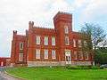 Jackson Hall, Kentucky State University |
April 11, 1973 (#73000802) |
E. Main St. 38°12′10″N 84°51′29″W |
Frankfort | |
| 30 | Julian Farm | May 26, 1988 (#88000670) |
Southern side of U.S. Route 60 38°09′51″N 84°55′49″W |
Bridgeport | ||
| 31 | Kentucky Governor's Mansion | Kentucky Governor's Mansion |
February 1, 1972 (#72000532) |
Eastern lawn of the Capitol at the end of Capital Ave. 38°11′14″N 84°52′25″W |
Frankfort | |
| 32 | Kentucky State Arsenal | 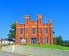 Kentucky State Arsenal |
April 11, 1973 (#73000803) |
Main St. at Capital Ave. 38°11′51″N 84°52′22″W |
Frankfort | |
| 33 | Kentucky State Capitol | 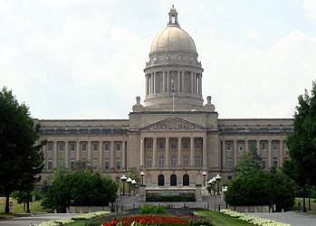 Kentucky State Capitol |
April 13, 1973 (#73000804) |
Capitol grounds at end of Capital Ave. 38°11′12″N 84°52′33″W |
Frankfort | |
| 34 | Knight-Taylor-Hockensmith House | June 25, 2013 (#13000475) |
4350 Peaks Mill Road 38°16′10″N 84°48′49″W |
Frankfort | ||
| 35 | Liberty Hall | 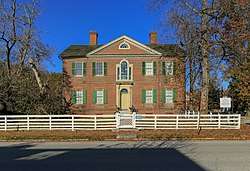 Liberty Hall |
November 11, 1971 (#71000344) |
218 Wilkinson St. 38°11′59″N 84°52′52″W |
Frankfort | |
| 36 | Gov. Charles S. Morehead House | 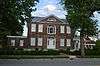 Gov. Charles S. Morehead House |
December 30, 1974 (#74000873) |
217 Shelby St. 38°11′39″N 84°52′33″W |
Frankfort | |
| 37 | Old Governor's Mansion |  Old Governor's Mansion |
March 11, 1971 (#71000345) |
420 High St. 38°11′58″N 84°52′26″W |
Frankfort | |
| 38 | Old Statehouse | 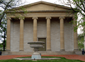 Old Statehouse |
March 11, 1971 (#71000346) |
On Broadway, bounded by Madison, Clinton, and Lewis Sts. 38°12′01″N 84°52′36″W |
Frankfort | |
| 39 | Old Statehouse Historic District | 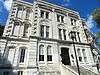 Old Statehouse Historic District |
June 19, 1980 (#80001529) |
Roughly bounded by Broadway, Blanton, St. Clair, Ann, and High Sts. 38°12′02″N 84°52′29″W |
Frankfort | |
| 40 | Old Stone Tavern | 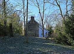 Old Stone Tavern |
June 23, 1983 (#83002774) |
Scruggs Lane and Leestown Pike 38°11′16″N 84°48′02″W |
Frankfort | |
| 41 | Old U.S. Courthouse and Post Office | 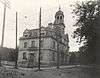 Old U.S. Courthouse and Post Office |
July 3, 1974 (#74000874) |
305 Wapping St. 38°11′51″N 84°52′45″W |
Frankfort | |
| 42 | Charles Patterson House | June 23, 1983 (#83002775) |
KY 1689 38°14′00″N 84°46′33″W |
Frankfort | ||
| 43 | Penn-Marshall Stone House | June 5, 1975 (#75000760) |
East of Harvieland on Stoney Creek Rd. at the Kentucky River 38°15′28″N 84°53′43″W |
Harvieland | ||
| 44 | Point Breeze | 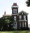 Point Breeze |
January 8, 2014 (#13001051) |
219 Riverview St. 38°11′00″N 84°52′41″W |
Frankfort | |
| 45 | Risk Brothers Site | November 21, 1978 (#78001329) |
Address Restricted |
Frankfort | ||
| 46 | Scotland | December 12, 1976 (#76000883) |
5 miles (8.0 km) east of Frankfort on Versailles Rd. 38°10′16″N 84°48′12″W |
Frankfort | ||
| 47 | South Frankfort Neighborhood Historic District | 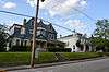 South Frankfort Neighborhood Historic District |
August 19, 1982 (#82002698) |
Roughly bounded by U.S. Route 60, Rockland Ct., and the Kentucky River; also roughly bounded by U.S. Route 60, Taylor Ave., the Kentucky River, and the Tanglewood subdivision 38°11′28″N 84°52′33″W |
Frankfort | Second set of boundaries represents a boundary increase of July 30, 2013 |
| 48 | George T. Stagg Distillery | 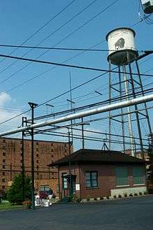 George T. Stagg Distillery |
May 2, 2001 (#01000450) |
1001 Wilkinson Boulevard 38°12′59″N 84°52′09″W |
Frankfort | Designated a National Historic Landmark on February 27, 2013[6] |
| 49 | Stewart Home School | June 3, 1976 (#76000884) |
5.5 miles (8.9 km) south of Frankfort on U.S. Route 127 38°07′35″N 84°54′28″W |
Frankfort | ||
| 50 | Switzer Covered Bridge |  Switzer Covered Bridge |
September 6, 1974 (#74000875) |
Off Rocky Branch Rd., over North Elkhorn Creek 38°15′14″N 84°45′08″W |
Switzer | |
| 51 | Robert Todd Summer Home | June 23, 1983 (#83002776) |
U.S. Route 421 38°10′50″N 84°47′13″W |
Frankfort | ||
| 52 | Andrew Trumbo Log House | November 17, 1977 (#77000618) |
East of Frankfort on Glenns Creek Rd. 38°10′29″N 84°50′53″W |
Frankfort | ||
| 53 | Valley Farm Ruins | July 24, 1975 (#75000759) |
Address Restricted |
Frankfort | ||
| 54 | Weehawken | April 24, 2007 (#07000283) |
1 Weehawken Ln. 38°11′44″N 84°49′20″W |
Jett | ||
| 55 | Rev. Jesse R. Zeigler House | 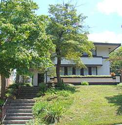 Rev. Jesse R. Zeigler House |
May 3, 1976 (#76000885) |
509 Shelby St. 38°11′25″N 84°52′35″W |
Frankfort |
See also
| Wikimedia Commons has media related to National Register of Historic Places in Franklin County, Kentucky. |
References
- The latitude and longitude information provided in this table was derived originally from the National Register Information System, which has been found to be fairly accurate for about 99% of listings. Some locations in this table may have been corrected to current GPS standards.
- "National Register of Historic Places: Weekly List Actions". National Park Service, United States Department of the Interior. Retrieved on June 19, 2020.
- Numbers represent an ordering by significant words. Various colorings, defined here, differentiate National Historic Landmarks and historic districts from other NRHP buildings, structures, sites or objects.
- The eight-digit number below each date is the number assigned to each location in the National Register Information System database, which can be viewed by clicking the number.
- "National Register Information System". National Register of Historic Places. National Park Service. July 9, 2010.
- "Weekly list of actions taken on properties: 3/25/13 through 3/29/13". National Park Service. April 5, 2013. Retrieved April 16, 2013.
| Topics | |
|---|---|
| Lists by state |
|
| Lists by insular areas | |
| Lists by associated state | |
| Other areas | |
| Related | |
| |
Municipalities and communities of Franklin County, Kentucky, United States | ||
|---|---|---|
| City | Location of Franklin County, Kentucky | |
| Unincorporated communities | ||
This article is issued from Wikipedia. The text is licensed under Creative Commons - Attribution - Sharealike. Additional terms may apply for the media files.