National Register of Historic Places listings in Boyd County, Kentucky
This is a list of the National Register of Historic Places listings in Boyd County, Kentucky.

Location of Boyd County in Kentucky
This is intended to be a complete list of the properties and districts on the National Register of Historic Places in Boyd County, Kentucky, United States. The locations of National Register properties and districts for which the latitude and longitude coordinates are included below, may be seen in a map.[1]
There are 26 properties and districts listed on the National Register in the county. Another 2 properties were once listed but have been removed.
- This National Park Service list is complete through NPS recent listings posted June 19, 2020.[2]
Current listings
| [3] | Name on the Register | Image | Date listed[4] | Location | City or town | Description |
|---|---|---|---|---|---|---|
| 1 | Ashland Armory | 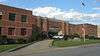 Ashland Armory |
September 6, 2002 (#02000920) |
2519 Lexington Ave. 38°28′06″N 82°37′52″W |
Ashland | |
| 2 | Ashland Coal and Iron Railroad Office | 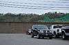 Ashland Coal and Iron Railroad Office |
July 3, 1979 (#79003565) |
1100 Front St. 38°28′58″N 82°38′39″W |
Ashland | |
| 3 | Ashland Coal and Iron Railroad Store | 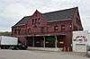 Ashland Coal and Iron Railroad Store |
July 3, 1979 (#79003553) |
900 Front St. 38°29′03″N 82°38′45″W |
Ashland | |
| 4 | Ashland Commercial Historic District |  Ashland Commercial Historic District |
August 5, 1994 (#94000838) |
Roughly bounded by 13th St., Carter Ave., 18th St. and Front St. 38°28′46″N 82°38′23″W |
Ashland | |
| 5 | Ashland Tuberculosis Hospital | 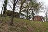 Ashland Tuberculosis Hospital |
February 7, 2008 (#08000002) |
3700 Landsdowne Dr. 38°27′11″N 82°40′04″W |
Ashland | |
| 6 | Alexander Bagby House | 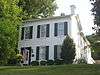 Alexander Bagby House |
July 3, 1979 (#79003561) |
1520 Lexington Ave. 38°28′27″N 82°38′38″W |
Ashland | |
| 7 | Bath Avenue Historic District | 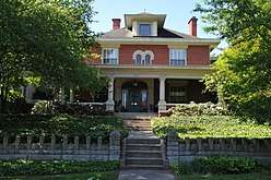 Bath Avenue Historic District |
July 3, 1979 (#79003552) |
Bath Ave. from 13th to 17th Sts. 38°28′35″N 82°38′35″W |
Ashland | |
| 8 | Catlett House | 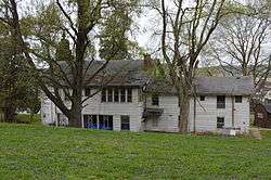 Catlett House |
May 25, 1973 (#73000788) |
25th and Walnut Sts. 38°25′01″N 82°36′02″W |
Catlettsburg | |
| 9 | Catlettsburg, Kentucky, Chesapeake and Ohio Railway Depot | 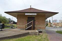 Catlettsburg, Kentucky, Chesapeake and Ohio Railway Depot |
August 6, 2012 (#12000446) |
Junction of Division (26th) and Panola Sts. 38°25′01″N 82°35′58″W |
Catlettsburg | |
| 10 | Catlettsburg National Bank | 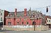 Catlettsburg National Bank |
May 25, 1973 (#73000789) |
110 26th St. 38°25′02″N 82°35′50″W |
Catlettsburg | |
| 11 | Henry Clay Hotel | 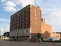 Henry Clay Hotel |
August 3, 1984 (#84001383) |
1736 Winchester Ave. 38°28′39″N 82°38′16″W |
Ashland | |
| 12 | Crump and Field Grocery Company | 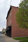 Crump and Field Grocery Company |
July 3, 1979 (#79003556) |
1401-1405 Greenup Ave. 38°28′51″N 82°38′26″W |
Ashland | |
| 13 | Culbertson House | 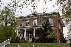 Culbertson House |
July 3, 1979 (#79003560) |
1520 Chestnut Dr. 38°28′26″N 82°38′42″W |
Ashland | |
| 14 | Nando Felty Saloon | July 3, 1979 (#79003557) |
1500 Front St. 38°28′51″N 82°38′21″W |
Ashland | ||
| 15 | Timothy Fields House | 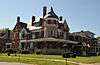 Timothy Fields House |
July 3, 1979 (#79003562) |
1600 Central Ave. 38°28′35″N 82°38′28″W |
Ashland | |
| 16 | First Christian Church of Ashland | 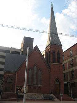 First Christian Church of Ashland |
March 22, 1990 (#90000475) |
315 17th St. 38°28′40″N 82°38′21″W |
Ashland | |
| 17 | First Presbyterian Church | 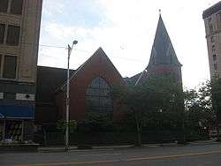 First Presbyterian Church |
June 19, 1973 (#73000787) |
1600 Winchester Ave. 38°28′42″N 82°38′22″W |
Ashland | |
| 18 | First United Methodist Church | 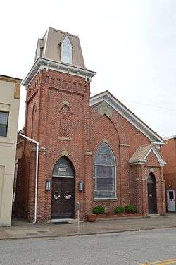 First United Methodist Church |
November 19, 1974 (#74000853) |
2712 Louisa St. 38°24′58″N 82°35′53″W |
Catlettsburg | |
| 19 | Martin Hilton House | 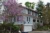 Martin Hilton House |
July 3, 1979 (#79003559) |
1314 Hilton Ct. 38°28′29″N 82°38′47″W |
Ashland | |
| 20 | Indian Mounds in Central Park |  Indian Mounds in Central Park |
January 21, 1974 (#74000852) |
Central Park, Carter Ave. 38°28′29″N 82°38′25″W |
Ashland | |
| 21 | Paramount Theatre | 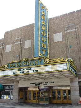 Paramount Theatre |
June 30, 1975 (#75000736) |
1304 Winchester Ave. 38°28′48″N 82°38′34″W |
Ashland | |
| 22 | Lon Rogers House | 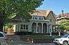 Lon Rogers House |
July 3, 1979 (#79003564) |
2008 Lexington Ave. 38°28′17″N 82°38′18″W |
Ashland | |
| 23 | St. James AME Church | 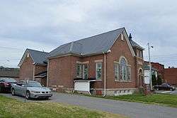 St. James AME Church |
July 3, 1979 (#79003555) |
12th St. and Carter Ave. 38°28′49″N 82°38′41″W |
Ashland | |
| 24 | Jacob Savageot House and Saloon |  Jacob Savageot House and Saloon |
July 3, 1979 (#79003558) |
1512 Front St. 38°28′51″N 82°38′21″W |
Ashland | |
| 25 | Stone Serpent Mound |  Stone Serpent Mound |
January 21, 1974 (#74000854) |
West of the Big Sandy River, south of Catlettsburg[5] 38°21′31″N 82°36′11″W |
Catlettsburg | |
| 26 | US Post Office-Ashland | 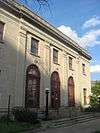 US Post Office-Ashland |
November 15, 1988 (#88002617) |
1645 Winchester Ave. 38°28′43″N 82°38′19″W |
Ashland |
Former listings
| [3] | Name on the Register | Image | Date listed | Date removed | Location | City or town | Summary |
|---|---|---|---|---|---|---|---|
| 1 | Edward Poage House | July 3, 1979 (#79003554) | February 3, 1988 | 1016 Winchester Ave. |
Ashland | ||
| 2 | Valdenar-Wheeler House | July 3, 1979 (#79003563) | February 3, 1988 | 2417 Winchester Ave. |
Ashland |
See also
| Wikimedia Commons has media related to National Register of Historic Places in Boyd County, Kentucky. |
References
- The latitude and longitude information provided in this table was derived originally from the National Register Information System, which has been found to be fairly accurate for about 99% of listings. Some locations in this table may have been corrected to current GPS standards.
- "National Register of Historic Places: Weekly List Actions". National Park Service, United States Department of the Interior. Retrieved on June 19, 2020.
- Numbers represent an ordering by significant words. Various colorings, defined here, differentiate National Historic Landmarks and historic districts from other NRHP buildings, structures, sites or objects.
- The eight-digit number below each date is the number assigned to each location in the National Register Information System database, which can be viewed by clicking the number.
- Sanders, Sara L. "The Stone Serpent Mound of Boyd County, Kentucky: An Investigation of a Stone Effigy Structure" Midcontinental Journal of Archaeology 16.2 (1991): 272-284: 280.
| Topics | |
|---|---|
| Lists by state |
|
| Lists by insular areas | |
| Lists by associated state | |
| Other areas | |
| Related | |
| |
Municipalities and communities of Boyd County, Kentucky, United States | ||
|---|---|---|
| Cities | Location of Boyd County, Kentucky | |
| CDPs | ||
| Unincorporated communities | ||
| Ghost towns |
| |
| Footnotes | ‡This populated place also has portions in an adjacent county or counties | |
This article is issued from Wikipedia. The text is licensed under Creative Commons - Attribution - Sharealike. Additional terms may apply for the media files.