National Register of Historic Places listings in Campbell County, Kentucky
This is a list of the National Register of Historic Places listings in Campbell County, Kentucky.
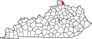
Location of Campbell County in Kentucky
This is intended to be a complete list of the properties and districts on the National Register of Historic Places in Campbell County, Kentucky, United States. The locations of National Register properties and districts for which the latitude and longitude coordinates are included below, may be seen in a map.[1]
There are 65 properties and districts listed on the National Register in the county. Another property was once listed but has been removed.
- This National Park Service list is complete through NPS recent listings posted June 19, 2020.[2]
Current listings
| [3] | Name on the Register | Image | Date listed[4] | Location | City or town | Description |
|---|---|---|---|---|---|---|
| 1 | Peter Barth Farm | March 9, 1983 (#83002594) |
Lower Tug Fork Rd. 39°00′13″N 84°22′44″W |
Alexandria | ||
| 2 | Baumann House |  Baumann House |
March 9, 1983 (#83002595) |
Four Mile Pike 38°59′20″N 84°21′49″W |
Camp Springs | |
| 3 | Bellevue | 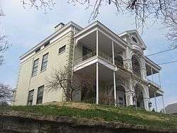 Bellevue |
April 22, 1976 (#76000857) |
335 E. 3rd St. 39°05′47″N 84°29′32″W |
Newport | Homestead of James Taylor, Jr. |
| 4 | Bellevue High School |  Bellevue High School |
January 9, 1986 (#86000026) |
Washington and Center Sts. 39°06′12″N 84°26′53″W |
Bellevue | |
| 5 | Bishoff House | March 9, 1983 (#83002622) |
Eight Mile Rd. 39°00′54″N 84°20′51″W |
Camp Springs | ||
| 6 | Blau's Four Mile House | %2C_Camp_Springs%2C_Kentucky.jpg) Blau's Four Mile House |
March 9, 1983 (#83002596) |
Four Mile Pike 38°59′49″N 84°21′46″W |
Camp Springs | |
| 7 | Blenk House | 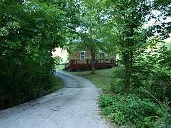 Blenk House |
March 9, 1983 (#83002597) |
Stonehouse Rd. 38°59′24″N 84°21′25″W |
Alexandria | |
| 8 | Bonnie Leslie Historic District | March 5, 2018 (#100002153) |
Bounded by Memorial Pkwy., Taylor, Wilson, Berry & Anspaugh Aves. 39°05′45″N 84°28′30″W |
Bellevue | ||
| 9 | John Braun House | 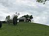 John Braun House |
March 9, 1983 (#83002598) |
Eight Mile Rd. 39°00′17″N 84°21′13″W |
Camp Springs | |
| 10 | Buena Vista Historic District | February 13, 2020 (#100004978) |
Roughly bounded by L&N/CSX RR, Lowell St., 8th St., & Putnam St., plus 700 blk. Columbia St. & 1000 blk. York St. 39°05′11″N 84°29′38″W |
Newport | ||
| 11 | Camp Springs House | 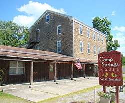 Camp Springs House |
March 9, 1983 (#83002599) |
Four Mile Pike 39°00′24″N 84°21′59″W |
Camp Springs | |
| 12 | Campbell County Courthouse at Newport | 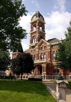 Campbell County Courthouse at Newport |
March 8, 1988 (#88000181) |
330 York St. 39°05′32″N 84°29′53″W |
Newport | |
| 13 | Cote Brillante Historic District |  Cote Brillante Historic District |
August 3, 2005 (#05000791) |
Portions of E. 10th, E. 11th Sts., Park Ave., Camryn Court, Vine, Center, Prospect, and Miller Sts., and Wiedemann Place 39°05′22″N 84°28′52″W |
Newport | |
| 14 | Dayton High School |  Dayton High School |
July 18, 1985 (#85001579) |
8th and Walnut Sts. 39°06′34″N 84°28′37″W |
Dayton | |
| 15 | Doyle Country Club |  Doyle Country Club |
March 13, 2017 (#100000735) |
37 Mary Ingalls Hwy. 39°06′46″N 84°27′20″W |
Dayton | |
| 16 | East Row Historic District | 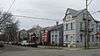 East Row Historic District |
August 25, 1983 (#83002600) |
Roughly bounded by the C&O railroad line, 6th, Saratoga, and Oak Sts. 39°05′28″N 84°29′13″W |
Newport | |
| 17 | John Faha House | March 9, 1983 (#83002601) |
Lower Tug Fork Rd. 39°00′17″N 84°21′13″W |
Alexandria | ||
| 18 | Fairfield Avenue Historic District | 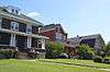 Fairfield Avenue Historic District |
February 22, 1988 (#88000100) |
Fairfield Ave. between LaFayette Ave. and O'Fallon 39°06′29″N 84°28′51″W |
Bellevue | |
| 19 | Foote-Fister Mansion | 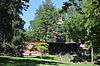 Foote-Fister Mansion |
February 24, 1988 (#88000099) |
801 Lincoln Rd. 39°06′12″N 84°28′23″W |
Bellevue | |
| 20 | Fort Thomas Commercial District | 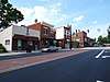 Fort Thomas Commercial District |
July 10, 2008 (#08000003) |
1011-1312 S. Ft. Thomas Ave, 9-11 River Rd., and 12-28 Midway Ct. 39°03′51″N 84°26′49″W |
Fort Thomas | |
| 21 | Fort Thomas Military Reservation District | May 15, 1986 (#86001103) |
Roughly bounded by Pearson, Alexander and Cochran Aves., River Rd., and S. Fort Thomas Ave. 39°03′55″N 84°26′39″W |
Fort Thomas | ||
| 22 | Grote Manufacturing Company Building (CP337) | 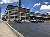 Grote Manufacturing Company Building (CP337) |
February 28, 2019 (#100003473) |
239 Grandview Ave. 39°06′03″N 84°28′44″W |
Bellevue | |
| 23 | Gubser-Schuchter Farm | 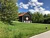 Gubser-Schuchter Farm |
March 9, 1983 (#83002602) |
Four Mile Pike Area 38°59′01″N 84°21′47″W |
Camp Springs | |
| 24 | Heiert Farm | March 9, 1983 (#83002603) |
Eight Mile Rd 39°00′18″N 84°20′37″W |
Camp Springs | ||
| 25 | Elijah Herndon House | October 29, 1983 (#83002604) |
Northwest of California on Washington Trace Rd. 38°55′37″N 84°17′40″W |
California | ||
| 26 | Hilbert Farm | March 9, 1983 (#83002605) |
Gunkel Rd. 39°00′39″N 84°20′18″W |
Camp Springs | ||
| 27 | Harlan Hubbard Studio | August 4, 2016 (#16000493) |
129 Highland Ave. 39°04′37″N 84°27′08″W |
Fort Thomas | ||
| 28 | Kort Grocery | 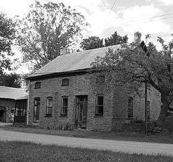 Kort Grocery |
March 9, 1983 (#83002606) |
Four Mile Pike 39°00′01″N 84°21′49″W |
Camp Springs | |
| 29 | Frederich Kremer House | March 9, 1983 (#83002607) |
317 Poplar Ridge Rd. 38°58′59″N 84°22′25″W |
Alexandria | ||
| 30 | Matthias Kremer House | 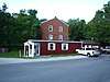 Matthias Kremer House |
March 9, 1983 (#83002608) |
Corner of Four Mile Pike and Stonehouse Rd. 38°59′35″N 84°21′45″W |
Camp Springs | |
| 31 | Nicholas Kremer House | 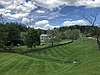 Nicholas Kremer House |
March 9, 1983 (#83002609) |
Stonehouse Rd 38°59′21″N 84°21′17″W |
Camp Springs | |
| 32 | Leick House | 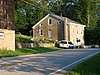 Leick House |
March 9, 1983 (#83002610) |
Four Mile Pike 38°59′42″N 84°21′39″W |
Camp Springs | |
| 33 | Mansion Hill Historic District |  Mansion Hill Historic District |
July 17, 1980 (#80001493) |
Roughly bounded by Interstate 471, Washington Ave., 2nd and 6th Sts.; also roughly bounded by Washington Ave., 6th, Saratoga, and 3rd Sts. 39°05′44″N 84°29′30″W |
Newport | Second set of addresses represents a boundary increase |
| 34 | Marianne Theater | 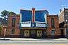 Marianne Theater |
March 17, 2015 (#15000081) |
609 Fairfield Ave. 39°06′30″N 84°28′52″W |
Bellevue | |
| 35 | Monmouth Street Historic District |  Monmouth Street Historic District |
July 25, 1996 (#96000794) |
Monmouth St. between 3rd and 11th Sts. 39°05′22″N 84°29′39″W |
Newport | |
| 36 | Newport and Cincinnati Bridge | 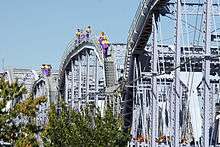 Newport and Cincinnati Bridge |
April 17, 2001 (#01000363) |
Over the Ohio River 39°05′41″N 84°29′40″W |
Newport | Also known as the Newport Southbank Bridge; extends into Cincinnati, Ohio |
| 37 | Newport Courthouse Square Historic District |  Newport Courthouse Square Historic District |
February 5, 2010 (#09001306) |
York St., Court Pl., and 4th St. 39°05′32″N 84°29′49″W |
Newport | |
| 38 | Ort-Heeb Farm | March 9, 1983 (#83002611) |
Four Mile Pike 38°58′48″N 84°22′01″W |
Alexandria | ||
| 39 | Posey Flats | 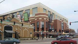 Posey Flats |
January 29, 1987 (#86003730) |
101-103 E. 3rd St. 39°05′40″N 84°29′45″W |
Newport | Destroyed; now the site of Newport on the Levee |
| 40 | Reitman House | March 9, 1983 (#83002612) |
Reitman Rd. 38°59′43″N 84°22′30″W |
Alexandria | ||
| 41 | Reitman's St. Joseph House |  Reitman's St. Joseph House |
March 9, 1983 (#83002613) |
Four Mile Pike 38°59′43″N 84°21′48″W |
Camp Springs | |
| 42 | Andrew Ritter Farm | March 9, 1983 (#83002614) |
Four Mile Pike 38°59′00″N 84°21′29″W |
Alexandria | ||
| 43 | E.O. Robinson House | August 2, 2017 (#100001420) |
105 Regency Ct. 39°02′06″N 84°26′50″W |
Highland Heights | ||
| 44 | Roth Farm | March 9, 1983 (#83002615) |
Off Nine Mile Rd. 39°00′45″N 84°21′22″W |
Camp Springs | ||
| 45 | Sacred Heart Church | 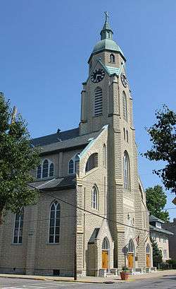 Sacred Heart Church |
August 13, 1974 (#74000856) |
337 Taylor Ave. 39°06′10″N 84°28′48″W |
Bellevue | |
| 46 | St. John's Lutheran Cemetery | 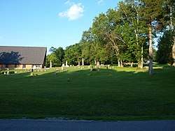 St. John's Lutheran Cemetery |
March 9, 1983 (#83002617) |
Upper Tug Fork Rd. 39°00′51″N 84°22′58″W |
Alexandria | |
| 47 | St. John the Baptist Roman Catholic Church | 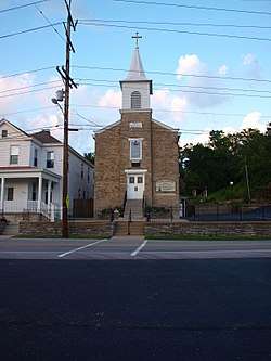 St. John the Baptist Roman Catholic Church |
August 11, 1980 (#80001495) |
641 Licking Pike / 1309 Johns Hill Rd. 39°02′48″N 84°29′07″W |
Wilder | |
| 48 | St. Joseph's Catholic Church and Cemetery | 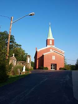 St. Joseph's Catholic Church and Cemetery |
May 16, 1983 (#83002618) |
Four Mile Pike 38°59′38″N 84°21′42″W |
Alexandria | |
| 49 | St. Paul's Episcopal Church | 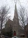 St. Paul's Episcopal Church |
November 25, 1980 (#80001494) |
15 Court Pl. 39°05′34″N 84°29′49″W |
Newport | |
| 50 | St. Vincent de Paul School | 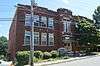 St. Vincent de Paul School |
October 11, 1989 (#89001598) |
117 Main St. 39°04′50″N 84°29′13″W |
Newport | |
| 51 | Salem Methodist Episcopal Church and Parsonage | 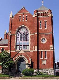 Salem Methodist Episcopal Church and Parsonage |
March 27, 1986 (#86000608) |
810 York St. 39°05′18″N 84°29′35″W |
Newport | |
| 52 | August Sauer House | 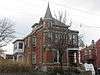 August Sauer House |
August 18, 1997 (#97000873) |
832 Central Ave. 39°05′11″N 84°29′42″W |
Newport | |
| 53 | Sauser Farm | March 9, 1983 (#83002616) |
Upper Tug Fork Rd. 39°00′56″N 84°23′01″W |
Alexandria | ||
| 54 | Joseph Seiter House | 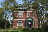 Joseph Seiter House |
April 3, 1986 (#86000617) |
307-309 Berry Ave. 39°06′11″N 84°29′02″W |
Bellevue | |
| 55 | Southgate-Parker-Maddux House | 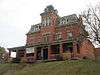 Southgate-Parker-Maddux House |
August 29, 1977 (#77000605) |
24 E. 3rd St. 39°05′36″N 84°29′47″W |
Newport | |
| 56 | Taylor's Daughters Historic District |  Taylor's Daughters Historic District |
February 24, 1988 (#88000101) |
Roughly bounded by O'Fallon Ave., Locust St., Retreat St., Clark St., Chen Ave., and Fairfield Ave. 39°06′11″N 84°28′47″W |
Bellevue | |
| 57 | Third Street Motor Car Company Building | 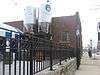 Third Street Motor Car Company Building |
December 5, 2002 (#02001465) |
216 E. 3rd St. 39°05′42″N 84°29′38″W |
Newport | |
| 58 | Tiemeyer House |  Tiemeyer House |
March 9, 1983 (#83002619) |
KY 8 39°01′40″N 84°21′16″W |
Melbourne | |
| 59 | Trutschell House | March 9, 1983 (#83002620) |
KY 8 39°01′32″N 84°21′00″W |
Melbourne | ||
| 60 | U.S. Army Fort Thomas Mess Hall |  U.S. Army Fort Thomas Mess Hall |
March 13, 1980 (#80001492) |
Cochran Ave. 39°04′05″N 84°26′40″W |
Fort Thomas | |
| 61 | Uebel House | March 9, 1983 (#83002621) |
Upper Tug Fork Rd. 38°59′34″N 84°23′08″W |
Alexandria | ||
| 62 | Walter House |  Walter House |
December 11, 2007 (#83004584) |
6570 Vineyard Ln. 38°59′51″N 84°19′35″W |
Melbourne | |
| 63 | John Weber Farm | 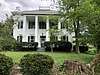 John Weber Farm |
July 11, 2007 (#07000672) |
6231 Four Mile Rd. 39°00′37″N 84°22′11″W |
Camp Springs | |
| 64 | Charles Wiedemann House |  Charles Wiedemann House |
August 18, 1984 (#84001401) |
1102 Park Ave. 39°05′20″N 84°28′57″W |
Newport | |
| 65 | York Street Historic District | 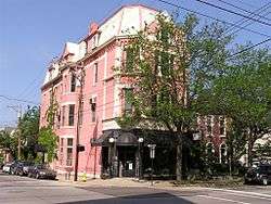 York Street Historic District |
May 26, 1995 (#95000640) |
York St. from 7th St. to 10th St. 39°05′15″N 84°29′34″W |
Newport |
Former listing
| [3] | Name on the Register | Image | Date listed | Date removed | Location | City or town | Summary |
|---|---|---|---|---|---|---|---|
| 1 | Thomas and Mary Jones House | January 17, 1976 (#76000858) | Unknown | 15th and Monmouth Sts. |
Newport |
See also
| Wikimedia Commons has media related to National Register of Historic Places in Campbell County, Kentucky. |
References
- The latitude and longitude information provided in this table was derived originally from the National Register Information System, which has been found to be fairly accurate for about 99% of listings. Some locations in this table may have been corrected to current GPS standards.
- "National Register of Historic Places: Weekly List Actions". National Park Service, United States Department of the Interior. Retrieved on June 19, 2020.
- Numbers represent an ordering by significant words. Various colorings, defined here, differentiate National Historic Landmarks and historic districts from other NRHP buildings, structures, sites or objects.
- The eight-digit number below each date is the number assigned to each location in the National Register Information System database, which can be viewed by clicking the number.
| Topics | |
|---|---|
| Lists by state |
|
| Lists by insular areas | |
| Lists by associated state | |
| Other areas | |
| Related | |
| |
Municipalities and communities of Campbell County, Kentucky, United States | ||
|---|---|---|
| Cities | Location of Campbell County, Kentucky | |
| CDP | ||
| Unincorporated communities | ||
This article is issued from Wikipedia. The text is licensed under Creative Commons - Attribution - Sharealike. Additional terms may apply for the media files.