Cottonwood Shores, Texas
Cottonwood Shores is a city in Burnet County, Texas, United States. The population was 1,123 at the 2010 census.[3]
Cottonwood Shores, Texas | |
|---|---|
| Motto(s): "People, Parks, and Prosperity" | |
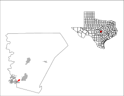
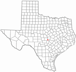 Location of Cottonwood Shores, Texas | |
 | |
| Coordinates: 30°33′22″N 98°19′28″W | |
| Country | United States |
| State | Texas |
| County | Burnet |
| Area | |
| • Total | 2.0 sq mi (5.1 km2) |
| • Land | 2.0 sq mi (5.1 km2) |
| • Water | 0.0 sq mi (0.0 km2) |
| Elevation | 830 ft (253 m) |
| Population (2010) | |
| • Total | 1,123 |
| • Density | 574/sq mi (221.8/km2) |
| Time zone | UTC-6 (Central (CST)) |
| • Summer (DST) | UTC-5 (CDT) |
| ZIP code | 78657 |
| Area code(s) | 830 |
| FIPS code | 48-17208[1] |
| GNIS feature ID | 1385470[2] |
| Website | cottonwoodshores |
Geography
Cottonwood Shores is located in southwestern Burnet County at 30°33′22″N 98°19′28″W,[4] on the south bank of the Colorado River below the outlet of Lake Lyndon B. Johnson. This is about 4 miles (6 km) southwest of Marble Falls, 17 miles (27 km) southwest of Burnet, the county seat, and 50 miles (80 km) west of downtown Austin.
According to the United States Census Bureau, the city has a total area of 2.0 square miles (5.1 km2), all of it land.[3]
Demographics
| Historical population | |||
|---|---|---|---|
| Census | Pop. | %± | |
| 1990 | 548 | — | |
| 2000 | 877 | 60.0% | |
| 2010 | 1,123 | 28.1% | |
| Est. 2019 | 1,227 | [5] | 9.3% |
| U.S. Decennial Census[6] | |||
As of the census[1] of 2000, there were 877 people, 312 households, and 232 families residing in the city. The population density was 932.9 people per square mile (360.2/km2). There were 351 housing units at an average density of 373.4 per square mile (144.2/km2). The racial makeup of the city was 88.60% White, 1.03% African American, 1.25% Native American, 0.11% Asian, 0.23% Pacific Islander, 7.75% from other races, and 1.03% from two or more races. Hispanic or Latino of any race were 19.61% of the population.
There were 312 households, out of which 39.7% had children under the age of 18 living with them, 56.4% were married couples living together, 10.6% had a female householder with no husband present, and 25.6% were non-families. 19.9% of all households were made up of individuals, and 8.3% had someone living alone who was 65 years of age or older. The average household size was 2.81 and the average family size was 3.23.
In the city, the population was spread out, with 30.0% under the age of 18, 8.7% from 18 to 24, 30.8% from 25 to 44, 19.2% from 45 to 64, and 11.4% who were 65 years of age or older. The median age was 34 years. For every 100 females, there were 104.0 males. For every 100 females age 18 and over, there were 102.6 males.
The median income for a household in the city was $36,094, and the median income for a family was $37,656. Males had a median income of $28,333 versus $17,500 for females. The per capita income for the city was $17,664. About 7.6% of families and 9.7% of the population were below the poverty line, including 12.8% of those under age 18 and 3.1% of those age 65 or over.
References
- "U.S. Census website". United States Census Bureau. Retrieved 2008-01-31.
- "US Board on Geographic Names". United States Geological Survey. 2007-10-25. Retrieved 2008-01-31.
- "Geographic Identifiers: 2010 Demographic Profile Data (G001): Cottonwood Shores city, Texas". U.S. Census Bureau, American Factfinder. Archived from the original on February 12, 2020. Retrieved April 23, 2014.
- "US Gazetteer files: 2010, 2000, and 1990". United States Census Bureau. 2011-02-12. Retrieved 2011-04-23.
- "Population and Housing Unit Estimates". Retrieved May 21, 2020.
- "Census of Population and Housing". Census.gov. Retrieved June 4, 2015.
External links
Municipalities and communities of Burnet County, Texas, United States | ||
|---|---|---|
| Cities | 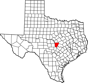 Burnet County map | |
| Unincorporated communities | ||
| Footnotes | ‡This populated place also has portions in an adjacent county or counties | |