Bongaigaon
Bongaigaon (/bɒŋˈɡaɪɡaʊ/ (![]()
Bongaigaon | |
|---|---|
City/UA | |
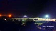
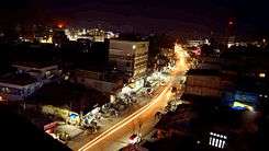
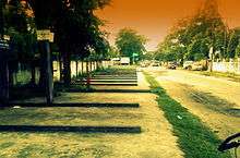
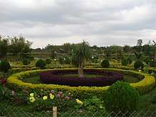
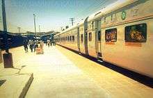
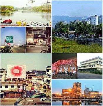 By clockwise : Bongaigaon Railway Crossing view of Mayapuri area, Night view of New Bongaigaon Junction railway station, Chilarai Indoor Games Stadium located at Borpara, Lighting view of NTPC Bongaigaon Thermal Power Project at Salakati, Aerial view of Station Road near ASTC Bus Stand, Chapaguri Road View and Koya Kujia Eco Tourism Park. | |
| Nickname(s): Industrial & Commercial Hub of Assam + Railway Capital of Western Assam | |
 Bongaigaon Location in Assam, India | |
| Coordinates: 26.49°N 90.53°E | |
| Country | |
| State | Assam |
| Region | Western Assam |
| District | Bongaigaon & Chirang district (10% area of city) |
| Zone | 4 |
| Zones Name | Central, North, South, Industrial |
| Town Type | Urban Agglomeration (UA, India) |
| Bongaigaon Municipal Board | 29 September 1989 |
| Founded by | Government of Assam |
| Government | |
| • Type | Mayor–Council |
| • Body | BMB, BDA, KMB |
| • Deputy Commissioner | M.S Lakshmipriya, (IAS) |
| • Superintendent | Kumar Sanjit Krishna, (IPS) |
| Area | |
| • City/UA | 14 km2 (5 sq mi) |
| Elevation | 62.6 m (205.4 ft) |
| Population | |
| • City/UA | 129,894 |
| • Rank | 6th |
| • Density | 9,300/km2 (24,000/sq mi) |
| • Metro | 139,650 |
| Languages | |
| • Official | Assamese, English |
| Time zone | UTC+5:30 (IST) |
| PIN | 3 postcodes
|
| Telephone code | 03664-XXXXXX |
| Vehicle registration | AS-19, AS-26 |
| Literacy | 96.42% (2011) |
| Legislature type | Municipality |
| Planning agency | 3 |
| Sex ratio | 961 per 1000 male (Census 2011) ♂/♀ |
| Climate | Semi-Arid (Köppen) |
| Distance from Delhi | 1,725 kilometres (1,072 mi) |
| Distance from Mumbai | 2,650 kilometres (1,650 mi) |
| Precipitation | 1,717.7 millimetres (67.63 in) |
| Avg. annual temperature | 26 °C (79 °F) |
| Summer temperature | 38 - 40 °C |
| Winter temperature | 33 - 28 °C |
| Out Growth (OG) incl Bongaigaon Urban Agglomerations | 9 region
|
| Census Towns (CT) incl Bongaigaon Urban Agglomerations | 3 region
|
| Website | bongaigaon |
| † Estimated as of 2015 | |
It was the last capital of the Kamatapur Kingdom and home to many historical monuments of Assamese culture. The city, divided into two parts – Old Bongaigaon and New Bongaigaon - is situated 180 kilometres (112 mi) north west of Guwahati, largest city of Assam. To meet the demands of Bodos of Assam, Bongaigaon was divided up to give way for Chirang district. Bongaigaon has a major petrochemical industry, the Indian Oil Corporation Limited[1][2] (IOCL BGR[3]). The town occupied a place in the map of Indian Railway with the establishment of the railway station in the year 1908. Most of the institutions like ITI, Bongaigaon College, Office of the Assam State Electricity Board[4][5] in the early 1960s and in fact the very base of the development of the town was laid in this decade only. The development further gained momentum with the establishment of the Bongaigaon Refinery and Petrochemicals Limited[6] (BRPL)[7] Complex in the year 1972 at Dhaligaon and also Thermal Power Plant at Salakati. Though these areas are not within the limit of Bongaigaon Municipality the town also caters to the demand of this population. The Bongaigaon Town Committee was first constituted in the year 1961 and was upgraded to a Municipal Board in the year 1977. Presently the Municipal Area consists of 25 nos. of wards covering an area of 14.31 sq m.
The city today has evolved to be one of the major commercial and business hubs of the state with growing numbers of shopping malls, restaurants, hotels, residential apartments and educational institutions. The city also serves as the base for tourism to places such as the Manas National Park.[8][9] Centrally located within the state, the city depicts a vibrant Assamese township and culture, making it one of the most preferred places for local people to congregate.
Localities in Bongaigaon
- Mayapuri
- Borpara
- Paglasthan
- Mahabeersthan
- Chapaguri
- Dhaligaon
- New Bongaigaon
- Borsongaon
- Deuripara
- Purani Bongaigaon
- BOC Gate
- Rolling Mill
- Dolaigaon
- Notunpara
- Kukurmari
- Hatimutra
- Salbari
- New Colony (Railway)
- Old Colony (Railway)
- Salbagan
- Bhakarivita
Geography
Bongaigaon is located at 26.47°N 90.57°E.[10] Bongaigaon is situated at an average altitude of 62.6 m with the cardinal points 26028" east latitude and 90034" north longitude. The town is situated at a distance of 200 km west from the State Capital and occupies an important place in the communication network in Assam as well as northeast India. The New Bongaigaon railway station is a major junction connecting Assam with the rest of India. This town is also very well connected by road through the National Highway 31 B and 31C. This connectivity and the strategic location of the town in the regional set up has helped it to emerge as an important center in trade and commerce in Western Assam serving a vast hinterland. It is one of the biggest industrial towns in Lower Assam.
Demography
As of the 2011 India census,[11] Bongaigaon district had a population of 1,09,810 (UA).[12] Hinduism is the major religion in the district. Bongaigaon has an average literacy rate of 70.44%.with male literacy of 75.48% and female literacy of 65.18%.Most of the residents outside city areas are farmers. The majority of the city population work in service industry.
Bir Chilarai Flyover
Recently in 2010 Bongaigaon city built a designable flyover in the city. The flyover[13] connect three part of the city
- New Bongaigaon with West Part of Bongaigaon
- North Part of Bongaigaon City with Central Part of Bongaigaon
- New Bongaigaon with North Part of Bongaigaon City
The flyover controlled the busy railway traffic and also the road traffic of the city. Now Bongaigaon city can't handle the whole communication of vehicle and train without the Bir Chilarai Flyover.
History
Creation
The decision of the government of Assam was taken in 1989, to create a new district of Bongaigaon, carving out some areas of the Goalpara and Kokrajhar District with its headquarters located at Bongaigaon. On 29 September 1989, the creation of Bongaigaon District was declared by the Government of Assam with its headquarters at Bongaigaon. In 2005, Government of Assam declared Bongaigaon town as a city.
Background
The original Goalpara district was first created in AD 1822 by David Scott, an employee of East India Company, who was the first Commissioner of newly created North East Rangpur district Hd. Qr. at Rangpur town (now in Bangla Desh) and newly created Goalpara district was also tagged with North-East Rangpur district for administration. The erstwhile Bijni Kingdom's area which included the undivided Garo Hills district area also constituted the original Goalpara district area in 1822. In 1866 Garo Hills was separated from Goalpara district area and in the same year a new district named "Greater Koch Behar" was created and the residual portion of Goalpara district was withdrawn from Rangpur and tagged with Koch Behar. In 1874 a new province named Assam Valley Province was created by the British government (successor of East India Company) and Goalpara district area was withdrawn from Koch Behar and tagged with Assam Province which continues till today unless petty political gambling disturbs. Now the original Goalpara district has given birth to five districts namely (i) Goalpara (ii) Dhubri (iii) Kokrajhar (iv) Bongaigaon and (v) Chirang.
Bijni Kingdom
The Bijni Kingdom was situated between 250 53' and 260 32' N. and 900 85' and 910 85' E. The estate was in possession of the Bijni family, descended from the Koch king Nara Narayan, who reigned over Kamata kingdom from 1534 to 1584. Before his death, Nara Narayana allowed his kingdom to be divided between his son Lakshmi Narayan and his nephew Raghu Rai (son of Chilarai). Raghu Rai established his capital at Barnagar in the Barpeta (now a district in Assam) and received as his share the Koch territories lying to the east of Sankosh River.
After the death of Nara Narayan in 1584, Raghu Rai declared independence. The eastern kingdom ruled by Raghu Rai came to be called Koch Hajo and the western Koch Bihar. Soon after the declaration of independence, the two kingdoms started showing hostilities against each other. Raghu Rai was succeeded by his son Parikshit Narayan and was defeated in 1602 by the army of Nawab of Dhaka (governor for the Mughals) who was moved by Lakshmi Narayan (ruler of Koch Bihar). Parikshit was defeated at Dhubri (now a district in Assam) and sued for peace. But soon, he continued with the hostilities and in 1614 was driven up to Pandu, now in Guwahati. There, Parikshit surrendered and agreed to become a vassal of the Mughal Empire. But before he could take up this assignment he died. The Mughals then appointed Kabisekhar as the kanungo and instructed Sheikh Ibrahim Karori to set up a Mughal system of administration. Parikshit's son Bijit Narayan was confirmed by the Mughals as 'jamindar' of the area between the river Manas and the Sankosh, and from him, the Bijni family descended. The name "Bijni", now a sub-division of Chirang district of Bodoland Territorial Area in Assam, comes from the name of the king Bijit Narayan.
Under the Mughal rule, the Bijni king Bijit Narayan paid a tribute of Rs. 5,998 which was afterward commuted to an annual delivery of 68 elephants. During the last two decades of the 17th century, the Mughals lost their influence on Assam while the East India Company gradually started strengthening their foothold in different parts of India including Bengal.
The East India Company was awarded the 'diwani' or overlordship of Bengal by the empire following the Battle of Buxar in 1764 and the company came to an agreement (known as Permanent Settlement) with Bengali landlords in 1793 to fix revenues to be raised from land. With the Treaty of Yandaboo in 1826, the East India Company finally took control of both Eastern Assam and Western Assam. However, it was doubtful whether Goalpara was ever included in the Permanent Settlement. According to The Imperial Gazetteer of India (Volume 8), a small assessment from the Bijni kingdom was always accepted in lieu of land revenue, though it has sometimes been argued it was nothing more than a tribute. The Imperial Gazetteer of India, which was published in 1902, states that the Bijni family paid a revenue of Rs. 1,500 and cesses amounting to nearly Rs. 19,000 for an estate which covered an area of 950 square miles (2,500 km2) with an estimated rent-roll of Rs. 2 lakh.
On the conclusion of the Bhutan war (or Duar War) fought between British India and Bhutan in 1864–1865, the Bijni family put forward claims to hold a large tract of land in the Eastern Duir which they alleged that they were in possession under the Bhutan government. The claim was admitted and in 1870 a settlement was effected with the Court of Wards on behalf of the minor Bijni Raja. The present extent of the estate to which they were entitled was still a matter of uncertainty, but in 1882 it was ruled by the government of India that the Raja should receive 130,000 acres (530 km2) of land. These estates generally remained under the direct management of the government, who allowed to the Raja 7.5 percent of the collections as his share of profits.
Rulers of Ancient Bijni Kingdom
- Bijit Narayan (alias Chandra Narayan)
- Joy Narayan
- Shiv Narayan
- Bijoy Narayan
- Mukunda Narayan
- Haridev Narayan
- Indra Narayan
- Amrit Narayan
- Kumud Narayan
- Jogendra Narayan
- Bhairabendra Narayan
Industries
Indian Oil Corporation Limited, Bongaigaon
The Bongaigaon Refinery is the eighth largest refinery of Indian Oil. Formed upon the amalgamation of Bongaigaon Refinery and Petrochemicals Limited (BRPL) with Indian Oil on 25 March. 2009, Bongaigaon refinery is situated at Dhaligaon in Chirang district of Assam, 200 km west of Guwahati.
It has two Crude Distillation Units (CDU), two Delayed Coker Units (DCU) and a Coke Calcination Unit (CCU) with a processing capacity of 2.35 million tonnes per year of crude oil. The first CDU with a capacity of 1 million tonnes per year was commissioned in 1979. The capacity was further increased to 1.35 million tonnes per year in 1986. An LPG bottling plant with a capacity of 44 million tonnes per year was also commissioned in 2003.
The refinery produces a wide range of petroleum products, namely LPG, Naphtha, MS, SKO, HSD, LDO, LSHS, LVFO, RPC, CPC, Needle coke and solvents (Petrosol and Bonmex-II) by processing Assam Crude and Ravva Crude (from the Ravva oil fields of Krishna Godavari Basin). Bongaigaon refinery has also undertaken special endeavours towards environment protection and conservation. The refinery has developed an ecological park and a pond surrounding it containing 65,000 cubic metres of water, through which the storm water drains of the plant are routed for final discharge. Another natural pond with a capacity of 30,000 cubic meters of water has developed into an environment-friendly park-cum-pond for migratory birds. In addition, a rainwater harvesting system has been installed in the Bongaigaon township complex and the installation of solar water heating systems (SWHS) and solar photovoltaic systems (streetlights) is underway.
In recognition of its green initiatives, Bongaigaon refinery has been a recipient of numerous prestigious awards, the latest being the National Award for "Prevention of Pollution" from the Ministry of Environment and Forests on 16 September 2010. The award acknowledges the Refinery's outstanding contribution in environmental conservation and creating environmental awareness in the Bodo Territorial Autonomous District region of Assam, which is predominantly a tribal dominated area. Bongaigoan Refinery is the country's first oil Refinery to have won this coveted honour. Last year the Refinery was honoured with the Indira Gandhi Paryavaran Puruskar by the Ministry of Environment, as well as the 'Greentech Environment Excellence Gold Award 2008' and the 'Indira Gandhi Paryavarn Puraskar 2006' for its outstanding environmental performance.
Bongaigaon Refinery Township (BGR Township)
BGR Township is a quarter campus of the employees of IOCL BGR. The town is located in Dhaligaon near Bongaigaon Refinery. In the township there are two schools, BGR HS School and DPS Dhaigaon. There are three luxury guest houses here. There are also two clubs, RCCC Club & Auditorium and Champa Club & Play Hub.

Entertainment
In the city, there are two movie theatres (Cinema Hall) named Jolly Max Theater and Mayapuri Cinema. Prakash Cinema which is situated in the north part of the town has been closed down.
Shopping & Entertainment
There are various public markets in the city for the different part of the city, those are mainly Boro Bazaar, (Borpara), Balaji Market (B.O.C Gate), China Market (New Bongaigaon), Tuniapaar Bazaar (near New Bongaigaon railway station), Dhaligaon Bazaar (near Bongaigaon Refinery and Petrochemicals Limited), Chapaguri Hat (near NH-31, Gate of Bongaigaon City), Dangtola Bazaar & Railway Market New Bongaigaon , Bazar India(BOC gate),Vishal Mega Mart( near prakash hall), Reliance Trends, Bongaigaon (near Mayapuri cinema hall), 1 India Family Mart, Bongaigaon (near Lower Assam Hospital), Cygnett Park Meghna( NH27, Chapaguri, a 4 star hotel), etc.
People
From the chequered historical background of this district, it can easily be surmised that the entire area was ruled by Kings/Zaminders/Feudal Lords hailing from the Koch-Rajbongshies belonging to Indo-Mongoloid ethnic group of peoples right from the 15th century to the end of princely states in AD 1956. The kings of this area had their hoary past and can be traced back to the "Kiratees" of epic age (Mahabharata fame) that is pre-vedic age. These Kiratees of impact are also mentioned in Kalika Purana and Jogingi Tantra and also in histories written both by native and foreign scholars.
Socio-cultural spectrum
Apart from the prevalent common environment in the erstwhile Bijni Kingdom and undivided Goalpara district of 1822, the most striking features of Bongaigaon district are the Hilly Caves (Gumphas) and stone carvings of Jogighopa hill-rocks demonstrating the existence of Buddhist culture. The hills and the hilly rocks, the rivers, natural and man-made ponds, the deep forest, the trees, plants, and the bushes.
Natural resource base
The district falls under Brahmaputra river basin.[14] The district has a large reservoir of water resources with the river Brahmaputra and its two tributaries of Ai and Manas. The soil type is generally sandy to sandy loam with alluvial deposits. Among the 15 agro-climatic regions of the country, categorised/identified on the basis of homogeneity in agro-characteristics, Bongaigaon falls in the Lower Brahmaputra Valley zone. The agro-climatic conditions of the district are conducive to various agricultural activities. The topography of the district represents mostly plain lands except a small portion of isolated hills in Bijni sub-division, bordering Bhutan. The district is drained by the Brahmaputra on the south and two of its major tributaries viz. Ai & Manas flowing from north to south. About 72 percent of normal rainfall is received from May to August. Agriculture in the district is characterised by over-dependence on rainfall, the predominance of seasonal crops and traditional methods of cultivation. The forest cover in the district is estimated to be 56598 hectares i.e. 22.6 percent of its total geographical area as per the estimates of Forest Statistics of Assam 2005. The Manas National Park is a wildlife forest reserve which lies in the northern part of the district.
Climate
Bongaigaon has a borderline monsoon-influenced humid subtropical climate (Köppen Cwa) marginally too cool to be a tropical savanna climate (Aw). During the "cool" season from November to February, afternoons are warm to very warm and mornings pleasantly cool. In the "hot" season of March and April, the weather becomes hot and thunderstorm rainfalls increase in frequency to prelude the oppressive monsoon season from June to September where heavy rainfall occurs every afternoon.
| Climate data for Bongaigaon | |||||||||||||
|---|---|---|---|---|---|---|---|---|---|---|---|---|---|
| Month | Jan | Feb | Mar | Apr | May | Jun | Jul | Aug | Sep | Oct | Nov | Dec | Year |
| Record high °C (°F) | 30 (86) |
33 (91) |
38 (100) |
40 (104) |
38 (100) |
40 (104) |
37 (99) |
37 (99) |
37 (99) |
35 (95) |
32 (90) |
28 (82) |
40 (104) |
| Average high °C (°F) | 23 (73) |
25 (77) |
30 (86) |
31 (88) |
31 (88) |
31 (88) |
32 (90) |
32 (90) |
31 (88) |
30 (86) |
27 (81) |
24 (75) |
29 (84) |
| Average low °C (°F) | 10 (50) |
12 (54) |
15 (59) |
20 (68) |
22 (72) |
25 (77) |
25 (77) |
25 (77) |
24 (75) |
21 (70) |
16 (61) |
11 (52) |
19 (66) |
| Record low °C (°F) | −2 (28) |
−3 (27) |
4 (39) |
11 (52) |
16 (61) |
18 (64) |
20 (68) |
21 (70) |
20 (68) |
9 (48) |
0 (32) |
−1 (30) |
−3 (27) |
| Average rainfall mm (inches) | 11.4 (0.45) |
12.8 (0.50) |
57.7 (2.27) |
142.3 (5.60) |
248.0 (9.76) |
350.1 (13.78) |
353.6 (13.92) |
269.9 (10.63) |
166.2 (6.54) |
79.2 (3.12) |
19.4 (0.76) |
5.1 (0.20) |
1,715.7 (67.53) |
| Source: wunderground.com[15] | |||||||||||||
Transport
Air
The nearest domestic and international airport is Lokopriya Gopinath Bordoloi International Airport, Guwahati.

Railways
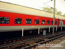
Bongaigaon falls under the Northeast Frontier Railway zone of the Indian Railways.There are two stations in Bongaigaon - New Bongaigaon railway station (2nd largest railway junction of Assam state) and Bongaigaon (old) station. Major trains serving Bongaigaon with major cities are Guwahati Rajdhani Express, Poorvottar Sampark Kranti Express, Saraighat Express, Brahmaputra Mail, North-East Express, Guwahati Bangalore Express, Guwahati Ernakulam Express, Kamrup Express. It is the largest station in Western Assam after Guwahati. According to 2012 budget, New Bongaigaon Jn. is considered to be the Adarsh Station of India.
Construction of the 265 km (165 mi) long 1,676 mm (5 ft 6 in) wide broad gauge Siliguri-Jogihopa line, between 1963 and 1965, brought broad gauge railways to Assam. It also was the reason for setting up the New Bongaigaon railway station.[16]
New railway track from New Bongaigaon to Guwahati was commissioned in 1984.[17]
Saraighat Bridge opened in 1962, initially carried a metre gauge track, which was later replaced by broad gauge.[18]
Electrification of New Bongaigaon Rly. Jn.
Electrification of the Barauni-Katihar-Guwahati line was sanctioned in 2008.[19] In the document on Vision 2020 – A Blue Print for Railway Electrification Programme, in the list of ongoing projects the entire route km (836) is shown as balance work as on 1 April 2010.[20] The entire electrification project is scheduled to be completed by October, 2015.[21]
Roadways
National Highway 31 connects Bongaigaon with the states Bihar, Jharkhand and West Bengal. National Highway 37 via Naranarayan Setu from Goalpara in Assam to Dimapur in Nagaland traverses the entire length of Assam and connects Bongaigaon with almost all the major cities of Assam including the cities of Jorhat and Dibrugarh. National Highway 31C connects Bongaigaon to Guwahati and National Highway 37 also connects Bongaigaon with Guwahati. There are many bus terminals like ASTC Bongaigaon, Barpara Private, Chapaguri Bus Stand. There are many buses which connect Bongaigaon with major cities of Assam like Basugaon, Mangaldai, Gossaigaon, Dhubri, Barpeta, Tezpur, Goalpara, Abhayapuri, Kokrajhar, Bijni, Siliguri, Cooch Behar and Guwahati etc.
Media
The most popular Assamese newspaper of Assam Asomiya Pratidin[22] is published from Bongaigaon along with Guwahati, Dibrugarh and North Lakhimpur.
Sports
The town has an indoor stadium named Chilarai Indoor Stadium and Swimming Pool At Borpara and a Mini Stadium Near Chapguri Road.

NTPC Bongaigaon
The NTPC project at Bongaigaon, NTPC Bongaigaon, a (3X250MW) is slated for commissioning. Assam will receive 300MW from Bongaigaon project. The total land requirement is 964 acres which is already available. The total project cost is estimated at Rs 40600 million.
Places of interest
Nakkati Pahar
The Nakkati Hill or we can say the hill that is hidden among the hills in the interiors of Bongaigaon district area near Dewangaon, has its peak as a cut-nose-shape. Situated at a height of about 300 meters from ground level, it has views the surroundings.[23]
Koyakujia Bil
Koya Kujia Eco Park, a project was undertaken by Assam Tourism Development Corporation, is a tourist attraction situated near Abhayapuri about 15 kilometers from Bongaigaon. It attracts thousands of local and foreign tourists every season. The vast water land consisting of small islands flourish with myriad flora & fauna. Many migratory birds migrate to this place during the winter.[24]
Bagheswari Temple
Bagheshwari Temple is a temple devoted to Goddess Durga for followers of Hindu religion in Western Assam. The temple is located in the middle part of the city. It is centrally located in the place Borpara of the city. It is said that the king of Abhayapuri decided to build a temple after a sword was found at the spot. It also under a spot in the nearby hill called Bagheswari pahar which has a cave inhabiting tigers as late as the middle of the 20 th century and hence comes the name devoted to the Tiger (Bagh)
Bagheswari Hill
Bagheswari hill is situated in the middle of the city. From the highest point of the hill, a view can be seen of the whole city. Here is also a Shiv temple in the highest point.
Jogighopa and Pancharatna
Jogighopa and Pancharatna are two historic sites situated on either bank of Brahmaputra river, in Assam. Pancharatna lies on the southern bank and is about 160 kilometers west of Guwahati by road. Jogighopa lies on the northern bank and is about 212 km from Guwahati by Northern Highways. Some cubicles which are cut on step rocks, supposed to have been used by monks for meditation in the medieval period, are found here. Most of the caves found in here are very small. Pancharatna boasts some ruins of a post-Gupta temple and some also rock cut ruins including a monolithic Buddhist stupa.
Kachugaon Game Reserve
Kachugaon Game Reserve is located in Kachugaon of Bongaigaon district of Assam. It is a protected area under the forest department of Assam. Kachugaon covers an area of around 214 km2 and has rare and endangered species such a gaur, golden langur, spotted deer and elephant.
Kakoijana Reserved Forest
(For golden langur and birds) KakoiJana Reserved Forest is an ideal spot for eco-tourism, KakoiJana was declared as a reserve forest in April 1966. Located 15 km away from Bongaigaon city towards the east, now it has been upgraded as a wildlife sanctuary, covering an area around 20 km2.[25]
Aai River Sand
Aai is a sub river of The mighty Brahmaputra. Its sandy bank is a picnic point. The border of Assam and Bhutan hill area is very amazing for the tourists.
Roumari Dam
Roumari Dam is well known Dam of the whole Western Assam. It is 10 km away from the city. It is picnic spot for the people of Assam. It is also in the border of India and Bhutan. The Dam is on Aai river.
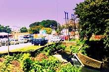
Bongaigaon City Garden
This garden includes a big pool for the boating. Here is also much of playing things for the children of the city. It is also a well-known place of the city.
.jpg)
Manas River Point
The Manas River (Pron: ˈmʌnəs) is a transboundary river in the Himalayan foothills between southern Bhutan and India. It is named after Manasa, the serpent god in Hindu mythology. It is the largest river system of Bhutan,[26] among its four major river systems; the other three are Amo Chu or Torsa, Wong Chu or Raidak, and Mo Chu or Sankosh. It is met by three other major streams before it again debouches into India in western Assam. The total length of the river is 376 kilometres (234 mi): it flows through Bhutan for 272 kilometres (169 mi) and then through Assam for 104 kilometres (65 mi) before it joins the mighty Brahmaputra River at Jogighopa. Another major tributary of the Manas, the Aie river joins it in Assam at Bangpari.[27][28]
The river valley has two major reserve forest areas, namely the Royal Manas National Park (43,854 hectares (108,370 acres), established in 1966) in Bhutan and the contiguous Manas Wildlife Sanctuary (391,000 hectares (970,000 acres) in 1955 increased to 95,000 hectares (230,000 acres) in December 1985) encompassing Project Tiger Reserve, an Elephant Reserve and a Biosphere Reserve, which constitutes a UNESCO World Heritage Site declared in December 1985.[29][30]
Sri Surjya Pahar
Sri Surya Pahar (Assamese: শ্ৰী সূৰ্য পাহাৰ) is a significant but relatively unknown archaeological site in Assam, India.[31] The site is a hilly terrain where several rock-cut Shivalingas, votive stupas and the deities of Hindu, Buddhist and Jain pantheon are scattered in an area of about one km. The site is centred on the hills (Pahar) of Sri Surya which is profusely filled up with Shiva Lingas (Lingam).[32] The popular belief is that 99999 Shiva Lingas were engraved here by Vyasa in order to build up a second Kashi (where there were 1,00000 Shiva Lingas) and once it was one of the holiest pilgrimage sites in the region. There is no historical evidence exactly how many Lingams once dotted these hills, but still, there are hundreds of them, from tiny to large in size, scattered everywhere at the foot of the hill and covering the extensive area after centuries of neglect and pilferage. The exact figure of the Lingas (and also other deities and relics) in the hill is yet to be counted scientifically.
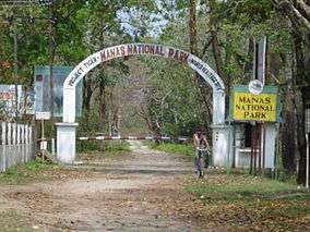
Manas National Park
Bongaigaon city is the entry point for the Manas National Park. Manas National Park or Manas Wildlife Sanctuary is a national park, UNESCO Natural World Heritage site, a Project Tiger reserve, an elephant reserve and a biosphere reserve in Assam, India. Located in the Himalayan foothills, it is contiguous with the Royal Manas National Park[8] in Bhutan. The park is known for its rare and endangered endemic wildlife such as the Assam roofed turtle, hispid hare, golden langur and pygmy hog. Manas is famous for its population of the wild water buffalo.[33]
Lalmati-Duramari Ganesh Temple
The Lalmati-Duramari Ganesh Temple near Abhayapuri town under North Salmara Sub-Division is one of the oldest temples of the state.
The historicity of the images are yet to be ascertained. But after a study of the stone carving and modes related to the carved idols, archeologists opine that the temple and images belong to the 8th to 10th centuries AD
There are three views advanced as the reason for the destruction of the temple. The first view has it that earthquakes during the 8th and 10th centuries destroyed the temple and its images, while according to the second view, Kalapahar who revolted against worshippers and priests, destroyed the temple along with other temples and images in the North-East. The third view has it that Burmese (Maan) invaders who camped at Malegarh (Manegarh) hills destroyed the temple along with the idols. But it seems that earthquake has been the prime cause of the destruction of the temple.
Rock Cut Caves
The best specimens of the architecture of the Salasthambha period are the remains of the five rock-cut caves at Jogighopa on the bank of the Brahmaputra in the district of Bongaigaon. These are the unique examples of rock-cut architecture in Assam. Though these rock-cut caves are not of such architectural interest as those in Western India, these remains at Jogighopa are the clear evidence of the fact that Assam was not outside the movement of this particular type of art developed in India as it will be seen from the description of the best-preserved cave noticed at Jogighopa.
The cave measures 2.60 m breadth, 1.8 metre in depth and 1.90 meters in height and also has a roughly rounded ceiling and in front a verandah 75 cm long by 35 cm broad. A platform of brick and mud masonry is found inside which is obviously a later addition. A chase running across the entire breath of the cave on the top serves to drain away rainwater from the facade. Flights of steps have been cut into the rock on either side and ledge on the top diverts the rainwater from the facade. The cave bears no sculptural designs. The other caves at the site have no flights and verandah and are smaller in size than the best preserved one.
This architectural site has been taken up by the Archaeological Survey of India for preservation.
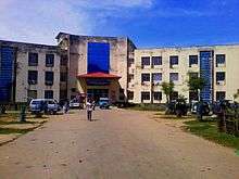
List of hospitals
There are 9 hospitals in the Bongigaon city, the list is given below.
- S M Hospital
- Lower Assam Hospital And Research Centre[34][35]
- Swagat Hospital[36][37][38]
- Chilarai Nursing Home
- Arogya Hospital and Research Centre
- St. Augustine's Hospital[39][40]
- Bongaigaon Civil Hospital
- Kajalgaon Civil Hospital
- New Bongaigaon Railway Hospital[41][42]
- Bongaigaon Refinery Hospital[43][44]

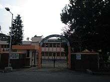
Education
The number of schools kept rising after the refinery started functioning. Although, there are a good number of schools. Renowned among them are :
Schools in Bongaigaon
- Bongaigaon Refinery HS School,[45] Dhaligaon (previously BRPL Vidyalaya)
- Birjhora Higher Secondary School
- Bongaigaon Railway Higher Secondary School
- DPS Dhaligaon, Bongaigaon Refinery[46]
- Kendriya Vidyalaya New Bongaigaon
- Bongaigaon Higher Secondary School English Medium (Menon)
- Santi Dham Kalibari High School
- Vivekananda Vidyapith Higher Secondary School
- Hindi Higher Secondary School
- Little Flower School, Chapaguri
- St. Albert's High School, New Bongaigaon
- Holy Child EM High School
- Jnanodoy Higher Secondary School
- Gyanadai Jatiya Vidyalaya
- Dhaligaon L.P School, Dhaligaon
- Dhaligaon High School, Dhaligaon
- Chapaguri M.E School, Chapaguri
- Shankardev Sishuneketan
- Shankardev Academy, Borpara
- Trinity English Medium
- Netaji Bidyaniketan M.E. School, Netaji Nagar, Paulpara
- Bongaigaon Model School
- LB Academy[47]
- Morning Glory School
- Pranab Academy
- Pranab Vidyapeeth, Mahabirsthan
- Girls' M.V. School[48]
- Borpara L.P School[49]
- Hindi High School, side of flyover, Mahabeersthan
- St. Francis D'Assisi School,[50] Nayapara
- North Salmara Buniyadi School
- JB High School, Salbari
- Netajee Vidyapith, BG Colony
- Netajee Vidyapith, Natunpara
- Mulagaon High School
- Lal Bahadur Shastri Vidyapith, Salbari
- Jawaharlal Navoday Vidyapith, Mulagaon
- St. Xavier's Public School
- Chilarai Jatiya Vidyalaya, Aatugaon
- Sungaputa Nimna Buniyadi School.
- Jnanpith Jatiya Vidyalaya, Jogighopa.
- G.M.High School, Jogighopa
- K.R.G. Hindi High School, Bongaigaon
- P.K.M. English Medium School, Dhaligaon
- St. Aloysius Semiary(Religious), Chapaguri
But seeing the results for quite a few years, the number of schools are on rise.
46. Chaprakata popragaon high school, chaprakata
Kids activity school
- Dafodill
- Sunflower
- KidZEE
- Euro Kids
- Kinder Garden, Natunpara
- Kinder Garden, Dhaligaon (inside BGR Township)
- Kids Model School
- Morning Glory Kids
- Kids veda
Colleges
- Bongaigaon College, established in 1964[51]
- Bongaigaon Polytechnic
- Birjhora Mahavidyalaya (Degree Science College)[52]
- Bongaigaon Law College[53]
- Bongaigaon B.Ed College[54]
- Birjhora Kanya Mahavidyalaya
- Upendranath Brahma College, Bongaigaon-783385
- SAI Institute (A college for professional excellence)
- DIET,Majgaon
Junior Colleges
- Gyanjyoti Jr. College (Arts & Commerce)
- Bongaigaon Jr. College
- BGR Higher Secondary
- Don Bosco Junior College
- Sankar Madhab Academy
3G Services
Bongaigaon UA has also high speed 3G services in the city and include with its outgrowths. The carriers give 3G service to the city. List is here:
| Carrier | Speed | Available areas |
|---|---|---|
| Aircel[56][57][58] | Up to 3.6 Mbit/s | Bongaigaon Main Town,[59] Dhaligaon, BGR Township, Dolaigaon (OG), Kukurmari (OG) |
| Airtel[60] | Up to 6.5 Mbit/s | Bongaigaon Main Town, Dhaligaon, New Bongaigaon Rly. Colony, BGR Township, Dangtol (OG), Dolaigaon (OG), Kukurmari (OG), Borsongaon (OG), Notunpara (OG), Dangtol Gate (OG), |
| Idea Cellular[61] | Up to 3.6 Mbit/s | Bongaigaon Main Town, Dhaligaon, New Bongaigaon |
| BSNL[62] | Up to 15 Mbit/s | Dhaligaon (OG), New Bongaigaon Rly. Colony (CT), BGR Township (CT), Dolaigaon (OG), Kukurmari (OG), New Colony (OG), Dangtol (OG), Notunpara (OG), Borsongaon (OG), Tengaigaon (OG), Mulagaon (OG), Deuripara (OG), Borpara, Mayapuri, Paglasthan, Chapaguri, BOC Gate, ITI Area, Rakhaldubi (OG), Bongaigaon to North Salmara Road, Bhageswari Hill, Polytechnic Area, Sohidbedi, Bhaulaguri (OG) |
| Reliance[63] | Up to 3.6 Mbit/s | Bongaigaon Main Town, Dhaligaon, BGR Township (CT), Dolaigaon (OG), Kukurmari (OG) |
Politics
Bongaigaon is part of Barpeta (Lok Sabha constituency).[64] Phani Bhusan Choudhury is the current M.L.A. of Bongaigaon constituency.
See also
- Bir Chilarai Flyover, Bongaigaon City
- Bongaigaon Municipal Board
- List of cities in Assam by population
- New Bongaigaon railway station
References
- "Global 500". Fortune Global 500. Retrieved 31 August 2013.
- "List of Maharatna, Navratna and Miniratna CPSEs". Dpe.nic.in. Archived from the original on 19 July 2013. Retrieved 28 July 2013.
- "IOC Raises 500 MN in Dollar Bond Issue". business-standard.com.
- "Assam Electricity Department". assamgovt.nic.in. Archived from the original on 27 February 2014.
- "EMT-India". emt-india.net.
- "Swaminomics". swaminomics.org.
- "BRPL India". brplindia.com. Archived from the original on 6 November 2013.
- "WWF - Royal Manas National Park, Bhutan". panda.org. Archived from the original on 7 November 2009.
- Amelan, Roni. "Successful preservation of India's Manas Wildlife Sanctuary enables withdrawal from the List of World Heritage in Danger". Retrieved 21 June 2011.
- "Falling Rain Genomics, Inc - Bongaigaon". fallingrain.com.
- "Census 2011". census2011.co.in. Retrieved 10 January 2012.
- "Constituents of urban Agglomerations Having Population 1 Lakh & above" (PDF). Provisional Population Totals, Census of India 2011. Retrieved 16 April 2012.
- Bir Chilarai Flyover
- "District Report Bongaigaon" (PDF). commissioned by Ministry of Minority Affairs, Government of India. Archived from the original (PDF) on 23 May 2012. Retrieved 10 January 2012.
- "Historical Weather for Delhi, India". Weather Underground. Retrieved 27 November 2008.
- Moonis Raza & Yash Aggarwal (1986). Transport Geography of India: Commodity Flow and the Regional Structure of Indian Economy. page 60. Concept Publishing Company, A-15/16 Commercial Block, Mohan Garden, New Delhi - 110059. ISBN 81-7022-089-0. Retrieved 12 May 2013.
- "IR History: Part V (1970-1990)". IRFCA. Retrieved 12 May 2013.
- "50 years of Saraighat bridge". The Times of India, 7 November 2012. Retrieved 12 May 2013.
- "CCEA approves Rs. 506 crores for Barauni-Katihar-Guwahati section". Projects Today. Retrieved 12 May 2013.
- "Vision 2020 – A Blue Print for Railway Electrification Programme" (PDF). Ministry of Railways, Government of India. Archived from the original (PDF) on 10 July 2012. Retrieved 12 May 2013.
- "Rajya Sabha unstarred question no. 1677 to be answered on 7 December 2012". Ministry of Railways. Retrieved 12 May 2013.
- "Archived copy". Archived from the original on 8 March 2016. Retrieved 30 December 2013.CS1 maint: archived copy as title (link)
- "nakkati pahar". nakkati blog.
- "The Telegraph - Calcutta (Kolkata) | Northeast | Tryst with park on treasure island". www.telegraphindia.com. Retrieved 20 April 2016.
- "14 years on, Kakoijana forest continues fight for sanctuary status - Indian Express". archive.indianexpress.com. Retrieved 14 April 2016.
- "Physiological survey". Food and Agriculture Organization. Retrieved 2 April 2010.
- "Physiological Survey". FAO Corporate Document Repository. Retrieved 7 March 2010.
- Report Volume I: Rashtriya Barh Ayog (National Commission On Floods). Government of India. 1973.
- "Royal Manas National Park, Bhutan". WWF Global. Archived from the original on 7 November 2009.
- "Bhutan" (PDF). Ramsar. Wetlands.org. Archived from the original (PDF) on 28 July 2011. Retrieved 7 March 2010.
- "Surya temple, Surya pahar temple, Surya pahar, Assam". Religiousportal.com. 1 January 1980. Archived from the original on 30 April 2013. Retrieved 29 March 2013.
- "Surya Pahar, Goalpara | Surya Pahar Photos | Goalpara Tourist Places". Holidayiq.com. Retrieved 29 March 2013.
- Choudhury, A.U.(2010)The vanishing herds : the wild water buffalo. Gibbon Books, Rhino Foundation, CEPF & COA, Taiwan, Guwahati, India
- "Lower Assam Hospital And Research Centre — Bongaigaon". doctoralia.in. Archived from the original on 1 February 2014. Retrieved 23 January 2014.
- "Lower Assam Hospital". Plus.google.com. Retrieved 31 July 2014.
- https://web.archive.org/web/20140304084738/https://plus.google.com/105922909114592311226/about?gl=in&hl=en. Archived from the original on 4 March 2014. Retrieved 23 January 2014. Missing or empty
|title=(help) - "Swagat Hospital & Research Centre". swagathospital.com.
- "Swagat Hospital BONGAIGAON, Assam". hotfrog.in.
- "St. Augustine Hospital — St. John's Rural Mission". stjohnsruralmission.org. Archived from the original on 8 August 2014.
- "Bongaigaon branch IMAASB" (PDF). imaasb.com. Archived from the original (PDF) on 8 August 2014.
- "New Bongaigaon Railway Hospital". Plus.google.com. Archived from the original on 4 March 2014. Retrieved 31 July 2014.
- "New Bongaigaon Railway Hospital". wikimapia.org.
- "BRPL Refinery Complex". wikimapia.org.
- "The Telegraph - Calcutta : Northeast". telegraphindia.com.
- "BGR HS School, Dhaligaon". Wowsome.com. Archived from the original on 11 January 2014. Retrieved 2 April 2010.
- "Delhi Public School Dhaligaon". dpsdhaligaon.com.
- "LB Academy, Bongaigaon city details". Wowsome.com. Archived from the original on 11 January 2014. Retrieved 2 April 2010.
- "Bongaigaon Girls' MV School". Google Maps. Retrieved 2 April 2010.
- "Borpara LP School". Retrieved 2 April 2010.
- "Bongaigaon School". Archived from the original on 10 January 2014. Retrieved 2 April 2010.
- http://www.bongaigaoncollege.nic.in%5B%5D
- "Official website of Birjhora Mahavidyalaya". birjhoramahavidyalaya.org.
- http://www.bongaigaonlawcollege.org%5B%5D
- "Bongaigaon B.Ed. College". bonbedcollege.org. Archived from the original on 10 January 2014. Retrieved 15 April 2019.
- http://www.saiinstituteedu.org
- Aircel#3G coverage
- "Aircel: Banking on the Future". Voice & Data. 24 July 2012. Archived from the original on 19 January 2013.
- "Aircel appoints Kaizad Heerjee as Chief Operating Officer". articles.economictimes.indiatimes.com.
- "Anup Vikal has been appointed as the chief financial officer by Aircel". communicationstoday.co.in. Archived from the original on 17 December 2013.
- "airtel India". airtel.in.
- "Archived copy". Archived from the original on 17 January 2014. Retrieved 27 December 2013.CS1 maint: archived copy as title (link)
- "3G COVERAGE DETAILS". telecomtalk.info.
- "Reliance 3G Now Available in 100+ Cities/Towns, Complete 3G Cities List Added". techwek.com. TechWek.
- "List of Parliamentary & Assembly Constituencies" (PDF). Assam. Election Commission of India. Archived from the original (PDF) on 4 May 2006. Retrieved 5 October 2008.
External links
| Wikimedia Commons has media related to Bongaigaon. |
- Bongaigaon District official govt. website
