Zimmersheim
| Zimmersheim Zímmersche | ||
|---|---|---|
| Commune | ||
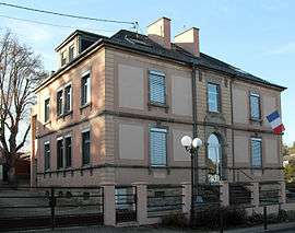 The town hall and school in Zimmersheim | ||
| ||
 Zimmersheim Location within Grand Est region  Zimmersheim | ||
| Coordinates: 47°43′13″N 7°23′20″E / 47.7203°N 7.3889°ECoordinates: 47°43′13″N 7°23′20″E / 47.7203°N 7.3889°E | ||
| Country | France | |
| Region | Grand Est | |
| Department | Haut-Rhin | |
| Arrondissement | Mulhouse | |
| Canton | Brunstatt | |
| Intercommunality | Mulhouse Alsace Agglomération | |
| Government | ||
| • Mayor (2014-2020) | Philippe Sturchler | |
| Area1 | 3.15 km2 (1.22 sq mi) | |
| Population (2014)2 | 1,066 | |
| • Density | 340/km2 (880/sq mi) | |
| Time zone | UTC+1 (CET) | |
| • Summer (DST) | UTC+2 (CEST) | |
| INSEE/Postal code | 68386 /68440 | |
| Elevation |
255–360 m (837–1,181 ft) (avg. 268 m or 879 ft) | |
|
1 French Land Register data, which excludes lakes, ponds, glaciers > 1 km2 (0.386 sq mi or 247 acres) and river estuaries. 2 Population without double counting: residents of multiple communes (e.g., students and military personnel) only counted once. | ||
.svg.png)
Zimmersheim (Alemannic German: Zímmersche) is a commune in the Haut-Rhin department of Alsace in eastern France. It forms part of the Mulhouse Alsace Agglomération, the inter-communal local government body for the Mulhouse conurbation.[1]
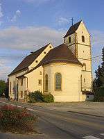 Church
See also
References
- ↑ "Mulhouse Alsace Agglomération". Mulhouse Alsace Agglomération. Retrieved 2011-04-07.
| Wikimedia Commons has media related to Zimmersheim. |
This article is issued from
Wikipedia.
The text is licensed under Creative Commons - Attribution - Sharealike.
Additional terms may apply for the media files.