Lapoutroie
| Lapoutroie | ||
|---|---|---|
| Commune | ||
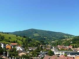 A general view of Lapoutroie | ||
| ||
 Lapoutroie Location within Grand Est region  Lapoutroie | ||
| Coordinates: 48°09′12″N 7°10′13″E / 48.1533°N 7.1703°ECoordinates: 48°09′12″N 7°10′13″E / 48.1533°N 7.1703°E | ||
| Country | France | |
| Region | Grand Est | |
| Department | Haut-Rhin | |
| Arrondissement | Colmar-Ribeauvillé | |
| Canton | Sainte-Marie-aux-Mines | |
| Intercommunality | Vallée de Kaysersberg | |
| Government | ||
| • Mayor (2014–2020) | Jean-Marie Muller | |
| Area1 | 21.12 km2 (8.15 sq mi) | |
| Population (2006)2 | 2,136 | |
| • Density | 100/km2 (260/sq mi) | |
| Time zone | UTC+1 (CET) | |
| • Summer (DST) | UTC+2 (CEST) | |
| INSEE/Postal code | 68175 /68650 | |
| Elevation |
329–1,221 m (1,079–4,006 ft) (avg. 422 m or 1,385 ft) | |
|
1 French Land Register data, which excludes lakes, ponds, glaciers > 1 km2 (0.386 sq mi or 247 acres) and river estuaries. 2 Population without double counting: residents of multiple communes (e.g., students and military personnel) only counted once. | ||
.svg.png)
Lapoutroie (German: Schnierlach; Welche: Lè Peutraille) is a commune in the Haut-Rhin department in Grand Est in north-eastern France.
See also
References
| Wikimedia Commons has media related to Lapoutroie. |
| Authority control |
|---|
This article is issued from
Wikipedia.
The text is licensed under Creative Commons - Attribution - Sharealike.
Additional terms may apply for the media files.