Fellering
| Fellering | ||
|---|---|---|
| Commune | ||
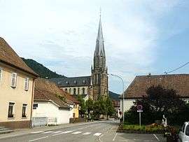 The church in Fellering | ||
| ||
 Fellering Location within Grand Est region  Fellering | ||
| Coordinates: 47°53′49″N 6°59′14″E / 47.8969°N 6.9872°ECoordinates: 47°53′49″N 6°59′14″E / 47.8969°N 6.9872°E | ||
| Country | France | |
| Region | Grand Est | |
| Department | Haut-Rhin | |
| Arrondissement | Thann-Guebwiller | |
| Canton | Cernay | |
| Intercommunality | Vallée de Saint-Amarin | |
| Government | ||
| • Mayor (2008–2014) | Annick Lutenbacher | |
| Area1 | 21.29 km2 (8.22 sq mi) | |
| Population (2006)2 | 1,713 | |
| • Density | 80/km2 (210/sq mi) | |
| Time zone | UTC+1 (CET) | |
| • Summer (DST) | UTC+2 (CEST) | |
| INSEE/Postal code | 68089 /68470 | |
| Elevation |
426–1,265 m (1,398–4,150 ft) (avg. 440 m or 1,440 ft) | |
|
1 French Land Register data, which excludes lakes, ponds, glaciers > 1 km2 (0.386 sq mi or 247 acres) and river estuaries. 2 Population without double counting: residents of multiple communes (e.g., students and military personnel) only counted once. | ||
.svg.png)
Fellering is a commune in the Haut-Rhin department in Grand Est in north-eastern France.
See also
References
| Wikimedia Commons has media related to Fellering. |
This article is issued from
Wikipedia.
The text is licensed under Creative Commons - Attribution - Sharealike.
Additional terms may apply for the media files.