Linthal, Haut-Rhin
| Linthal | ||
|---|---|---|
| Commune | ||
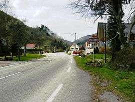 The southern entrance to the village of Linthal | ||
| ||
 Linthal Location within Grand Est region  Linthal | ||
| Coordinates: 47°56′51″N 7°07′52″E / 47.9475°N 7.1311°ECoordinates: 47°56′51″N 7°07′52″E / 47.9475°N 7.1311°E | ||
| Country | France | |
| Region | Grand Est | |
| Department | Haut-Rhin | |
| Arrondissement | Thann-Guebwiller | |
| Canton | Guebwiller | |
| Intercommunality | Région de Guebwiller | |
| Government | ||
| • Mayor (2001–2008) | Robert Weigel | |
| Area1 | 20.84 km2 (8.05 sq mi) | |
| Population (2006)2 | 624 | |
| • Density | 30/km2 (78/sq mi) | |
| Time zone | UTC+1 (CET) | |
| • Summer (DST) | UTC+2 (CEST) | |
| INSEE/Postal code | 68188 /68610 | |
| Elevation |
429–1,320 m (1,407–4,331 ft) (avg. 497 m or 1,631 ft) | |
|
1 French Land Register data, which excludes lakes, ponds, glaciers > 1 km2 (0.386 sq mi or 247 acres) and river estuaries. 2 Population without double counting: residents of multiple communes (e.g., students and military personnel) only counted once. | ||

Linthal is a commune in the Haut-Rhin department in Grand Est in north-eastern France.
See also
References
| Wikimedia Commons has media related to Linthal (Haut-Rhin). |
This article is issued from
Wikipedia.
The text is licensed under Creative Commons - Attribution - Sharealike.
Additional terms may apply for the media files.