Urschenheim
| Urschenheim Ürsche | ||
|---|---|---|
| Commune | ||
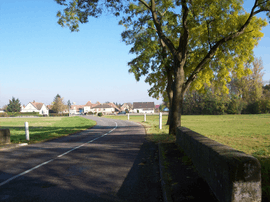 The road into Urschenheim | ||
| ||
 Urschenheim Location within Grand Est region  Urschenheim | ||
| Coordinates: 48°05′13″N 7°29′13″E / 48.0869°N 7.4869°ECoordinates: 48°05′13″N 7°29′13″E / 48.0869°N 7.4869°E | ||
| Country | France | |
| Region | Grand Est | |
| Department | Haut-Rhin | |
| Arrondissement | Colmar-Ribeauvillé | |
| Canton | Ensisheim | |
| Intercommunality | Pays de Brisach | |
| Government | ||
| • Mayor (2014–2020) | Robert Kohler | |
| Area1 | 6.42 km2 (2.48 sq mi) | |
| Population (2006)2 | 683 | |
| • Density | 110/km2 (280/sq mi) | |
| Time zone | UTC+1 (CET) | |
| • Summer (DST) | UTC+2 (CEST) | |
| INSEE/Postal code | 68345 /68320 | |
| Elevation |
185–190 m (607–623 ft) (avg. 185 m or 607 ft) | |
|
1 French Land Register data, which excludes lakes, ponds, glaciers > 1 km2 (0.386 sq mi or 247 acres) and river estuaries. 2 Population without double counting: residents of multiple communes (e.g., students and military personnel) only counted once. | ||
.svg.png)

Urschenheim, watertower in the street
Urschenheim (Alemannic German: Ürsche) is a communes in the Haut-Rhin department in Grand Est in north-eastern France.
See also
References
| Wikimedia Commons has media related to Urschenheim. |
This article is issued from
Wikipedia.
The text is licensed under Creative Commons - Attribution - Sharealike.
Additional terms may apply for the media files.