Niffer
| Niffer | ||
|---|---|---|
| Commune | ||
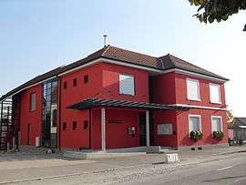 The town hall in Niffer | ||
| ||
 Niffer Location within Grand Est region  Niffer | ||
| Coordinates: 47°42′53″N 7°30′37″E / 47.7147°N 7.5103°ECoordinates: 47°42′53″N 7°30′37″E / 47.7147°N 7.5103°E | ||
| Country | France | |
| Region | Grand Est | |
| Department | Haut-Rhin | |
| Arrondissement | Mulhouse | |
| Canton | Rixheim | |
| Intercommunality | CA Mulhouse Alsace Agglomération | |
| Government | ||
| • Mayor (2008–2014) | Jean-Luc Vonfelt | |
| Area1 | 8.72 km2 (3.37 sq mi) | |
| Population (2006)2 | 874 | |
| • Density | 100/km2 (260/sq mi) | |
| Time zone | UTC+1 (CET) | |
| • Summer (DST) | UTC+2 (CEST) | |
| INSEE/Postal code | 68238 /68680 | |
| Elevation |
222–245 m (728–804 ft) (avg. 232 m or 761 ft) | |
|
1 French Land Register data, which excludes lakes, ponds, glaciers > 1 km2 (0.386 sq mi or 247 acres) and river estuaries. 2 Population without double counting: residents of multiple communes (e.g., students and military personnel) only counted once. | ||
.svg.png)
Niffer is a commune in the Haut-Rhin department in Alsace in north-eastern France.
See also
References
| Wikimedia Commons has media related to Niffer. |
This article is issued from
Wikipedia.
The text is licensed under Creative Commons - Attribution - Sharealike.
Additional terms may apply for the media files.