Xaffévillers
| Xaffévillers | |
|---|---|
| Commune | |
 | |
 Xaffévillers Location within Grand Est region  Xaffévillers | |
| Coordinates: 48°24′36″N 6°36′44″E / 48.41°N 6.6122°ECoordinates: 48°24′36″N 6°36′44″E / 48.41°N 6.6122°E | |
| Country | France |
| Region | Grand Est |
| Department | Vosges |
| Arrondissement | Épinal |
| Canton | Raon-l'Étape |
| Intercommunality | Communauté de communes de la Région de Rambervillers |
| Government | |
| • Mayor (2014-2020) | André Clément |
| Area1 | 8.43 km2 (3.25 sq mi) |
| Population (2014)2 | 159 |
| • Density | 19/km2 (49/sq mi) |
| Time zone | UTC+1 (CET) |
| • Summer (DST) | UTC+2 (CEST) |
| INSEE/Postal code | 88527 /88700 |
| Elevation |
256–321 m (840–1,053 ft) (avg. 260 m or 850 ft) |
|
1 French Land Register data, which excludes lakes, ponds, glaciers > 1 km2 (0.386 sq mi or 247 acres) and river estuaries. 2 Population without double counting: residents of multiple communes (e.g., students and military personnel) only counted once. | |
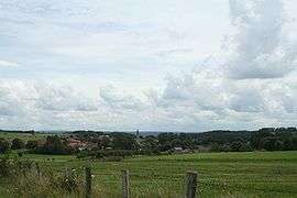
Xaffévillers (French pronunciation: [ksafevilɛʁ]) is a commune in the Vosges department in Grand Est in northeastern France.
Geography
The village lies in the middle of the commune, on the right bank of the Belvitte, a tributary of the Mortagne, which forms most of the commune's western border.
See also
References
| Wikimedia Commons has media related to Xaffévillers. |
This article is issued from
Wikipedia.
The text is licensed under Creative Commons - Attribution - Sharealike.
Additional terms may apply for the media files.