La Grande-Fosse
| La Grande-Fosse | |
|---|---|
| Commune | |
 | |
 La Grande-Fosse Location within Grand Est region  La Grande-Fosse | |
| Coordinates: 48°20′23″N 7°04′13″E / 48.3397°N 7.0703°ECoordinates: 48°20′23″N 7°04′13″E / 48.3397°N 7.0703°E | |
| Country | France |
| Region | Grand Est |
| Department | Vosges |
| Arrondissement | Saint-Dié-des-Vosges |
| Canton | Saint-Dié-des-Vosges-2 |
| Intercommunality | CA Saint-Dié-des-Vosges |
| Government | |
| • Mayor (2008–2014) | Bernard Maetz |
| Area1 | 6.79 km2 (2.62 sq mi) |
| Population (2006)2 | 118 |
| • Density | 17/km2 (45/sq mi) |
| Time zone | UTC+1 (CET) |
| • Summer (DST) | UTC+2 (CEST) |
| INSEE/Postal code | 88213 /88490 |
| Elevation |
449–820 m (1,473–2,690 ft) (avg. 630 m or 2,070 ft) |
|
1 French Land Register data, which excludes lakes, ponds, glaciers > 1 km2 (0.386 sq mi or 247 acres) and river estuaries. 2 Population without double counting: residents of multiple communes (e.g., students and military personnel) only counted once. | |
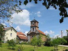
La Grande-Fosse is a commune in the Vosges department in Grand Est in northeastern France.
Points of interest
See also
References
External links
| Wikimedia Commons has media related to La Grande-Fosse. |
This article is issued from
Wikipedia.
The text is licensed under Creative Commons - Attribution - Sharealike.
Additional terms may apply for the media files.