Igney, Vosges
| Igney | ||
|---|---|---|
| Commune | ||
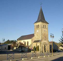 Church of Saint-Nicolas | ||
| ||
 Igney Location within Grand Est region  Igney | ||
| Coordinates: 48°16′32″N 6°23′46″E / 48.2756°N 6.3961°ECoordinates: 48°16′32″N 6°23′46″E / 48.2756°N 6.3961°E | ||
| Country | France | |
| Region | Grand Est | |
| Department | Vosges | |
| Arrondissement | Épinal | |
| Canton | Golbey | |
| Intercommunality | CA Épinal | |
| Government | ||
| • Mayor (2008–2014) | Jean-Marie Remy | |
| Area1 | 7.66 km2 (2.96 sq mi) | |
| Population (2006)2 | 1,145 | |
| • Density | 150/km2 (390/sq mi) | |
| Time zone | UTC+1 (CET) | |
| • Summer (DST) | UTC+2 (CEST) | |
| INSEE/Postal code | 88247 /88150 | |
| Elevation |
286–373 m (938–1,224 ft) (avg. 310 m or 1,020 ft) | |
|
1 French Land Register data, which excludes lakes, ponds, glaciers > 1 km2 (0.386 sq mi or 247 acres) and river estuaries. 2 Population without double counting: residents of multiple communes (e.g., students and military personnel) only counted once. | ||

Igney is a commune in the Vosges department in Grand Est in northeastern France.
See also
References
| Wikimedia Commons has media related to Igney (Vosges). |
This article is issued from
Wikipedia.
The text is licensed under Creative Commons - Attribution - Sharealike.
Additional terms may apply for the media files.