Denipaire
| Denipaire | |
|---|---|
| Commune | |
 | |
 Denipaire Location within Grand Est region  Denipaire | |
| Coordinates: 48°20′37″N 6°58′00″E / 48.3436°N 6.9667°ECoordinates: 48°20′37″N 6°58′00″E / 48.3436°N 6.9667°E | |
| Country | France |
| Region | Grand Est |
| Department | Vosges |
| Arrondissement | Saint-Dié-des-Vosges |
| Canton | Raon-l'Étape |
| Intercommunality | CA Saint-Dié-des-Vosges |
| Government | |
| • Mayor (2008–2014) | Roseline Pierrel-Villemin |
| Area1 | 7.02 km2 (2.71 sq mi) |
| Population (2006)2 | 253 |
| • Density | 36/km2 (93/sq mi) |
| Time zone | UTC+1 (CET) |
| • Summer (DST) | UTC+2 (CEST) |
| INSEE/Postal code | 88128 /88210 |
| Elevation |
333–650 m (1,093–2,133 ft) (avg. 350 m or 1,150 ft) |
|
1 French Land Register data, which excludes lakes, ponds, glaciers > 1 km2 (0.386 sq mi or 247 acres) and river estuaries. 2 Population without double counting: residents of multiple communes (e.g., students and military personnel) only counted once. | |
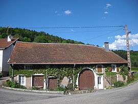
Denipaire is a commune in the Vosges department in Grand Est in northeastern France.
See also
References
| Wikimedia Commons has media related to Denipaire. |
This article is issued from
Wikipedia.
The text is licensed under Creative Commons - Attribution - Sharealike.
Additional terms may apply for the media files.