Umbogintwini
| Umbogintwini | |
|---|---|
 Umbogintwini | |
|
Location within Durban 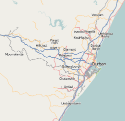 Umbogintwini  Umbogintwini Umbogintwini (South Africa)  Umbogintwini Umbogintwini (Africa) | |
| Coordinates: 30°01′S 30°53′E / 30.017°S 30.883°ECoordinates: 30°01′S 30°53′E / 30.017°S 30.883°E | |
| Country | South Africa |
| Province | KwaZulu-Natal |
| Municipality | eThekwini |
| Main Place | Durban |
| • Councillor | (African National Congress) |
| Area[1] | |
| • Total | 5.47 km2 (2.11 sq mi) |
| Population (2011)[1] | |
| • Total | 105 |
| • Density | 19/km2 (50/sq mi) |
| Racial makeup (2011)[1] | |
| • Black African | 33.0% |
| • Coloured | 5.7% |
| • Indian/Asian | 15.1% |
| • White | 42.5% |
| • Other | 3.8% |
| First languages (2011)[1] | |
| • English | 43.3% |
| • Afrikaans | 21.2% |
| • Zulu | 20.2% |
| • Tsonga | 5.8% |
| • Other | 9.6% |
| Time zone | UTC+2 (SAST) |
| Postal code (street) | 4120 |
| PO box | 4120 |
| Area code | 905 |
Umbogintwini (a corruption of eZimbokodweni)[2] is a town near Durban in KwaZulu-Natal, South Africa. Its post office received the corrected name in 1997. It is best known for the industrial complex which has Acacia, Chemical Initiatives and Sammar warehouses.
The current ward (93) Councillor is Mrs Zungu.
Holiday resort on the Indian Ocean, 23 km south-west of Durban and 4 km north-east of Amanzimtoti. The name is an adaptation of Zulu Mbokodweni, ‘river of round grinding-stones’; the resort is named after the river which enters the sea there.[3]
eZimbokodweni means "site where small, round grinding stones are collected".[2]
References
- 1 2 3 4 "Sub Place Umbogintwini". Census 2011.
- 1 2 Jenkins, Elwyn (2007), Falling into place: the story of modern South African place names, David Philip Publishers, p. 76
- ↑ "Dictionary of Southern African Place Names (Public Domain)". Human Science Research Council. p. 444.
.svg.png)
This article is issued from
Wikipedia.
The text is licensed under Creative Commons - Attribution - Sharealike.
Additional terms may apply for the media files.